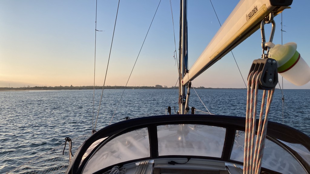
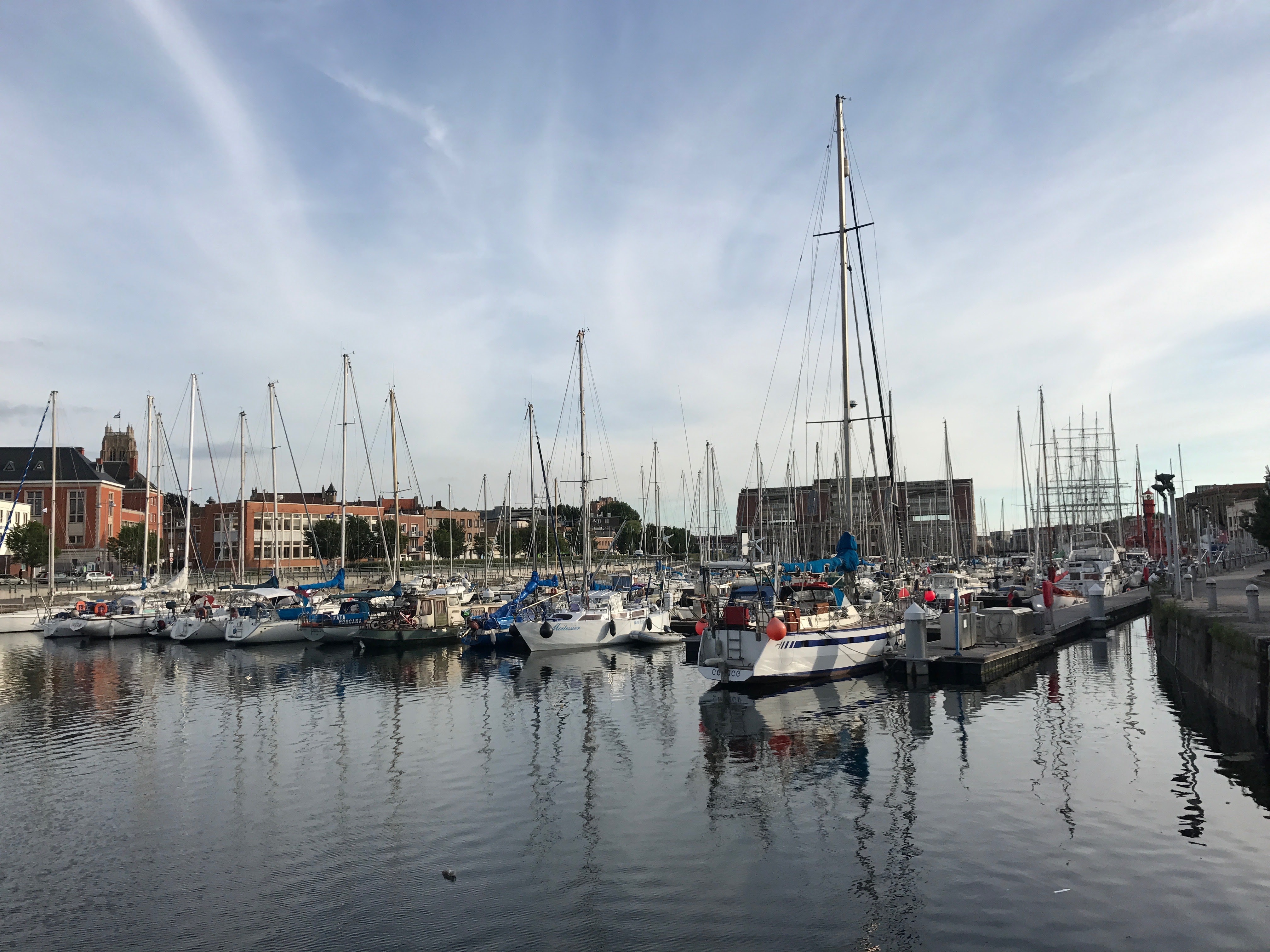
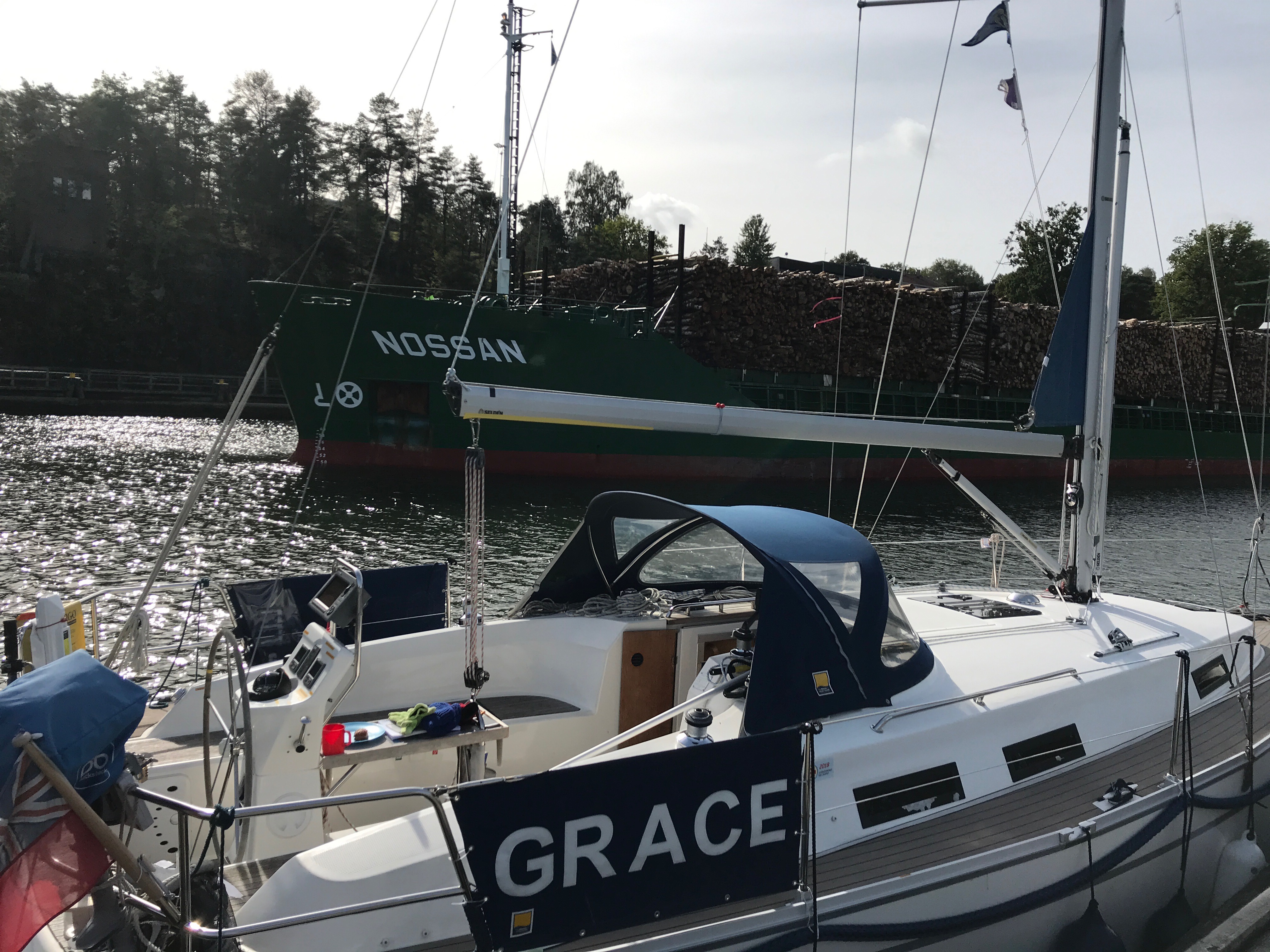
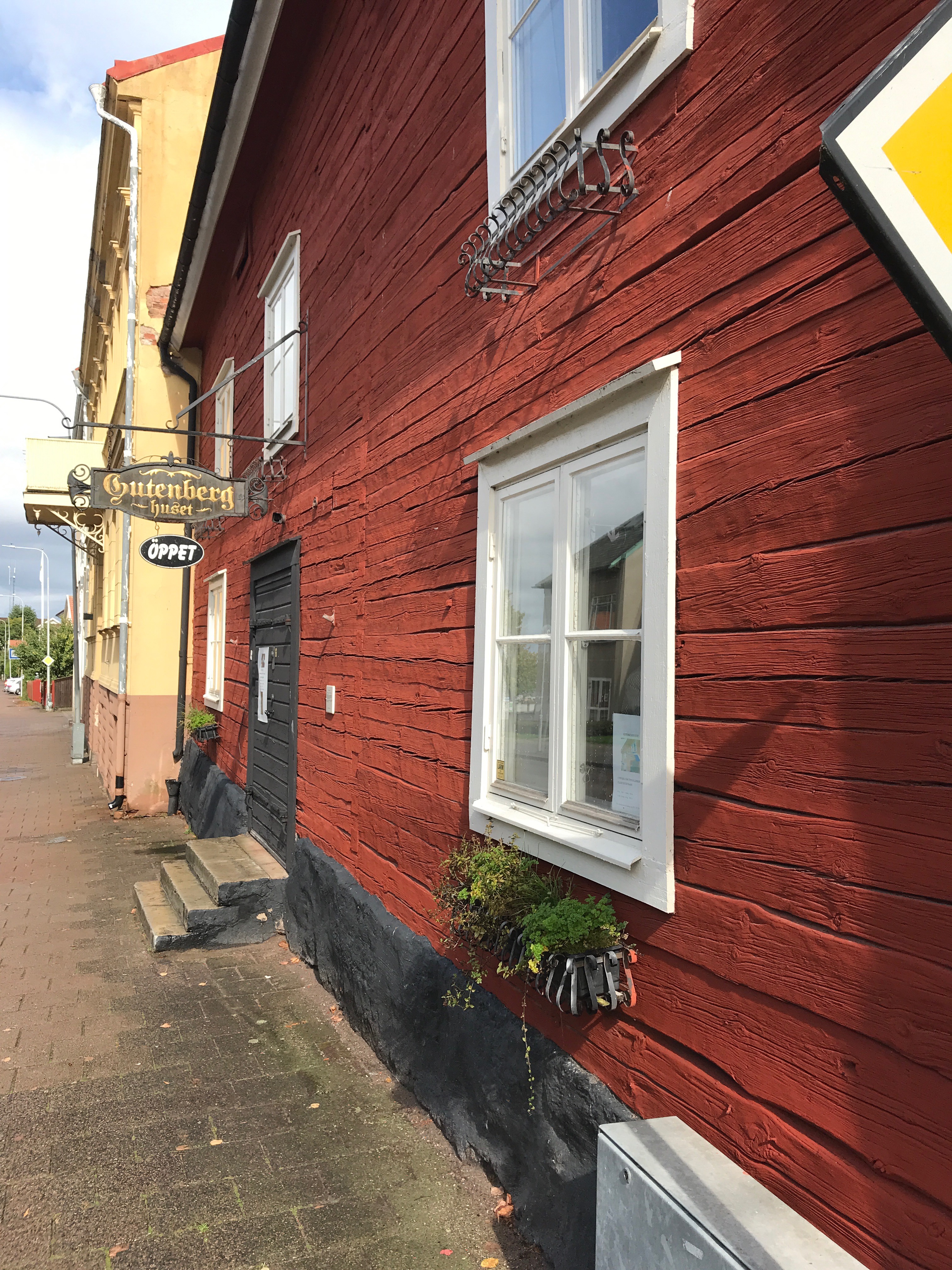
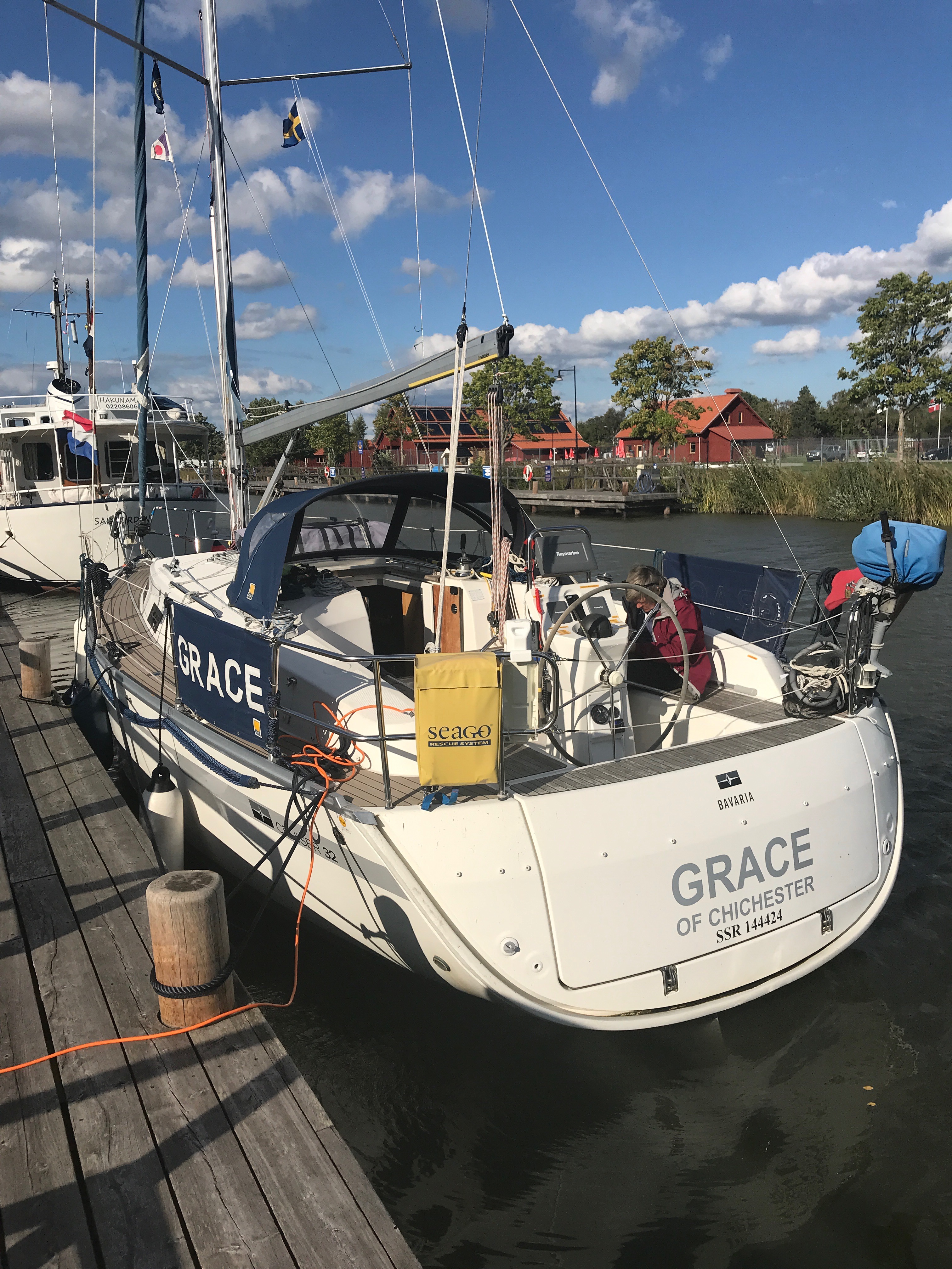
Grace is a Bavaria Cruiser 32 yacht built in 2010. She has a shoal draft of 1.5 m with a Volvo Penta 27 hp and a Bruntons autoprop. She has Selden spars with inmast reefing. Her instruments are all by Raymarine.

A sailing adventure to the Baltic Sea…….and back!
Grace is a Bavaria Cruiser 32 yacht built in 2010. She has a shoal draft of 1.5 m with a Volvo Penta 27 hp and a Bruntons autoprop. She has Selden spars with inmast reefing. Her instruments are all by Raymarine.
Finally, a spring/summer break in the Covid pandemic means that it is now or perhaps never to getaway and go West! Grace is fighting fit! She has a new saildrive diaphragm, a clean, antifouled hull, an engine service and a hull polish. Her decks are a bit grim but a quick clean will bring up the ‘plastic’ teak wonderfully!


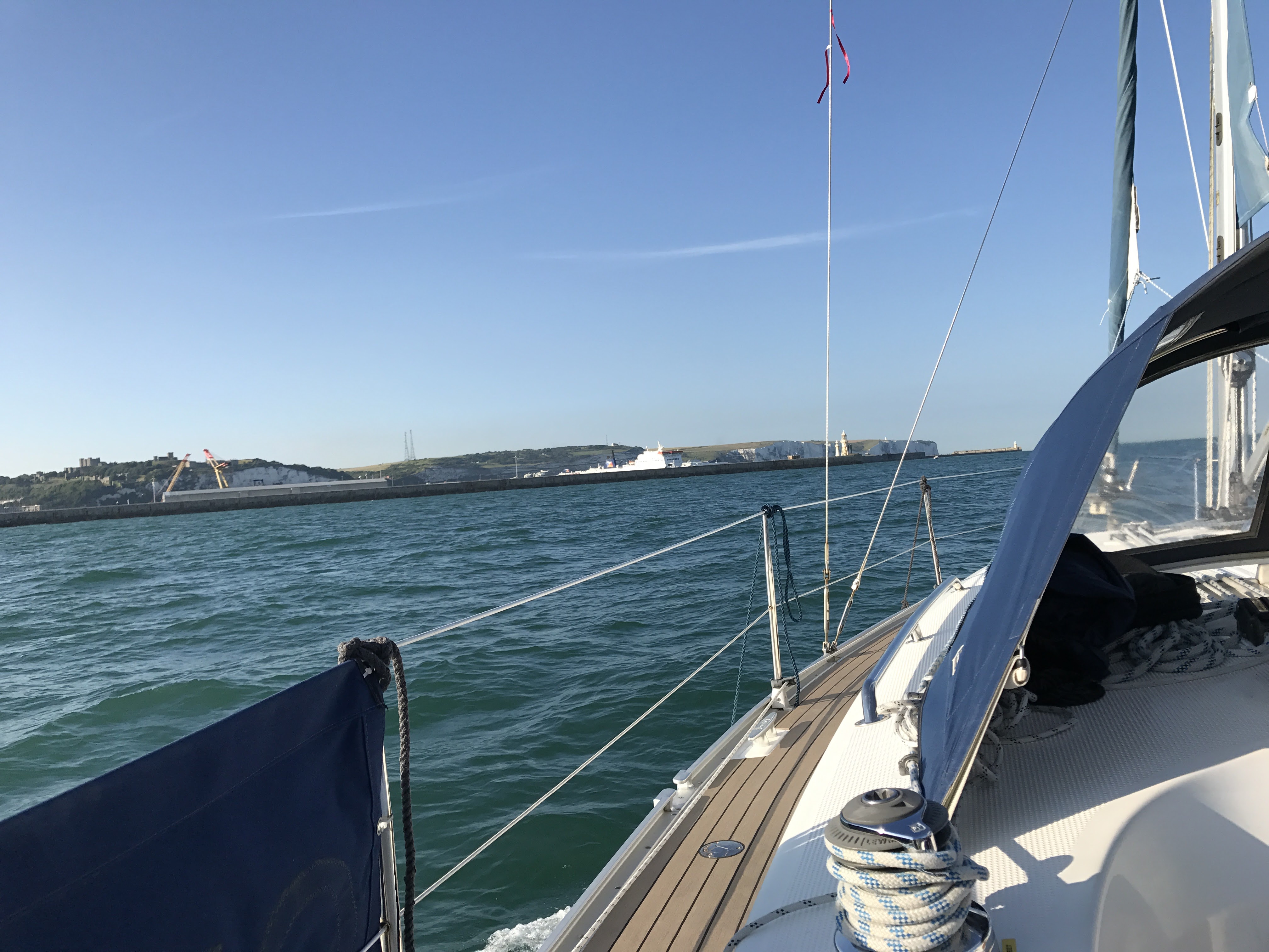
We’re off! It is 6.30 am and we are ready to leave Northney, we want to catch the westerly tidal stream to take us the 19nm down the Solent to Cowes.

Within 50 mins we were at West Pole and heading West. Soon we were flying down towards Portsmouth, and passing the harbour mouth at just after 9 am I ‘VHFed’ the NCI at Gosport on Channel 65 to ask for a radio check. I was quickly responded to!

It is now 10.30 am and we are in Cowes! Berthed on White 4. An incredible quick trip for us – Northney to Cowes in just 4 hours!


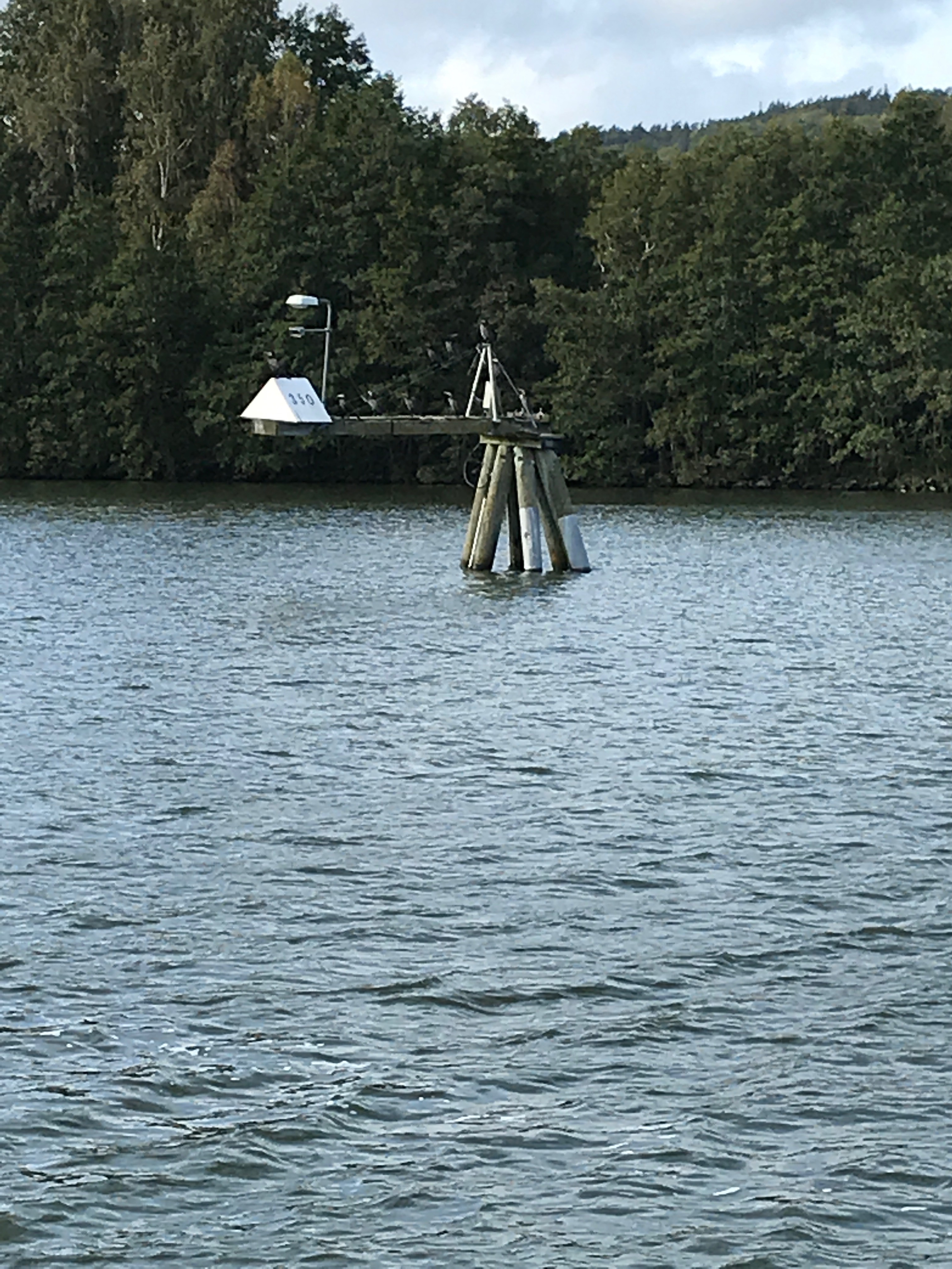
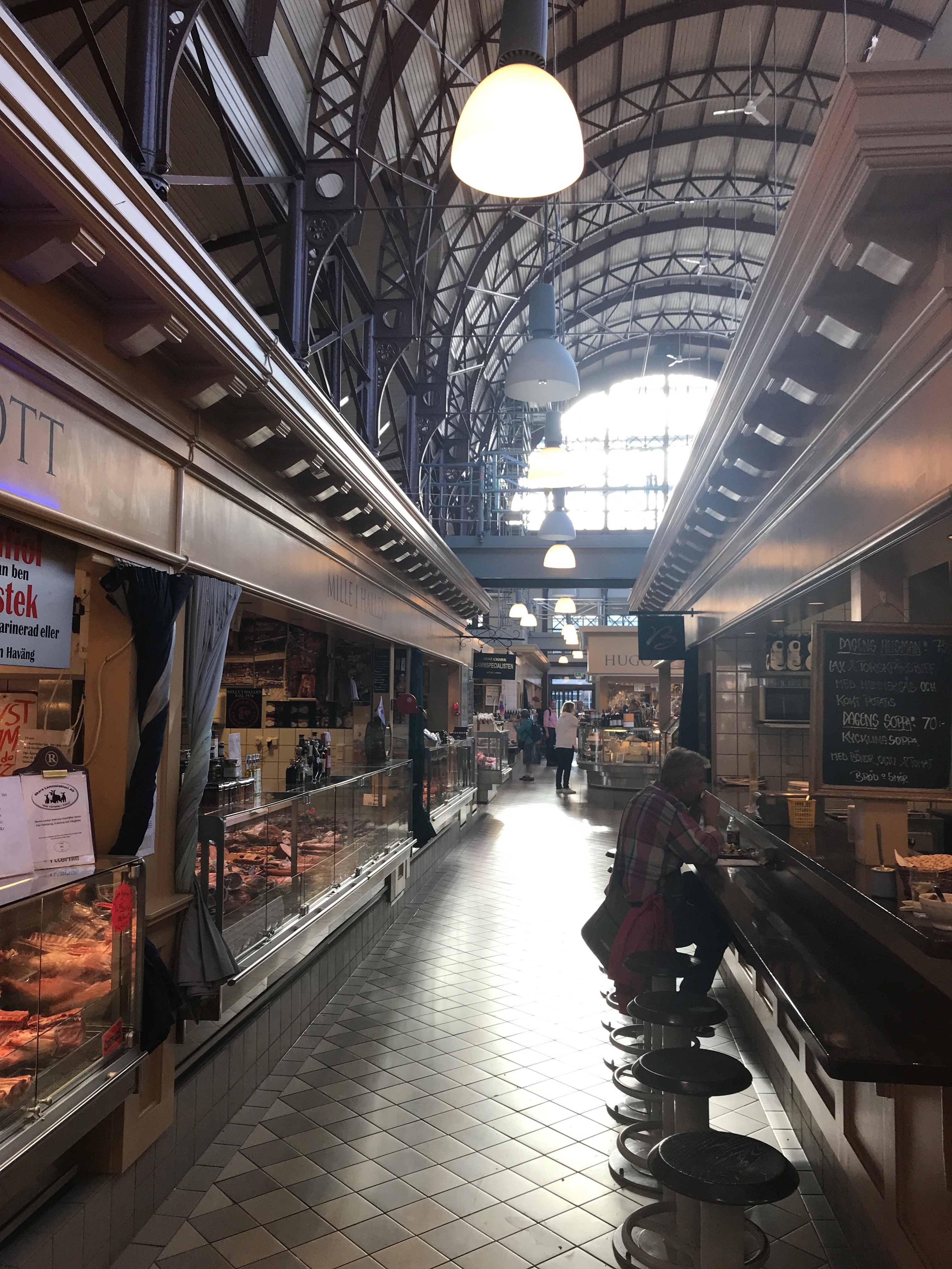
Pictures from my phone…


Early morning in South Harting
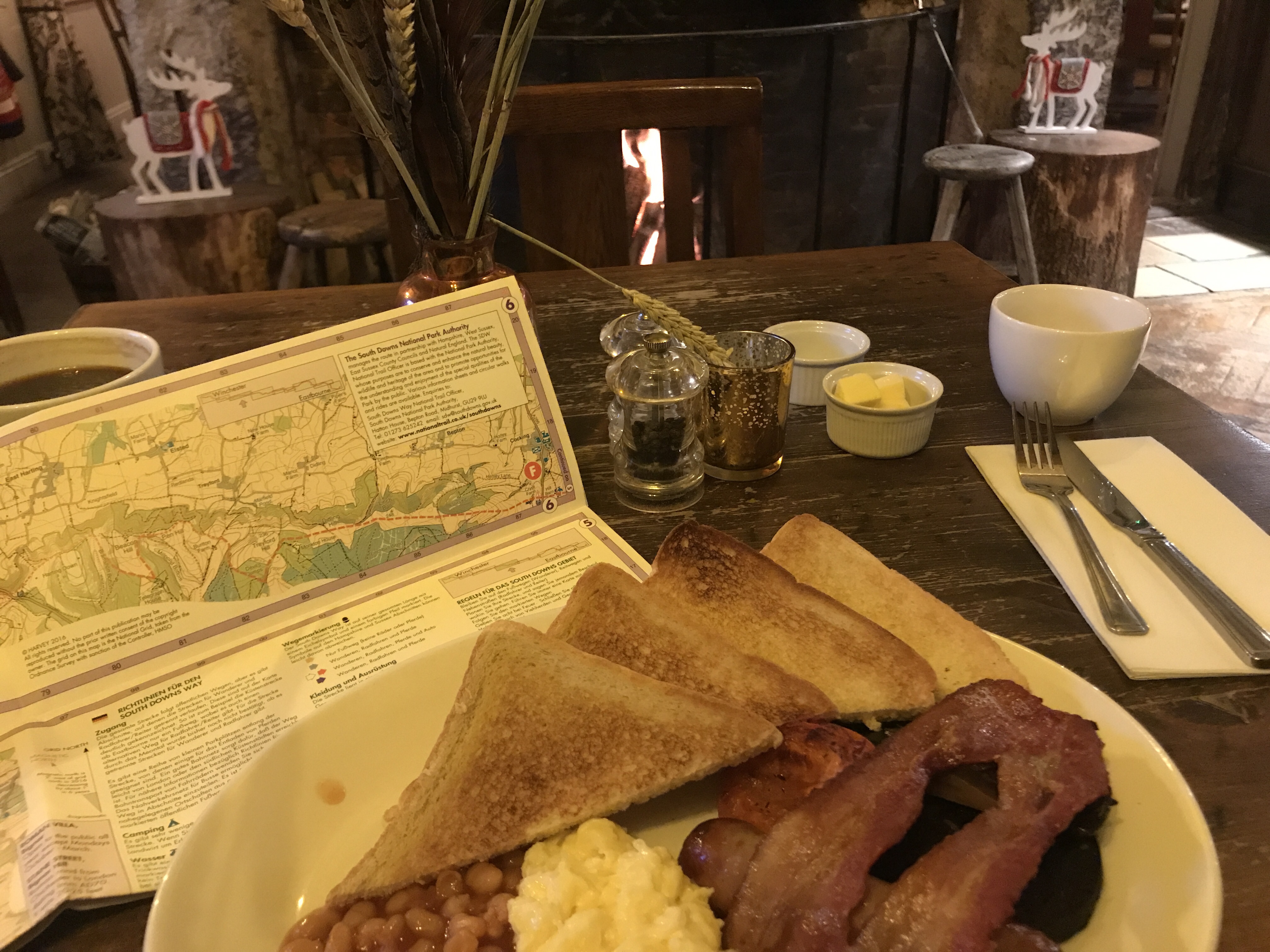
It is Pitch black; 2° degrees, 7:15 am and I was beginning to regret my enthusiasm of the previous night for walking another section of the South Downs Way. Especially as Anne’s warm car disappeared into the distance, leaving me and Hester the dog standing on the very empty and deserted main street of South Harting. Even the White Hart pub my destination for breakfast was in darkness.
The best seat in the house!
Bang on 7:30 am, the White Hart opened its front door and with relief, both Hester and I went inside to be greeted with a lovely fire in the hearth and the promise of a full English breakfast! Fortified, Hester and I set off up the hill past the church to join the South Downs Way. (In truth it was not such a straightforward start! Over breakfast, after studying the OS map I actually set off down the hill, in completely the wrong direction and only realising my mistake when we passed the village pump!)
Careful planning of our route over breakfast!

At the pump I realised I had gone the wrong way!
The very fine church dates back to the 11th century but was modernised at regular intervals in the 13th century and 14th century to keep up with the latest church styles before being burnt to the ground in 1576. It then has continuously undergone improvements by the local gentry to ensure their places in heaven, even employing such illustrious architects such as Sir George Scotts whose buildings include St Pancras station, the Albert Memorial as well as rebuilding the Chichester Cathedral Spire. In fact, he’s is buried in Westminster Abbey as indication of how well regarded an architect he was.

South Harting’s lovely church and churchyard

A peaceful churchyard!
Perched on the hill, the church has an imposing position over the village, a set of stocks outside – clearly for the encouragement of unbelievers. Passing the church, the pavements disappeared and we had to take our chances on the main road dodging the poor commuters as they rushed to their work. We on the other hand rushed on to reach the footpath to join the South Downs Way.

Stocks for the unbelievers!
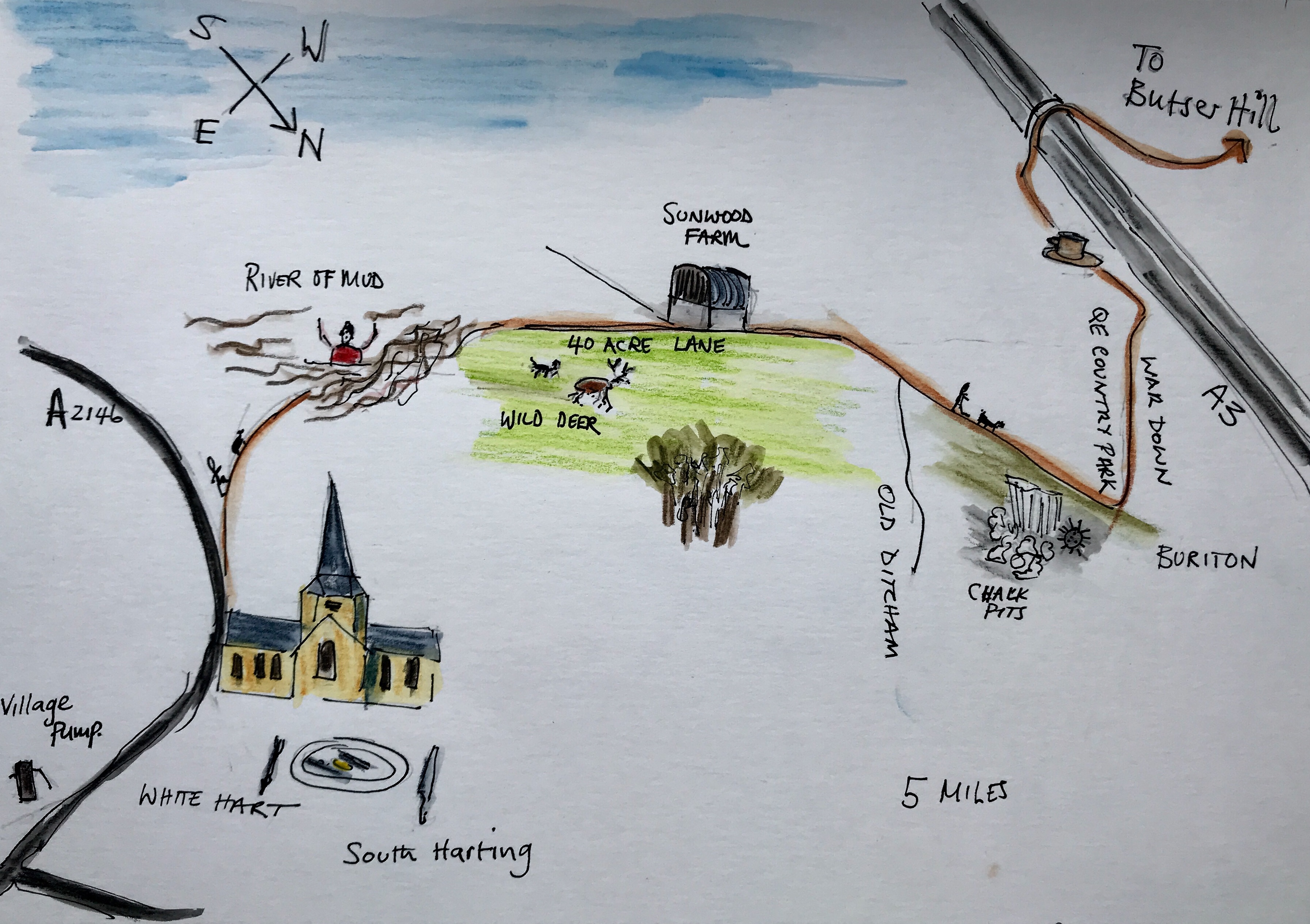
As we stood at the bottom of the hill surveying a river of mud that was all that was left of the footpath after forestry logging, a Ranger came up and said that we would drown in the mud if we were to try to walk up the path and we should take to the bushes at the far side of path and work our way through the undergrowth, or better still give up! This actually work quite well until we got to the top of the hill where we all ended up in one great big muddy swamp which Hester and I had to wade through with the mud flowing over the top of my boots. But at least we had reached South Downs Way.
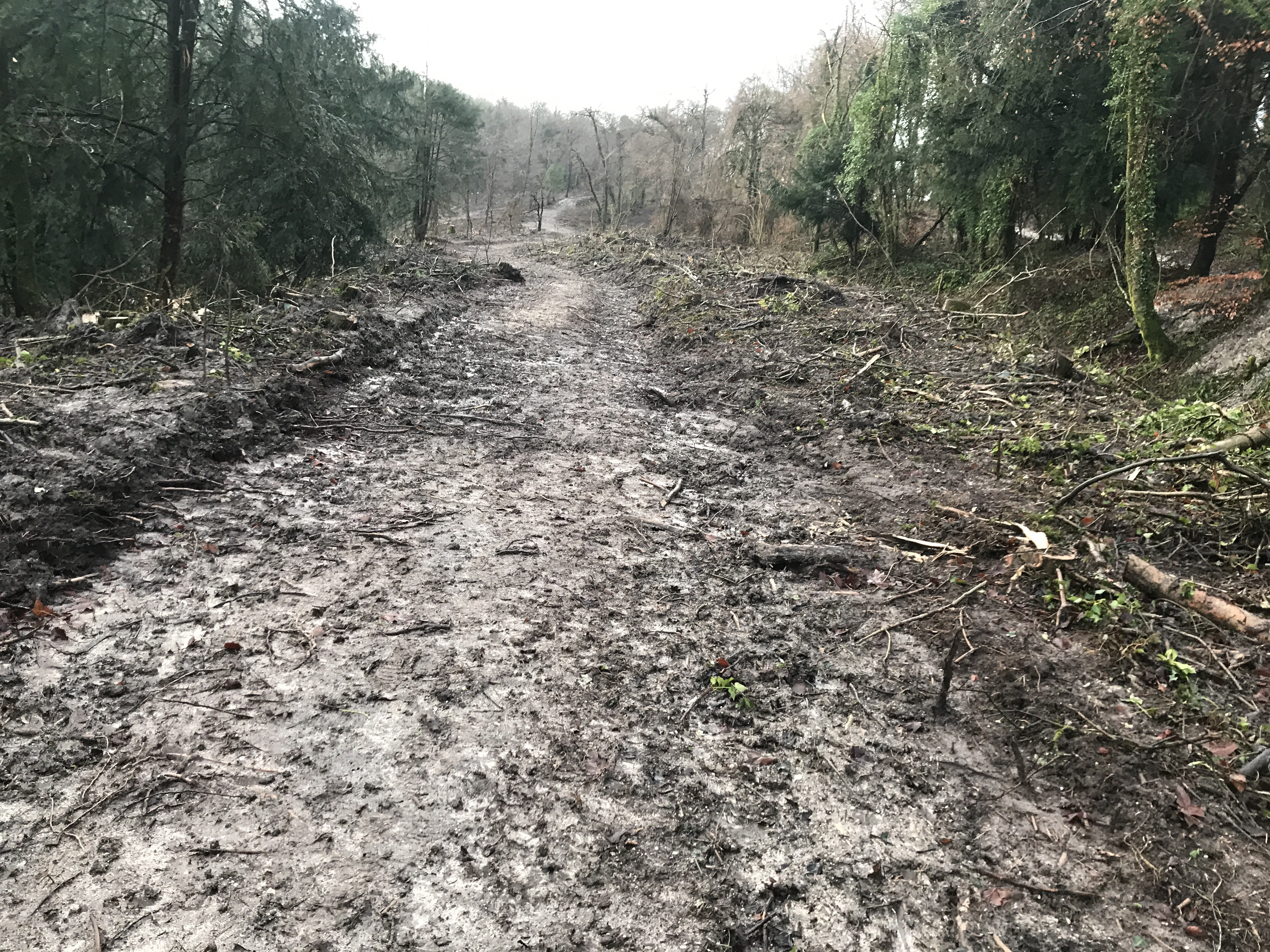
A river of mud flowing down the hill!

Left or right?
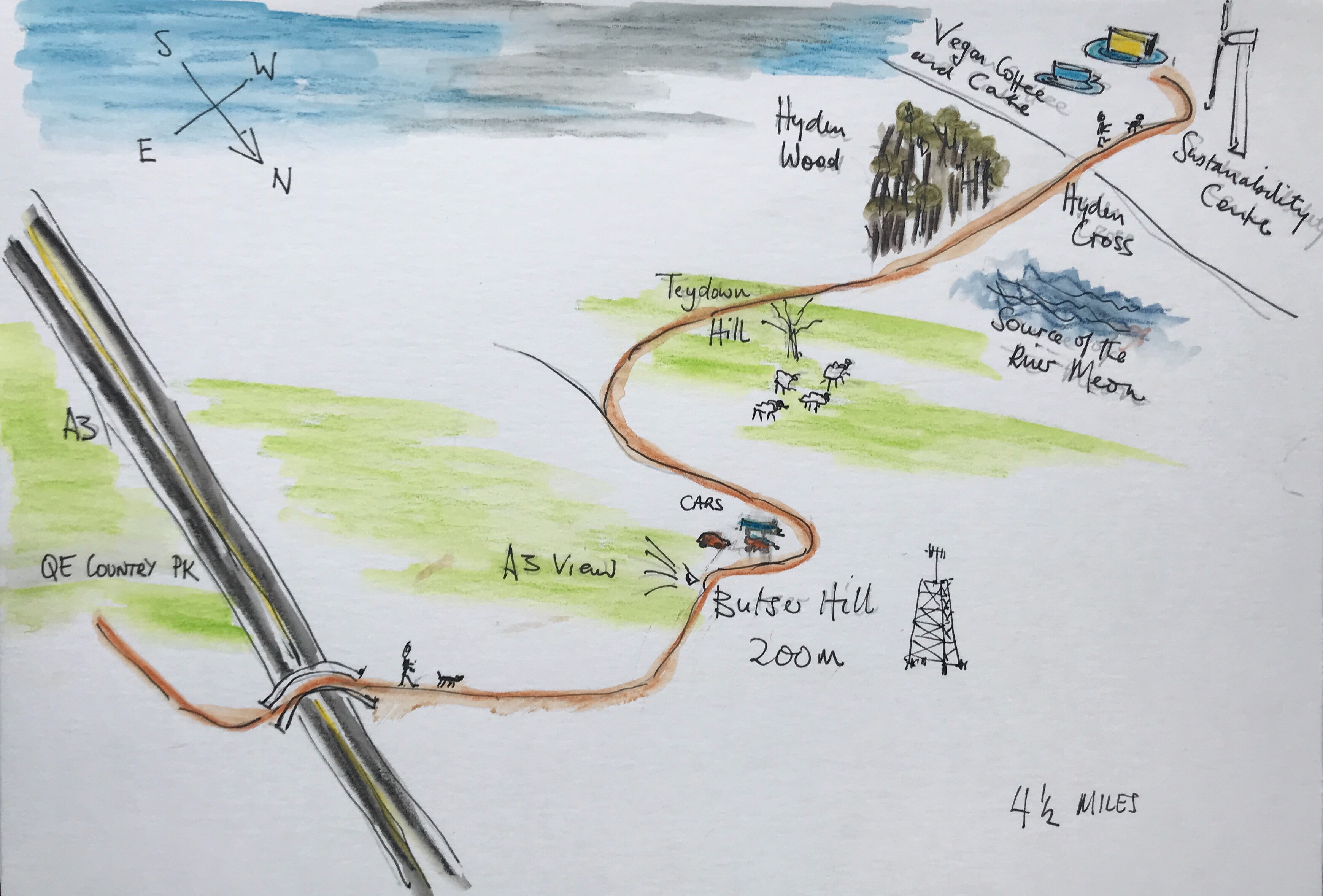
We now had a choice, if we turned left, we would go towards Buriton and a slightly easier route as far as the Queen Elizabeth Country Park. A convenient place just off the A3 to wait to be collected from and a walking distance of about 4 1/2 miles. Turning right, we would head towards Cocking and Chichester but that would mean traversing Treyford Hill which at over 250 m would be one of the highest points on the South Downs Way and a bit of a steep climb. Especially as the weather was set to deteriorate in the afternoon. So turning left, we headed along 40 Acre Lane towards Smallwood farm.

Setting off down the 40 Acre Lane.

Views from 40 Acre Lane.
It was all going very well and we were enjoying the December sunshine when Hester suddenly scented a deer and set off in hot pursuit! Leaping a 4 foot high fence in one bound and taking off up across the field, my worst nightmare had begun! I’m in the middle of nowhere and I’ve lost the dog! The deer outpaced Hester but actually not by that much and disappeared into a copse – in a real Benton moment I stood yelling Hester to no avail! Way up at the far end of the field, she finally stopped chasing the deer and turned round and trotted back towards me, chest puffed out and looking very pleased with herself! The only snag was that she could not jump the fence again without the surge of adrenaline from the chase and I had to coax her back through a hole in the hedge.

Hester went over the hedge in one bound!
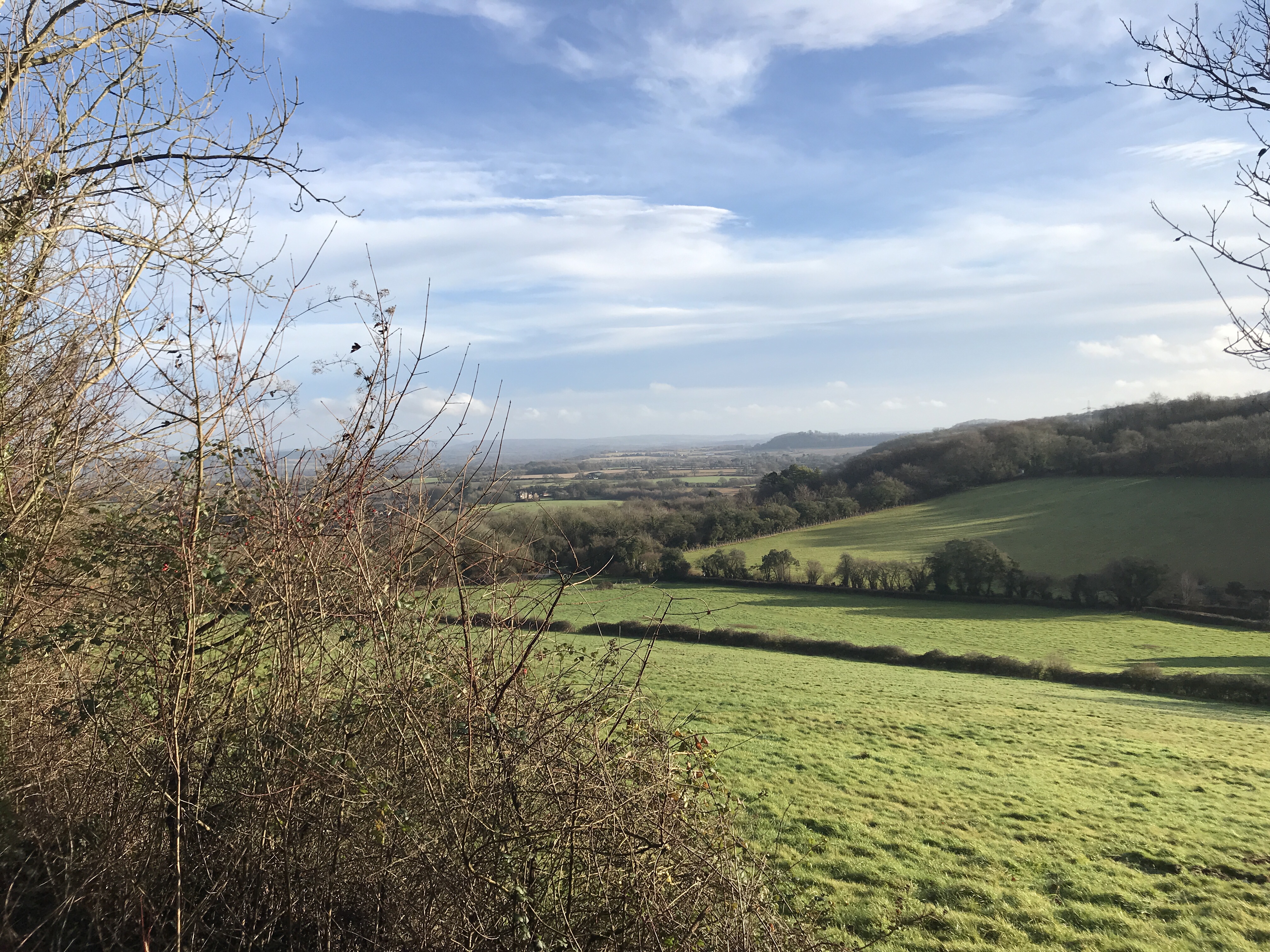
Following the ridge line at a height of about 150 m there was a tremendous view towards Hemner Hills. Walking past Smallwood farm we followed the road towards Old Ditcham. When you are obviously on a ‘walk’, the people you meet are friendly and stop to chat and a motorcyclist even stopped and waited until we walked past in case we got splashed with mud from his wheels. Although at this time of year you don’t see people for hours on end, those you do are always happy to exchange mud stories! Tramping a further 2 miles we reach the chalk pits at Buriton. Back in the 1940s the whole area was an enormous chalk quarry with lime kilns belching out black smoke on every hill. The Navy even brought up unexploded mines out the chalk pits to defuse them in safety (except for those diffusing them of course). But what a contrast, now in just 80 years the whole place is completely rewilded, nature has taken over again!
No sign of the lime kilns.
Following the path, we climbed the steep War Down and into the Queen Elizabeth Country Park. We had made tremendous progress. It was now 11 am and we had covered the 5 miles to our planned pick up point and it was only just time for coffee! Admittedly, with aching knees we went into the very dog friendly café in the visitor centre. It was great to sit down and just as I was contemplating how long I could stay there and whether I would have shepherds pie or lasagna for lunch when Hester now fully recharged, bounced up and was ready to go walking again. So off we went!
Climbing War Down.

A confused Hester! This sheep does not smell right!
Just the right time to stop for coffee!
The next part of our walk.
So, crossing the A3 we headed up Butser Hill. At around a height of 200 metres you get a great view of the A3! It is a bit of a let down as it is a long steep climb and you rather expect something better than the A3. We now reach the top of the ridge and we set off along Claypit Road and across Hillhampton Down. For an increasingly grey and windy day in December there is an awful lot of parked cars up there with steamed up windows – clearly they were not there for the view!

Up Butser Hill
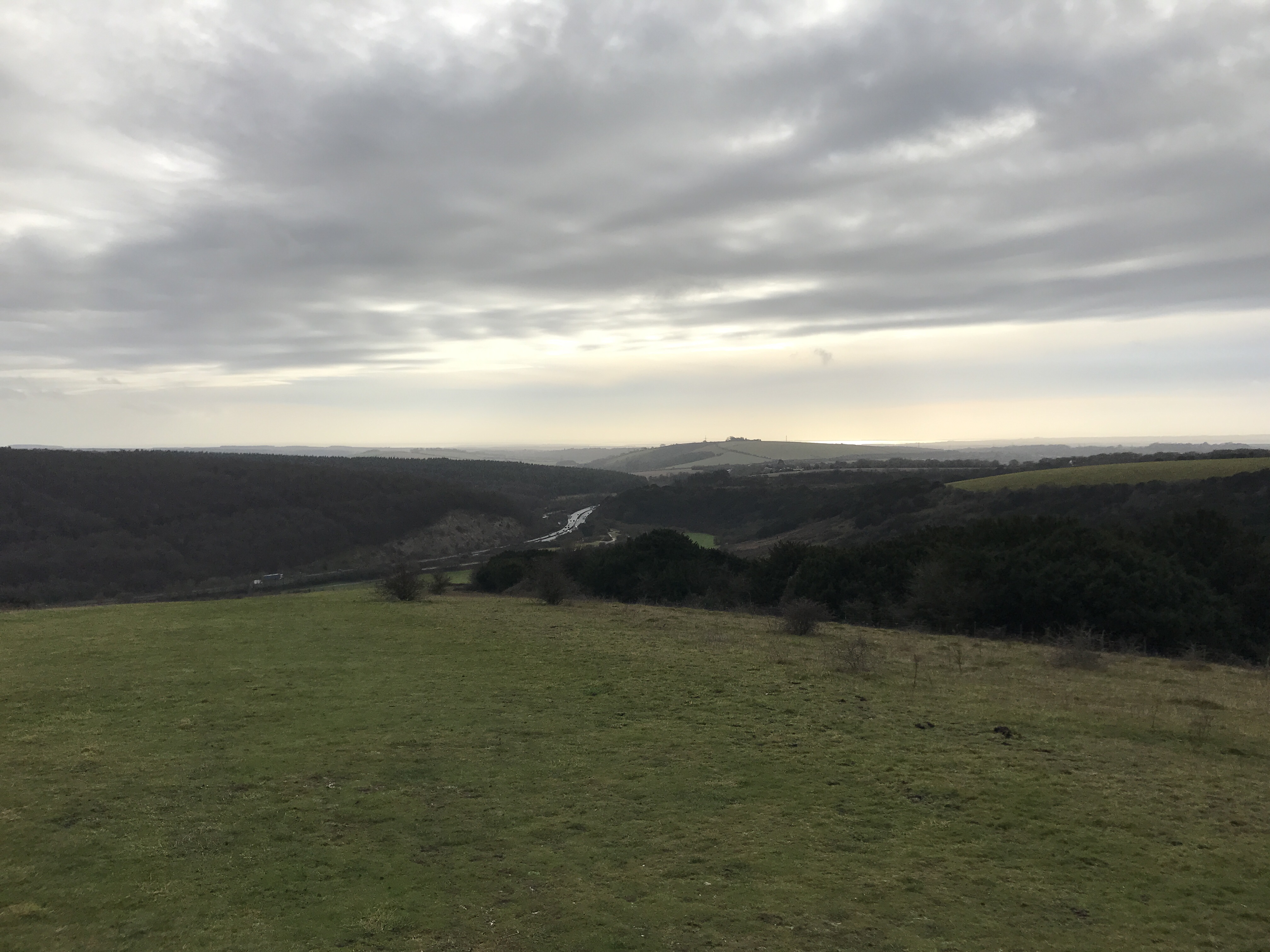
Great views of the A3!
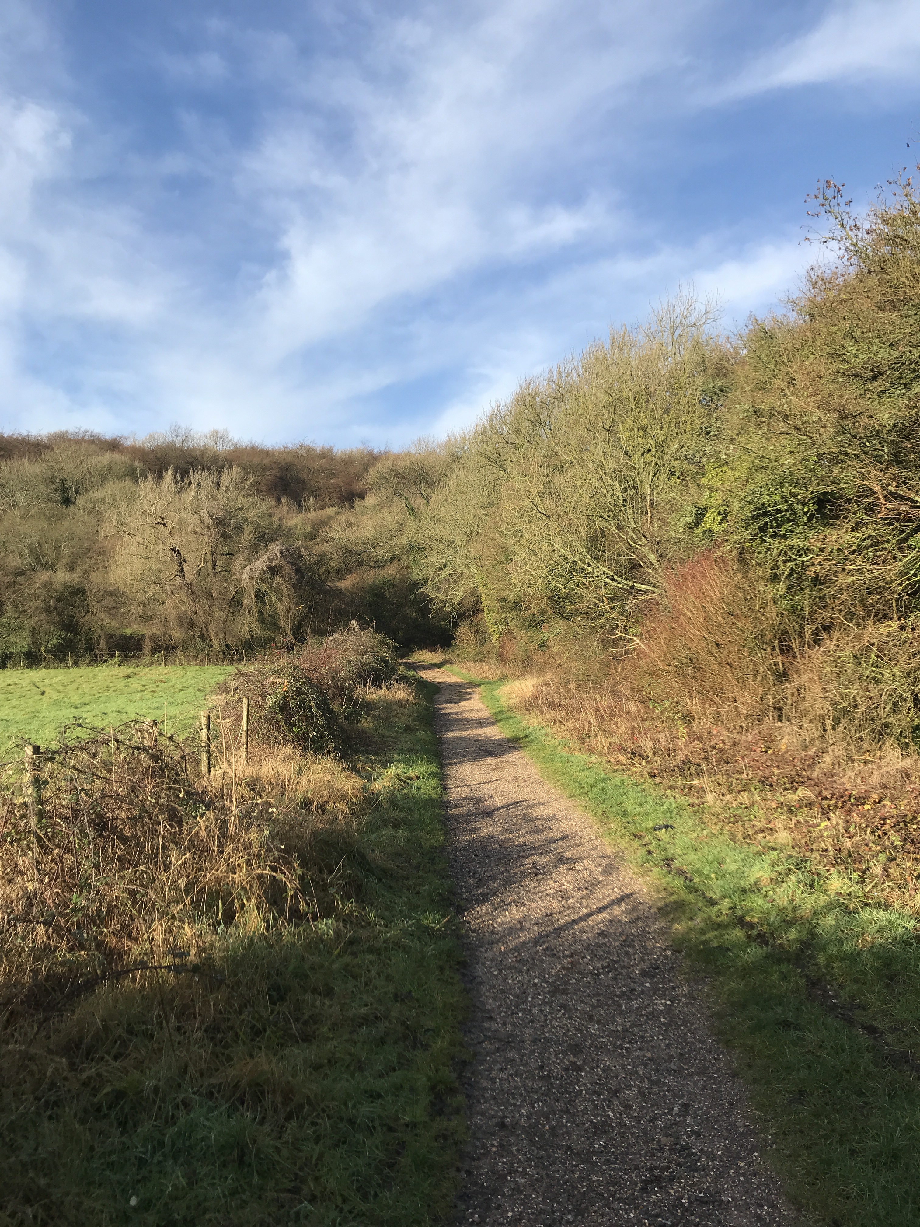
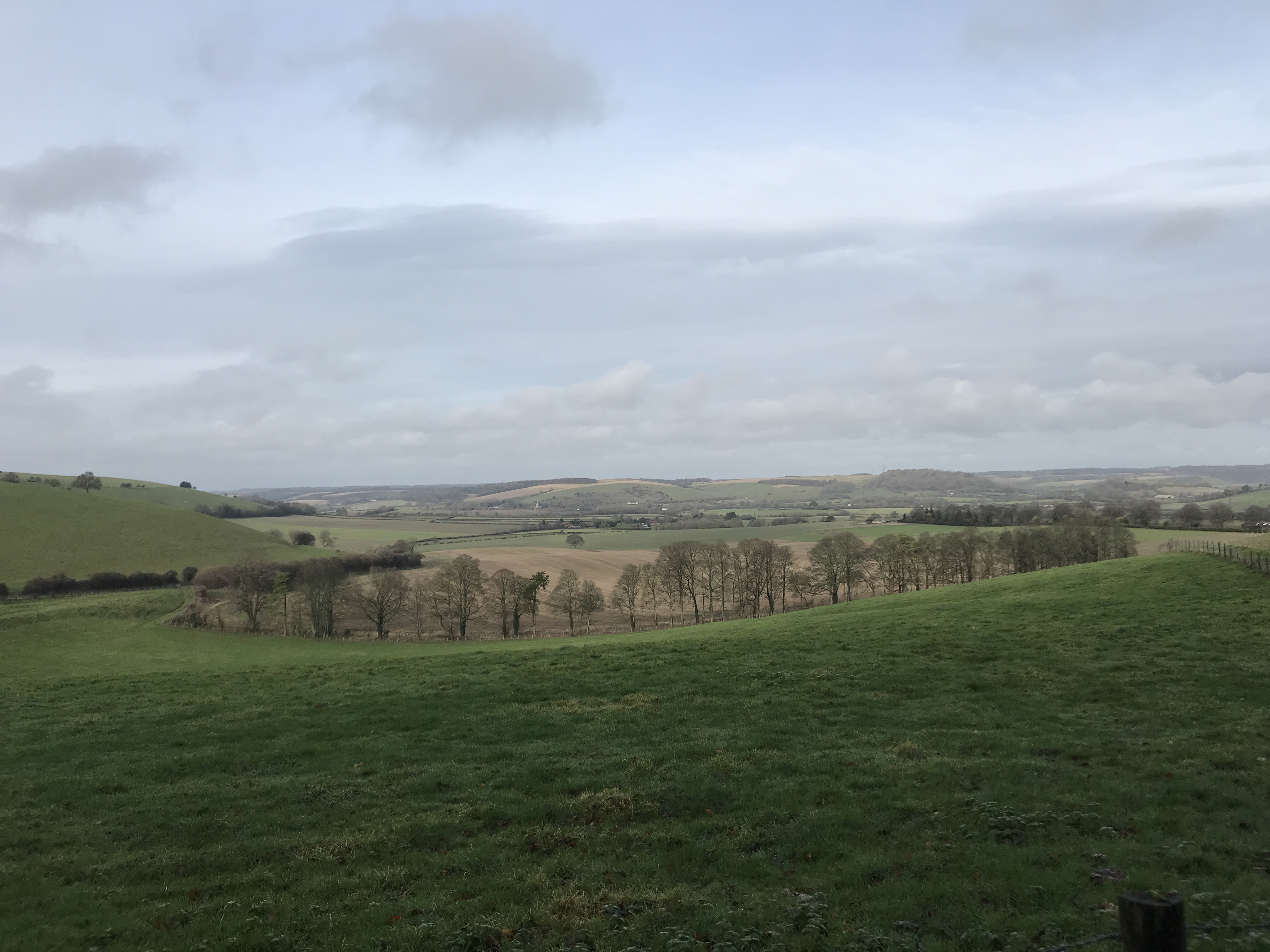
At the end of the road we took the path to the right across Tegdown Hill. This felt to be the homeward stretch and in some respects the nicest part of the walk with open fields and expansive views on either side and a firm dry chalky path under foot.

Tegdown Hill
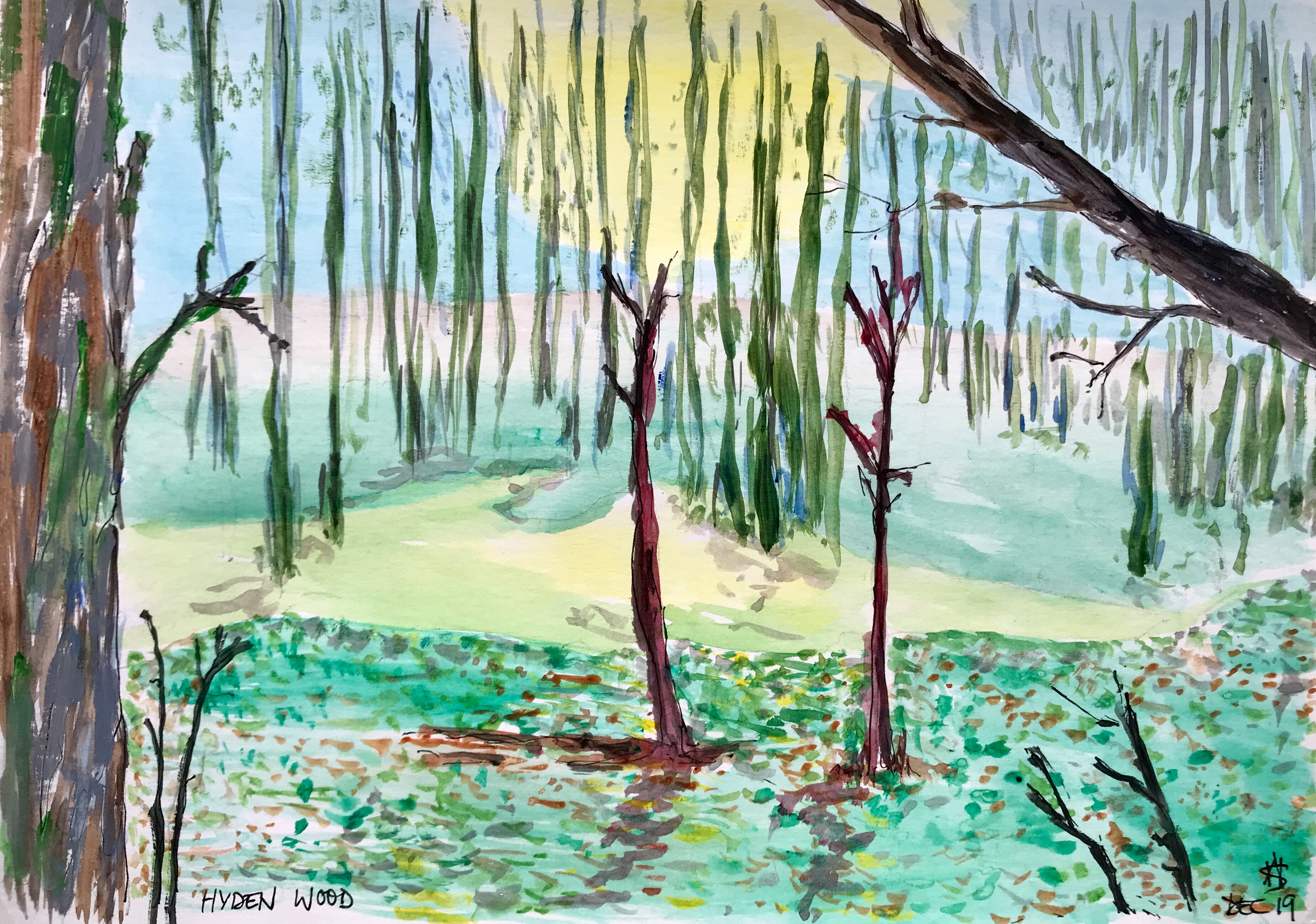
Needle straight ashes in Hyden Wood
Tracking along the hill line, the wind had got up, the sky had become very grey and rain did not look very far away, so picking up our pace we passed through Hyden Wood, the path deep in crispy ash leaves through which Hester joyfully ran and jumped, clearly enjoying the sound they made. Deep in the valley to our right was the source of the River Meon, we were now at Hyden Cross and journeys end. After 9.5 miles and seven hours later Hester and I were sat in the warm and dry of the “Sustainability Centre” (a popular stop with us SDW walkers!) enjoying vegan chocolate cake and fair trade coffee and waiting for Anne to rescue us!
Journeys end and the source of the river Meon
Finally stopped for coffee and cake!
Walking the South Downs Way
This winter, my plan is to walk the South Downs Way in a series of easy steps with Hester the dog. We will be dropped off in one place and picked up 4 or 5 hours later in convenient place after Anne has finished her work. Sounds like a good plan to me!
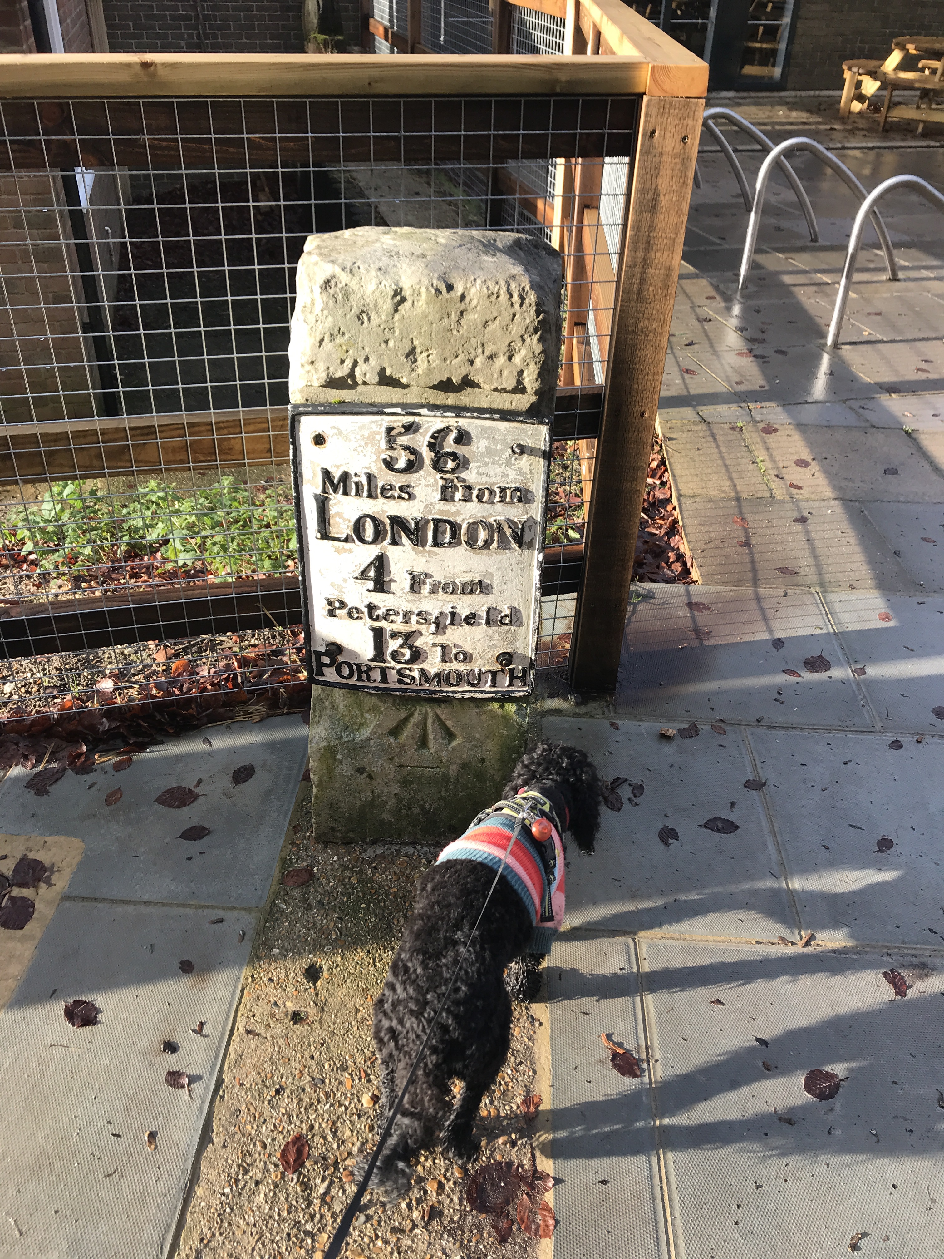
The South Downs Way stretches approximately 100 miles from Winchester to Eastbourne. Its starting point in Winchester is a bit unclear, some say the cathedral, others say the statue of King Alfred – so I walked to them both just in case! I had imagined that the SDW was some historic way taken by pilgrims for centuries…… but no! It is not a historic route but one created in the 1970’s. It does however link age old paths, trails and drover ways – some over 8000 years old! The paths follow the chalky downs ridge line and avoids the marshy and damp of the weald.

The first part from Cheesefoot Head to Winchester
Every good walk needs to start off with a good lunch to ward against the hardship of the journey…. And today was no exception! Lunch at the Hinton Arms in Cheriton sorted this! Cheriton has an interesting history, it was the site of a particularly brutal and decisive battle of the civil war. In 1644, five thousand royalist troops were defeated by 10,000 parliamentarian soldiers and effectively ended Charles 1 offensive in Southern England. It was all downhill after that, the royalists ever gained the initiative again and lead to his beheading! It is claimed that the road through the village ran red with blood.

View across the Itchen Valley
Suitably fortified Hester and I were dropped off at Cheesefoot Head for a gentle 4 miles downhill walk into Winchester. This part of the walk from Telegraph Hill is the highest part of the route and it felt a bit like cheating as we had avoided the walk up from Winchester! Cheesefoot Head is a huge natural bowl scoured out of the chalk. It looks like it is a manmade amphitheatre because of its even shape. It is natural but has been use as a meeting place for millennia, including during the preparations for D-Day where Ike addressed 100,000 allied soldiers in June 1944.

Iron Age Bowl burial mound on Telegraph Hill
On Telegraph Hill, named because it was the site of beacons and a semaphore station is peppered with Iron Age bowl burial barrows, on one of them is a trig point denoting the highest point but I never found it! From here on in it was down hill all the way to Winchester. Following the finger posts down the field margin, we walked towards Winchester. Hester running on ahead off her lead, head in every rabbit and fox hole – she would get a shock if she met one!
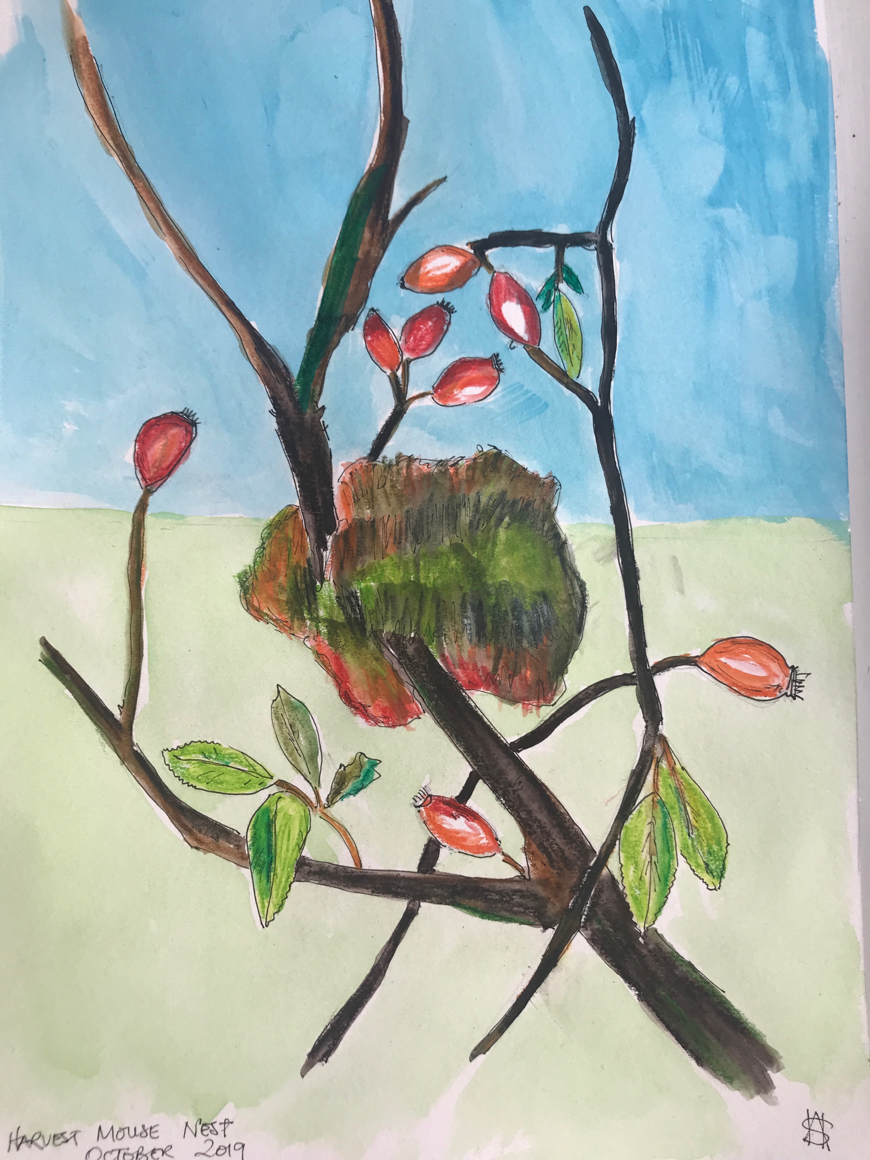
Harvest mouse nest amongst the rosehips
As we walked down towards Winchester, it got progressively noisier, first with the firing ranges at Chilcomb which we skirted through the village and passed the vineyard. Pressing on, the noise of the M3 became louder until suddenly we were on the footbridge crossing over it and into the outskirts of Winchester. We walked along the river bank, which was rerouted to form a moat around the city by the Romans towards the centre of the town and to the statue of King Alfred, our official start point of the SDW and the end of our walk (possibly).
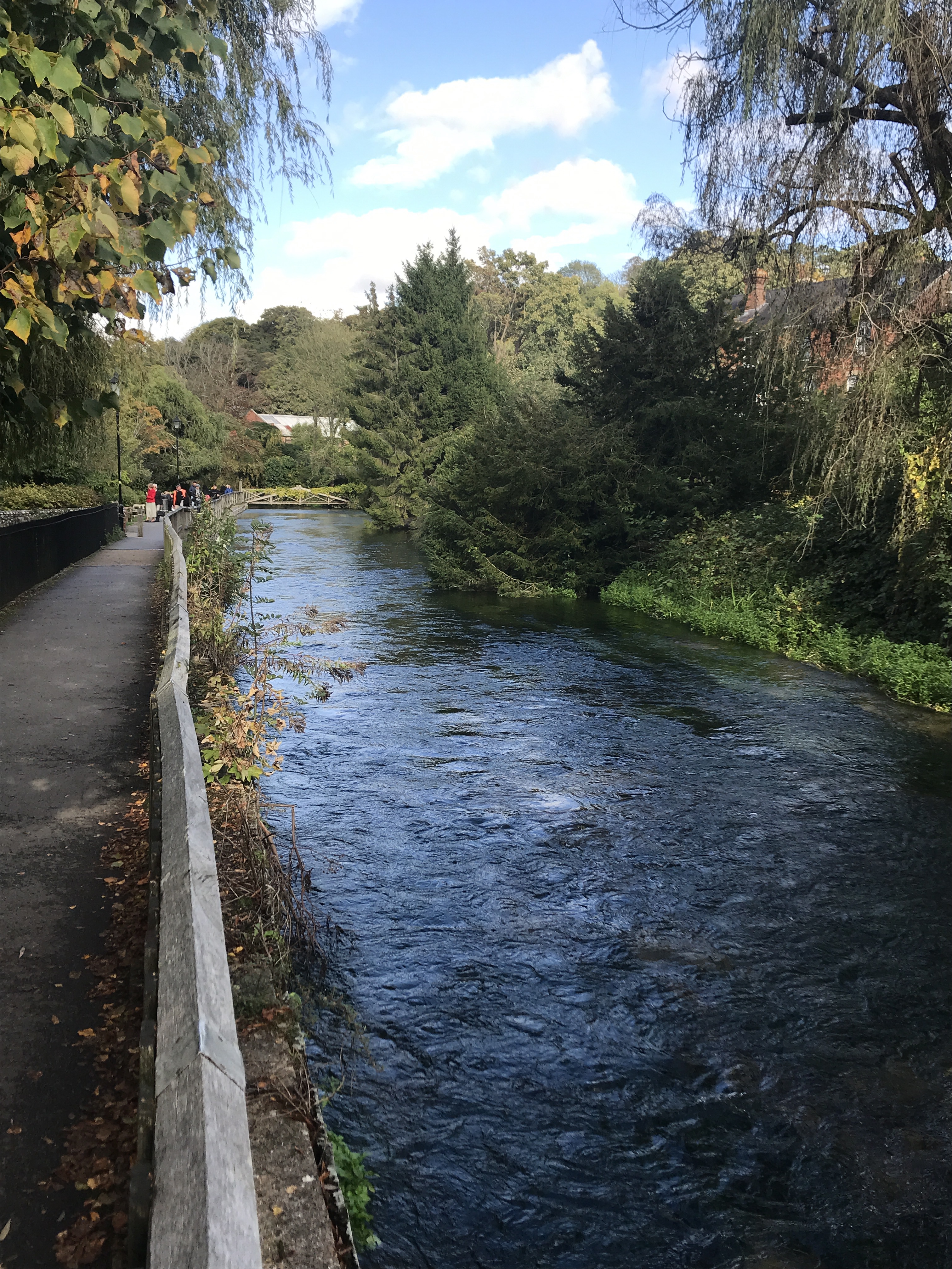
Following the river into Winchester
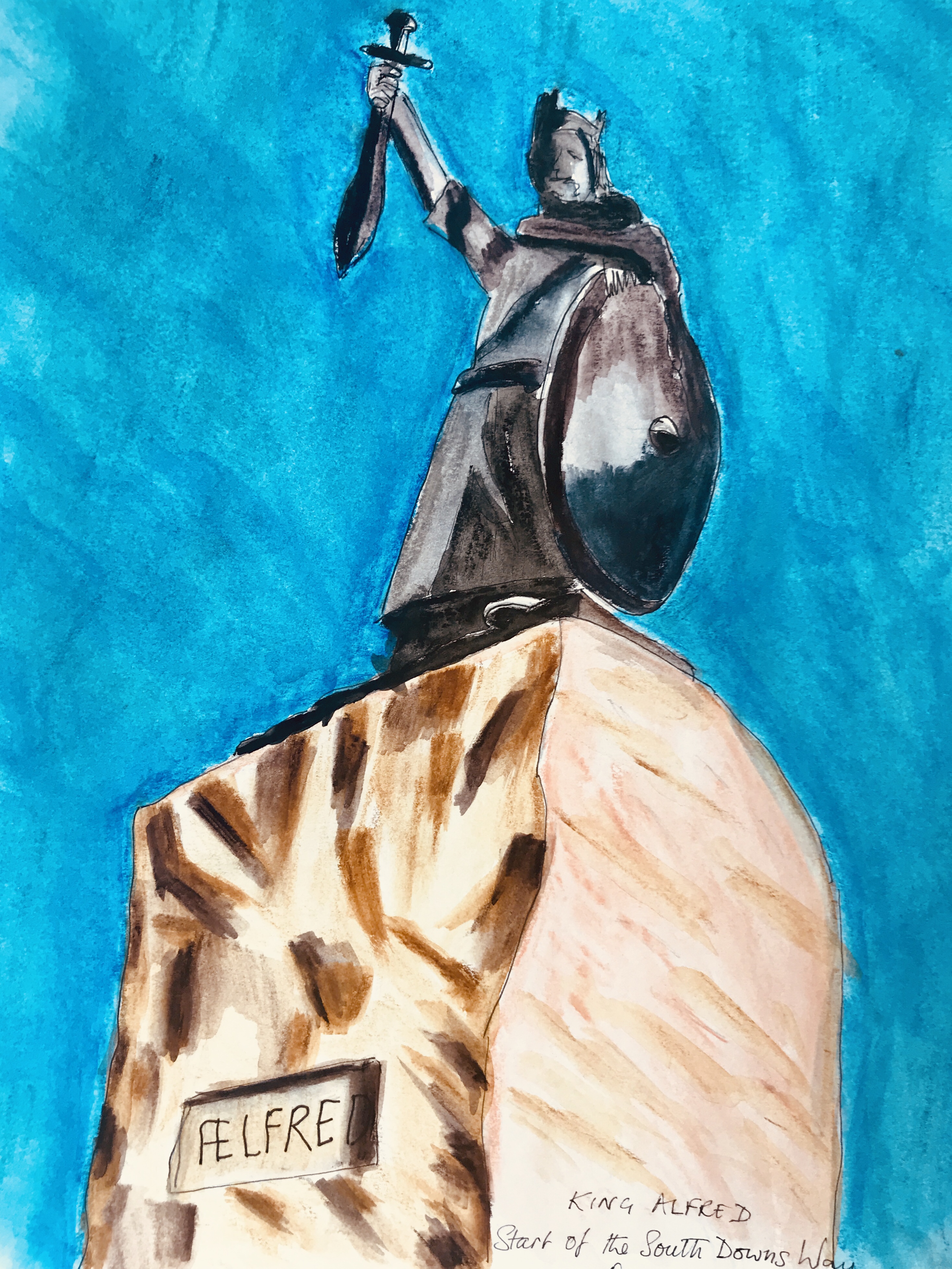
King Alfred and possibly the start of the South Downs Way
However just to make sure we had found true start of the SDW, we set off to find the cathedral. If it was like Chichester cathedral, it would have been easy to find as you can see the spire for miles but not Winchester. No, we wandered around the streets until we found a small alley that said something like ‘Abbey Way’ and following it we eventually found the cathedral!

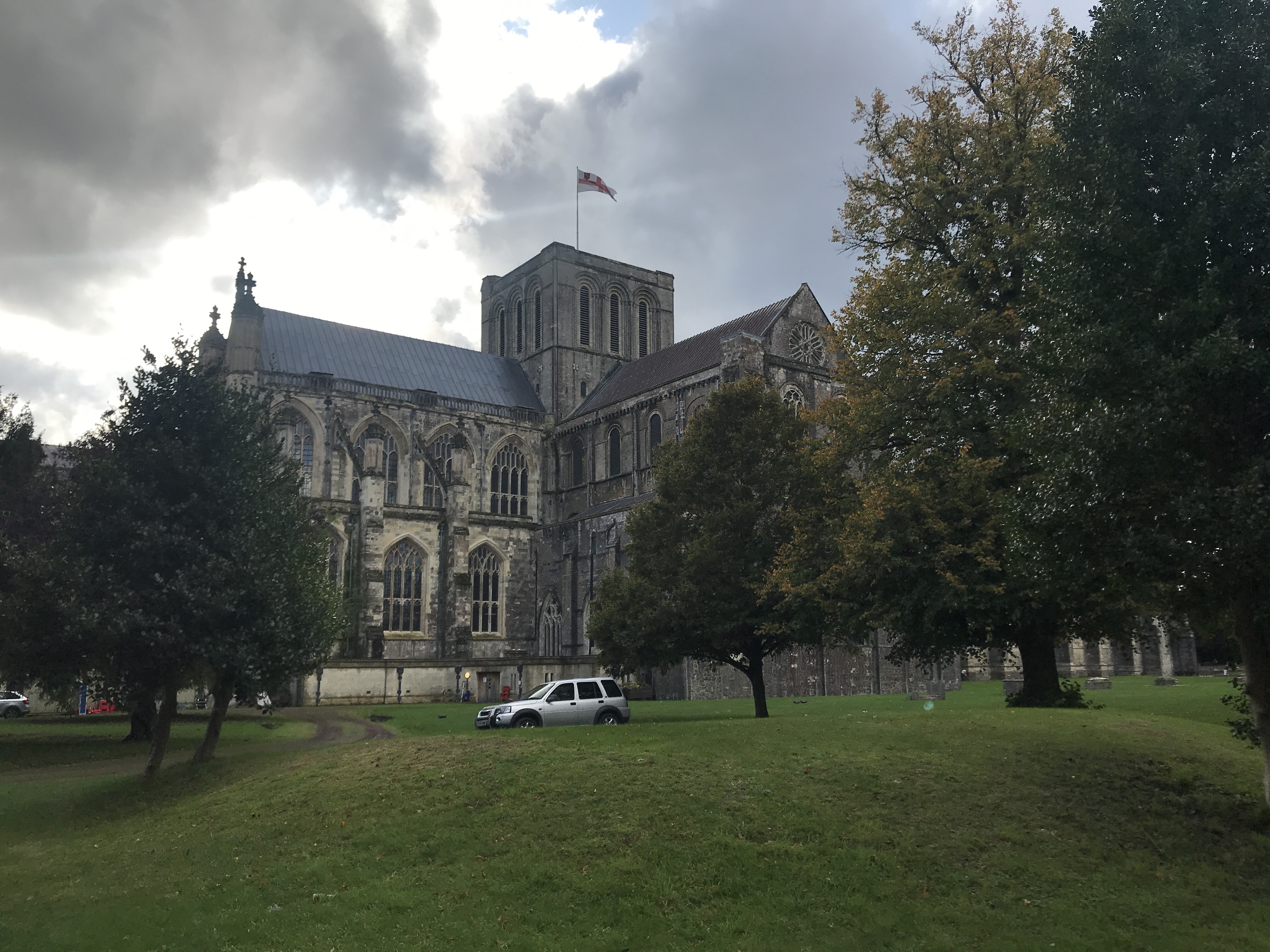
At the Cathedral, possibility the start/end of the South Downs Way
Now just 96 miles or so left to walk.
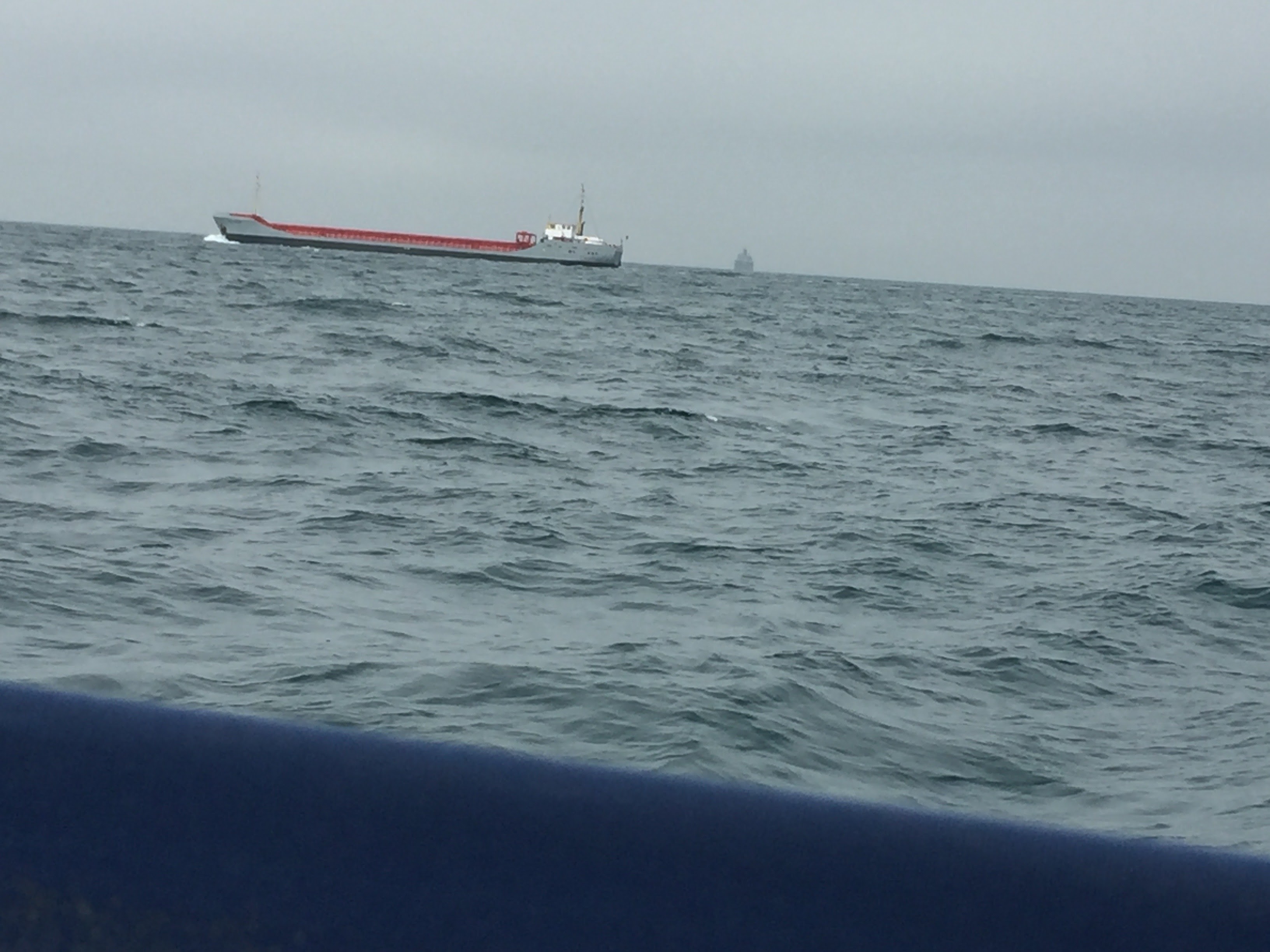
What a wash-out! Twice our summer cruise has had to be abandonned due to the terrible weather, the first time was at the beginning of August ahead of Cowes week and then now in late September. The prospect of being storm bound and bobbing around on the end of a pontoon in some godforsaken harbour, trapped in 80 square feet with a wet dog is not going to be much fun….but that’s sailing for you! So I created a virtual cruise instead, where wind, weather and tides were always perfect!
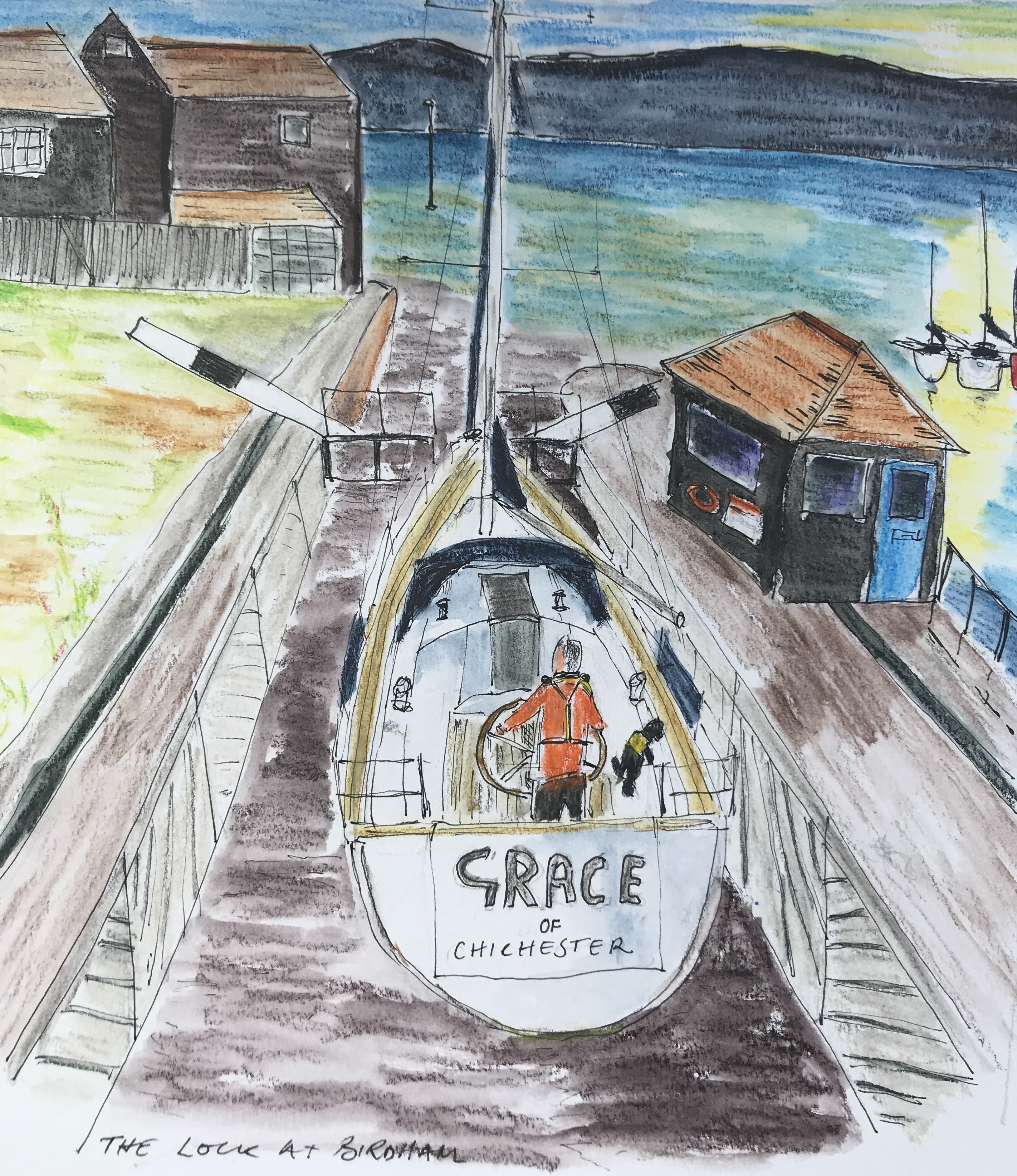
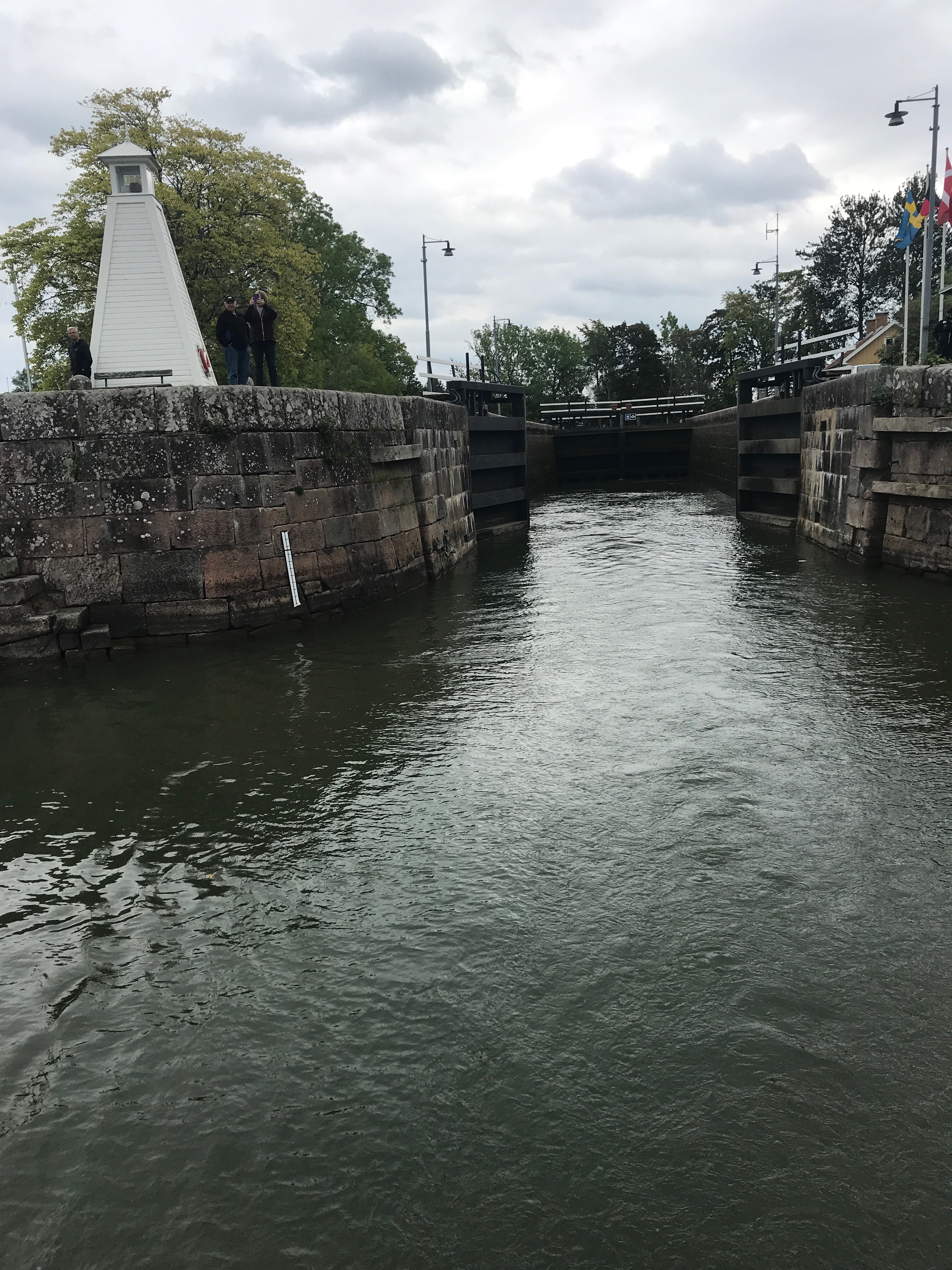
In the lock at Birdham Pool
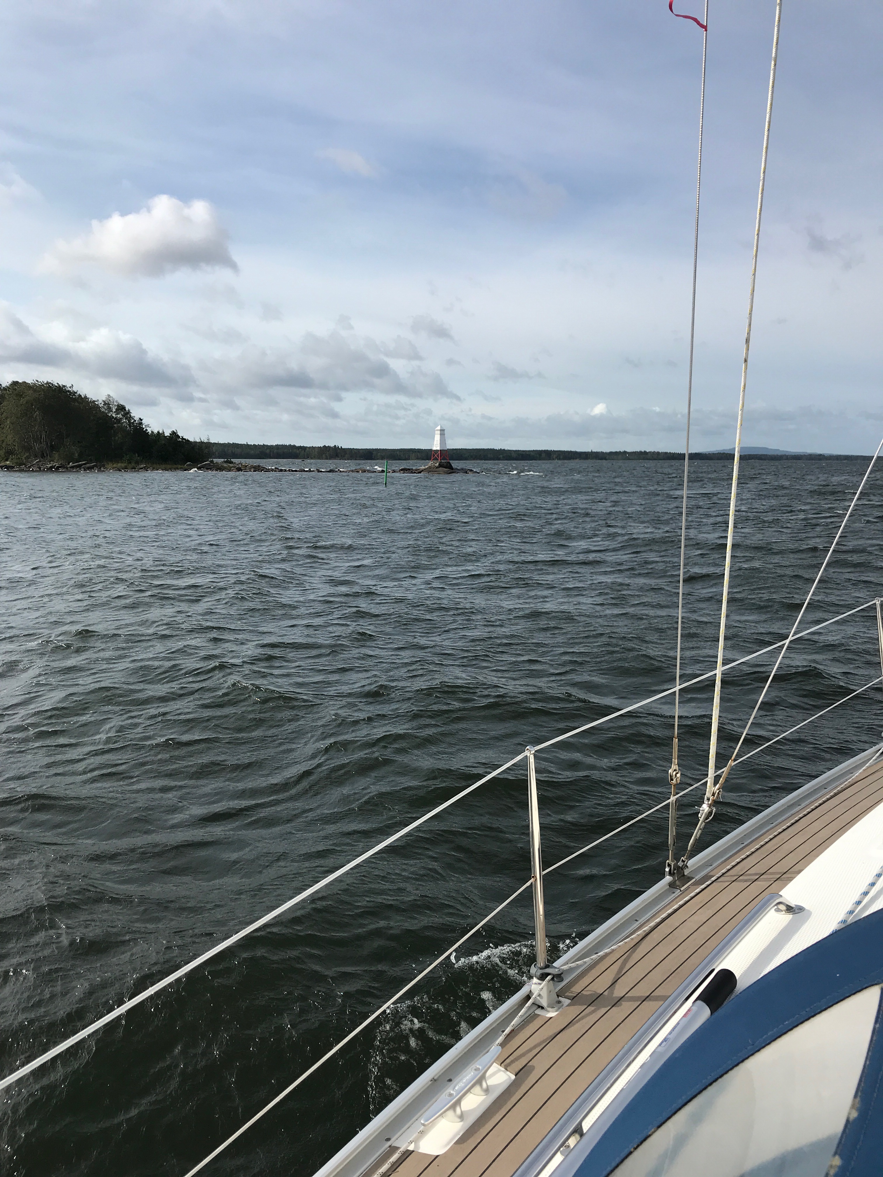
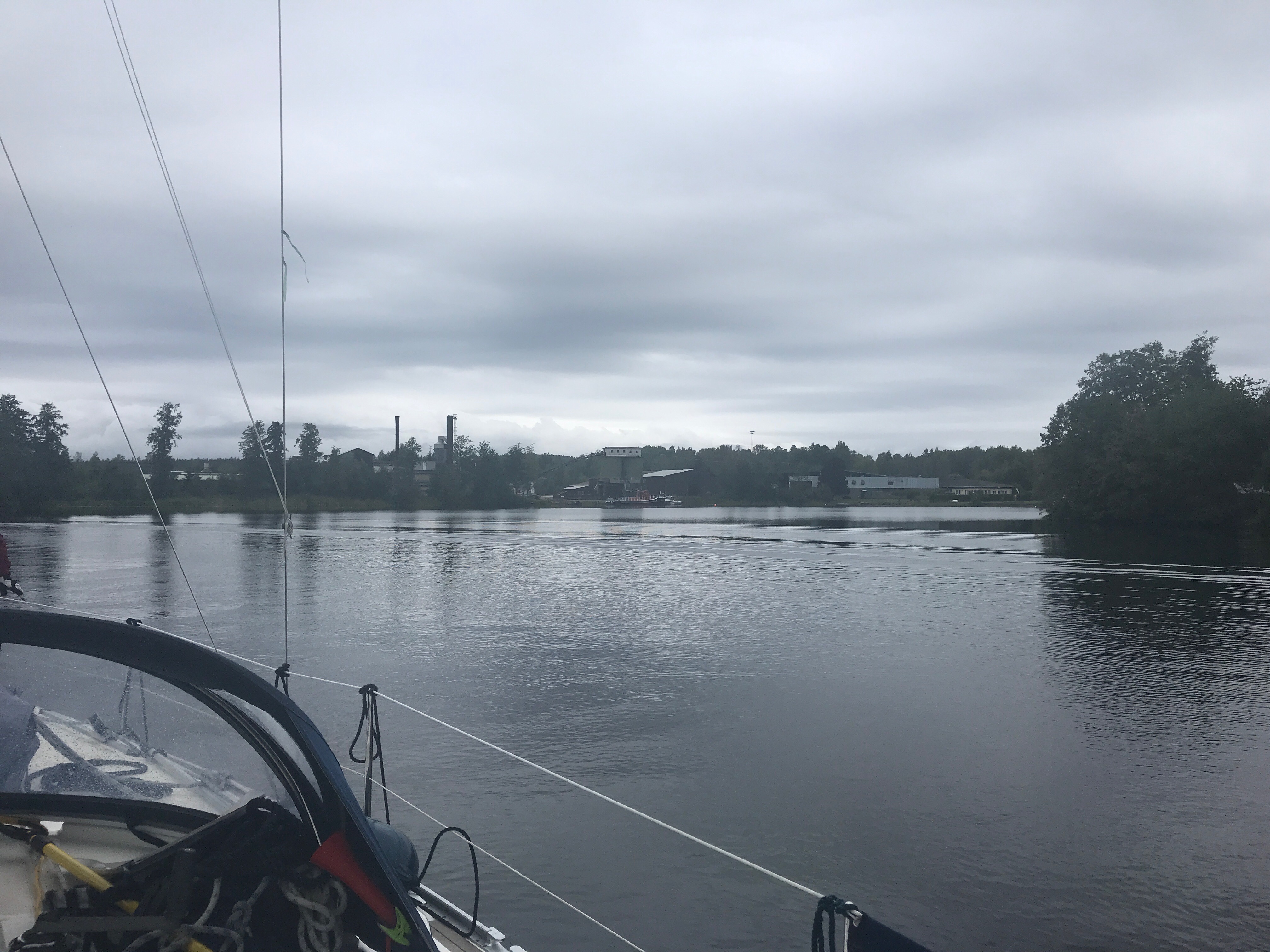
Leaving 2 hours after high tide at Birdham and slipping through the lock at 0815. We motored out into Chichester harbour; down past Itchenor Reach and Roman Transit, keeping the ancient stand of trees behind us as we sailed down toward the Camber Beacon. At East Head, we past the last, still sailing Lowestoft fishing smack at anchor. Apparently the design was revolutionary at the time, increasing the efficiency of the fishing fleets and was the start of the overfishing of fish stocks! Heading South on 180, the strong ebbing tide swept us out past Hayling Island towards the Bar Beacon and over Chichester Bar, clearing it with 1.4 m under our keel.
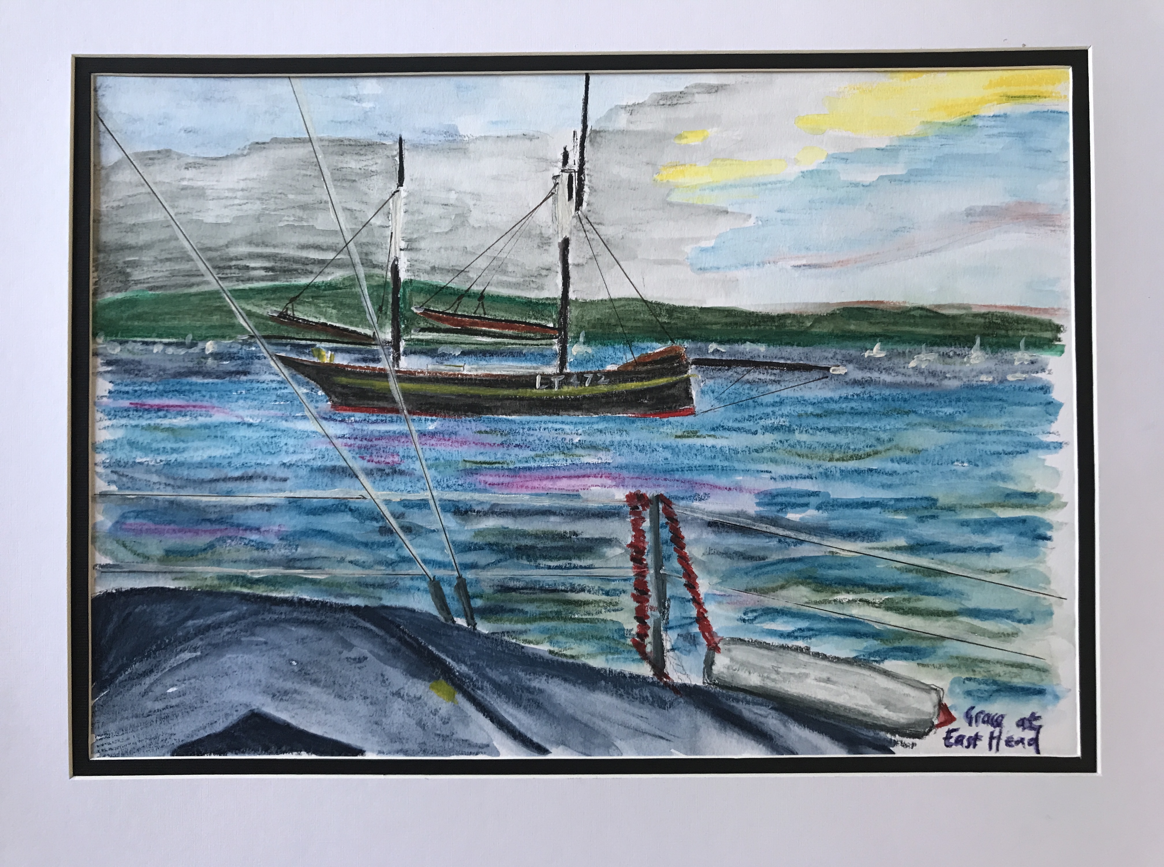
Lowestoft Fishing Smack
‘Sails up’ at 0925 as we past the West Pole and headed towards the Dean Tail Cardinal on a bearing of 240 in the nice light South Westerly breeze. Once at the Cardinal we gybed onto a very broad reach to 280 towards Seaview on the Isle of Wight. By 1200 we were tied up to a visitors buoy just off the Seaview Sailing Club. A rib from the club took us ashore in time for lunch. Later, slipping our moorings we set off on a Northerly course for Gosport and the Royal Sovereign Marina. Royal Sovereign Marina is one of 4 original naval victualling yards, similar to the one in Plymouth. Portsmouth has 24 hours, all weather access so perfect for our first nights stop. As an NCI watch keeper I was keen not to make any mistakes when sailing under the watchful eyes of the NCI in the tower at the harbour mouth!
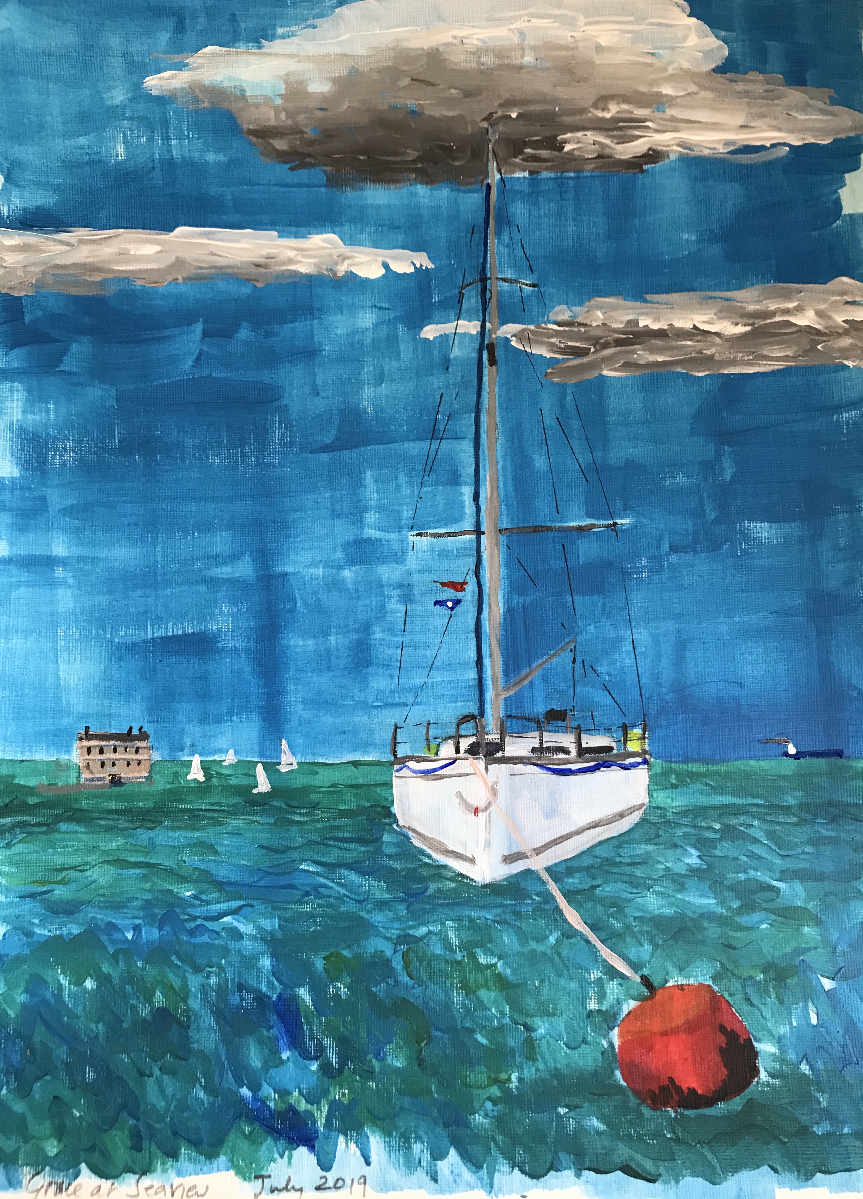
Grace at Seaview

Grace leaving Gosport and passing the NCI tower
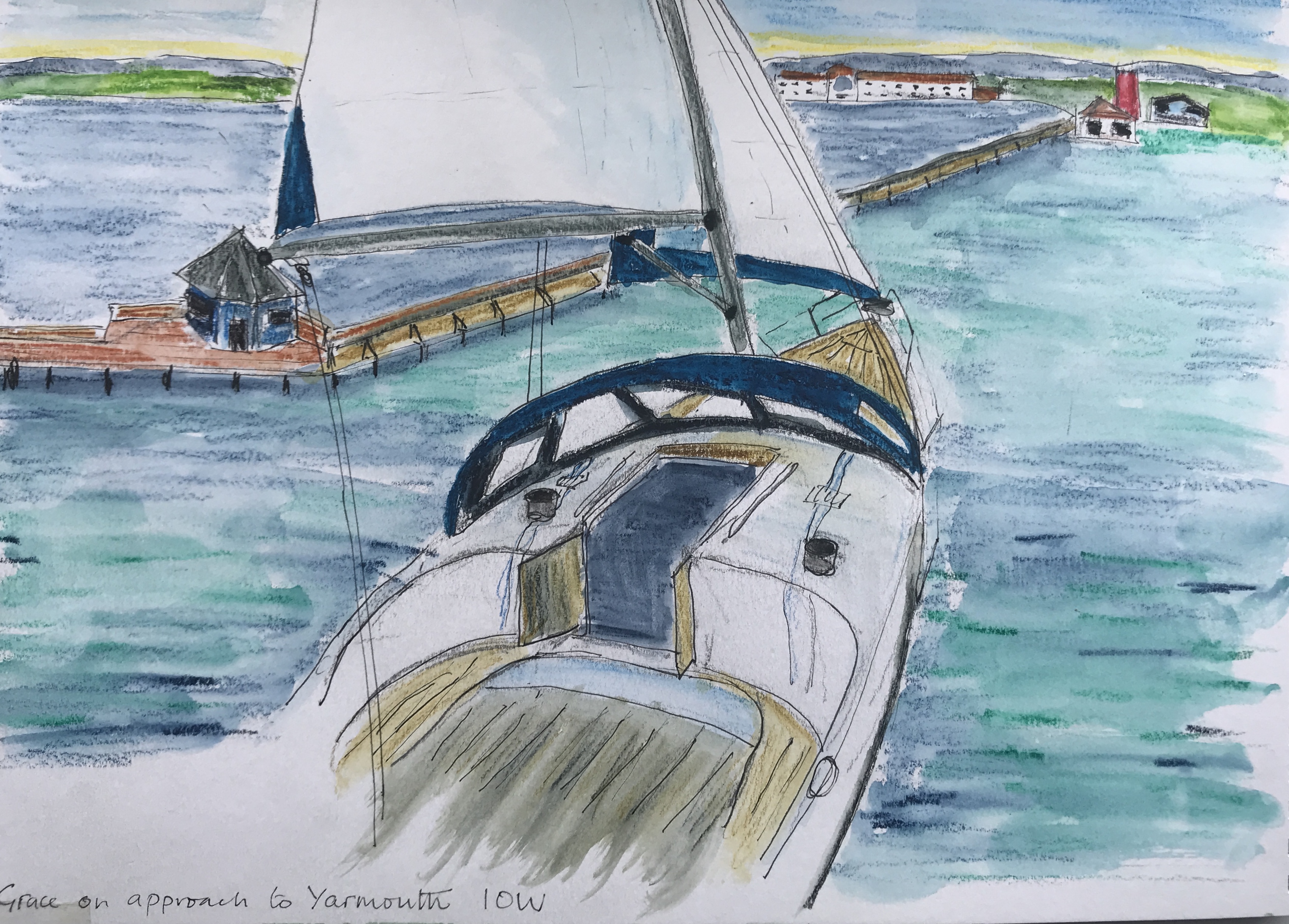
Early next morning we left for Yarmouth, it is a distance of around 31 nm so would take us a good 9 hours given fair winds, which for the purpose of this virtual cruise it will be! Taking the small boat channel we passed the NCI tower and out towards the Spit Bank Fort. Then at the War Memorial we followed the transit with the back of block of flats to pick up the Swashway and out towards Ryde on the Isle of Wight. We were reaching down the East Solent on a bearing of 280. At around 1230 we took the inner channel past Ryde Middle and the Bramble Bank.
We passed Cowes to port and were then into the West Solent. We were making good progress and we could see mouth of the Beaulieu river to starboard. In the rising easterly winds we had a swift reach all they way down to the Yarmouth Pier and the entrance to the marina. Originally we had booked a walk a shore berth for the night as it was the start of Cowes Week and the place will be packed, but as we not able to make it, we rescheduled for September….but even then we had to let it lapse due to the terrible weather. Next season we really will make it to Yarmouth! It was especially disappointing as we had hoped to see the SailGP racing on the Friday.
Grace on approach to Yarmouth

Grace at Alum Bay and the Needles
Our next leg was to sail to past Alum Bay and on down the Needles Channel to the Needles Light. It is important to stay clear of the Shingles Bank and its overfalls. The thought of the breakers to starboard was not an attractive proposition! Clearing the SW Shingles Buoy we sailed on for approximately 2 nm to the safe water mark before making our turn to track across Christchurch Bay. We passed Hengistbury Head at about 5 nm to keep clear of the strong tidal streams. It is possible to anchor off the fort at Hengistbury Head but it is not really very comfortable in anything but good weather and light breezes.

Hengistbury Head
On a bearing of 285, we crossed the 10 nm into Pool Harbour. Passing South Haven Point we motored up the North Haven Channel, keeping Brownsea Island to port. Then taking the channel to starboard marked by the south cardinal, we moored up at the Town Quay.
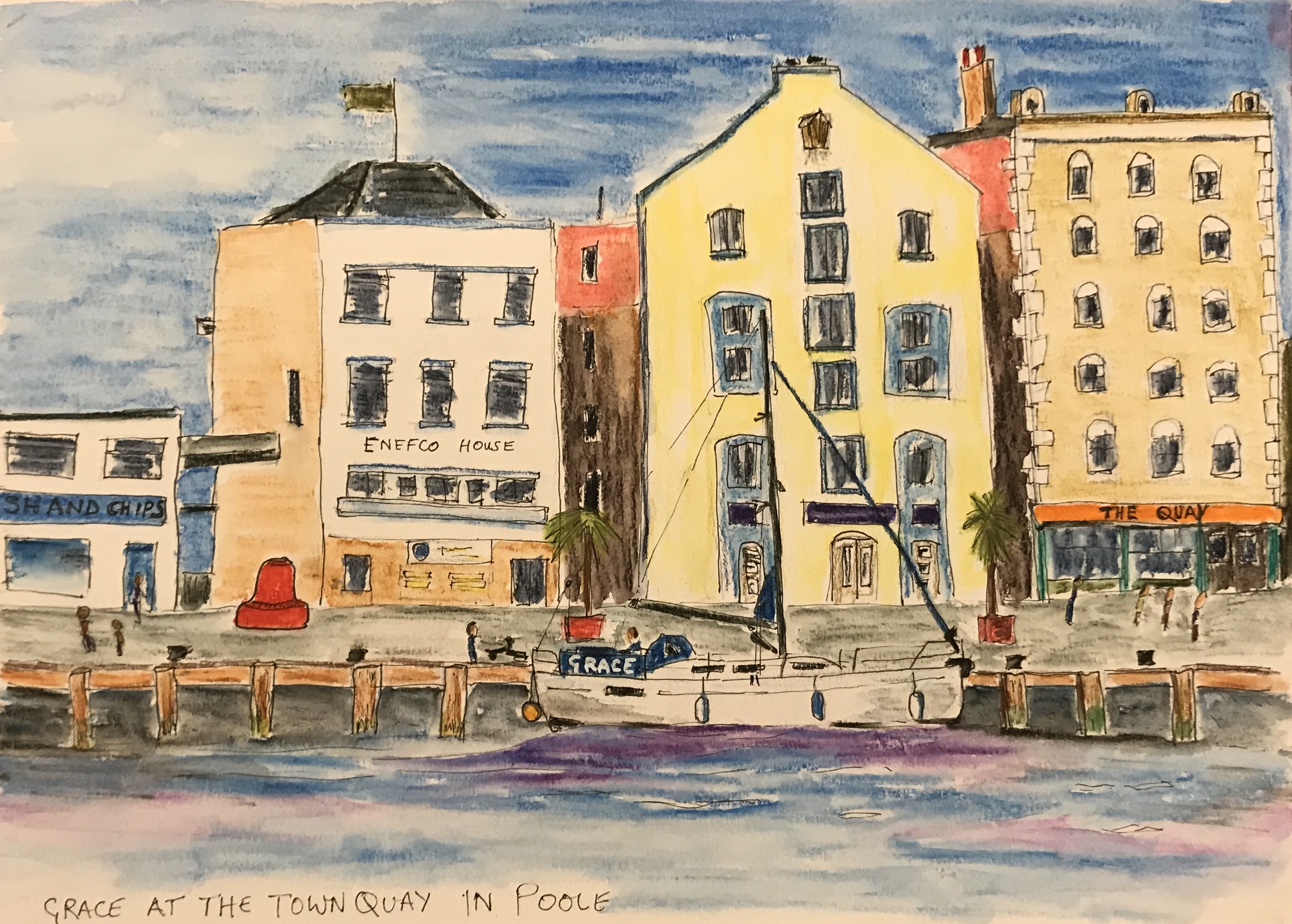
Town Quay at Poole
Although only a short hop along the coast, to get to Swanage requires a 9 nm detour into the bay to clear the Old Harry Rocks off Handfast Point. We anchored in the bay in 4 m off the pier at Swanage. The holding is not great in the thin sandy bottom but okay for a quiet night if vigilant! ‘Anchor up’ early next morning gave us plenty of time to get past Anvil Point and St Albans Ledge. We motored out on a bearing 090 for 2.5 nm to clear the overfalls on the Peverill Ledge. Then ‘sails up’ for a fast broad reach on a bearing of 230, keeping the Anvil Point Lighthouse to starboard and then on for a further 10 nm to clear some very rough looking water over St Albans Ledge. At the yellow DZB buoy we changed course to NNW for approximately 8 nm past Warbarrow Bay to pick up the mouth of Lulworth Cove. This can be a really tricky spot to find, but we kept a lookout for the old coastguard hut to the western side and had set a waypoint on the chart plotter for the mouth of the cove. Keeping slightly east of centre in the entrance to avoid a submerged ledge, we anchored toward the northern side in about 2.5 m of water. In the south easterly winds, the cove is very sheltered but if it shifted to an onshore wind then it becomes untenable and you need to be ready to clear out quickly!

Anvil Point
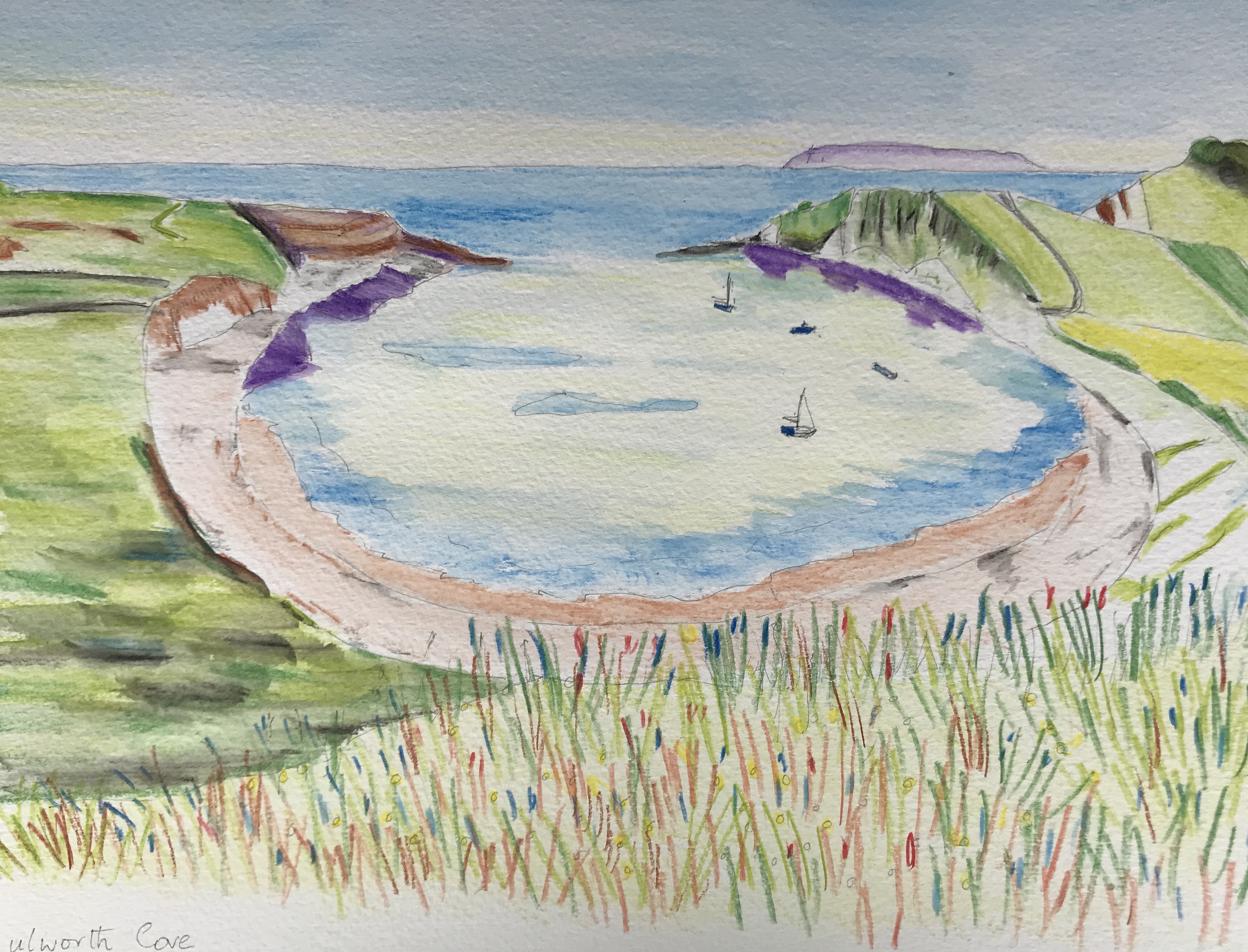
Lulworth Cove
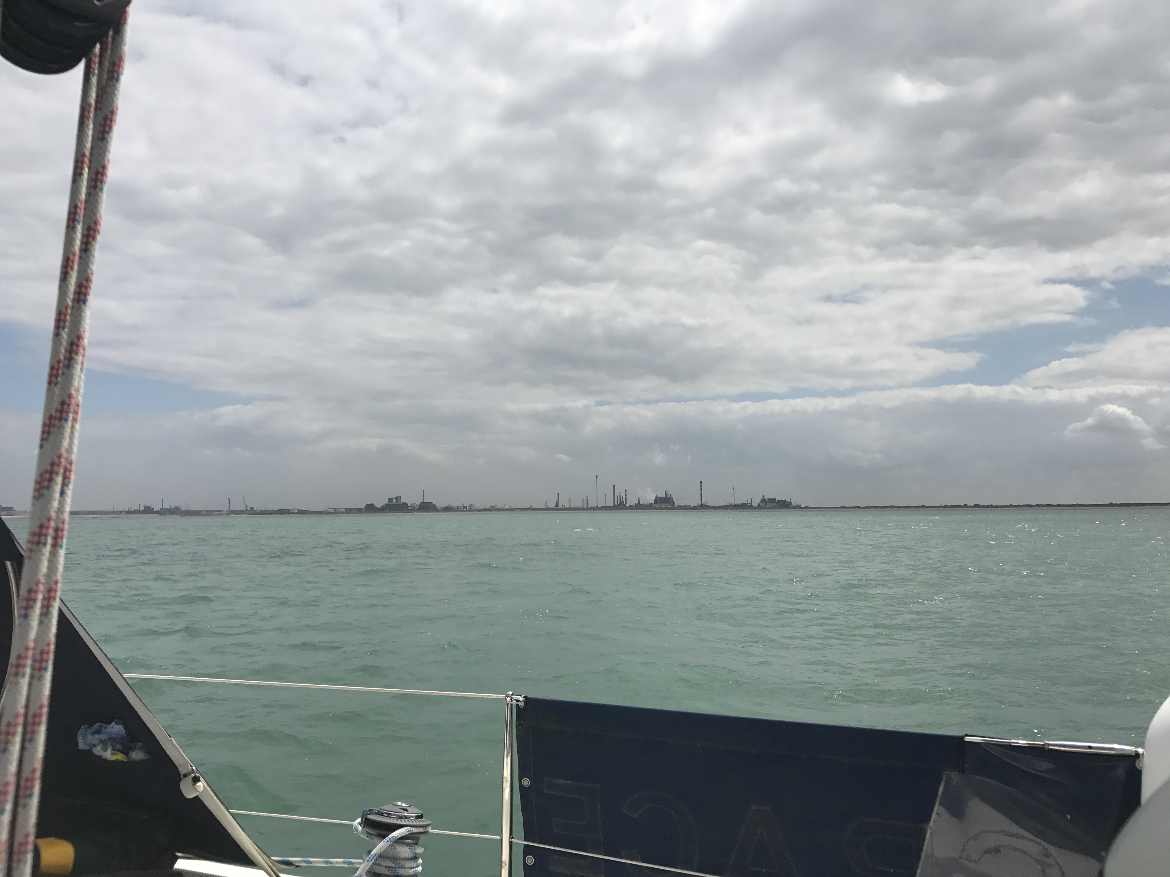
The next leg of our imagined cruise was a relatively short sail of about 8 nm over to Weymouth. The harbour mouth is very, very easy to see, the 50 m tall Weymouth Eye Tower can even seen from the cove! We motored into the harbour and up through the lifting bridge and into the marina. The final part of our cruise is the most challenging, that is to cross Lyme Bay. It is a voyage of about 60 nm at its shortest, a reasonable 10 hour trip if you can average 6 knots but Grace can only 4 knots so it becomes a bit of a marathon, especially if you want to avoid night sailing!
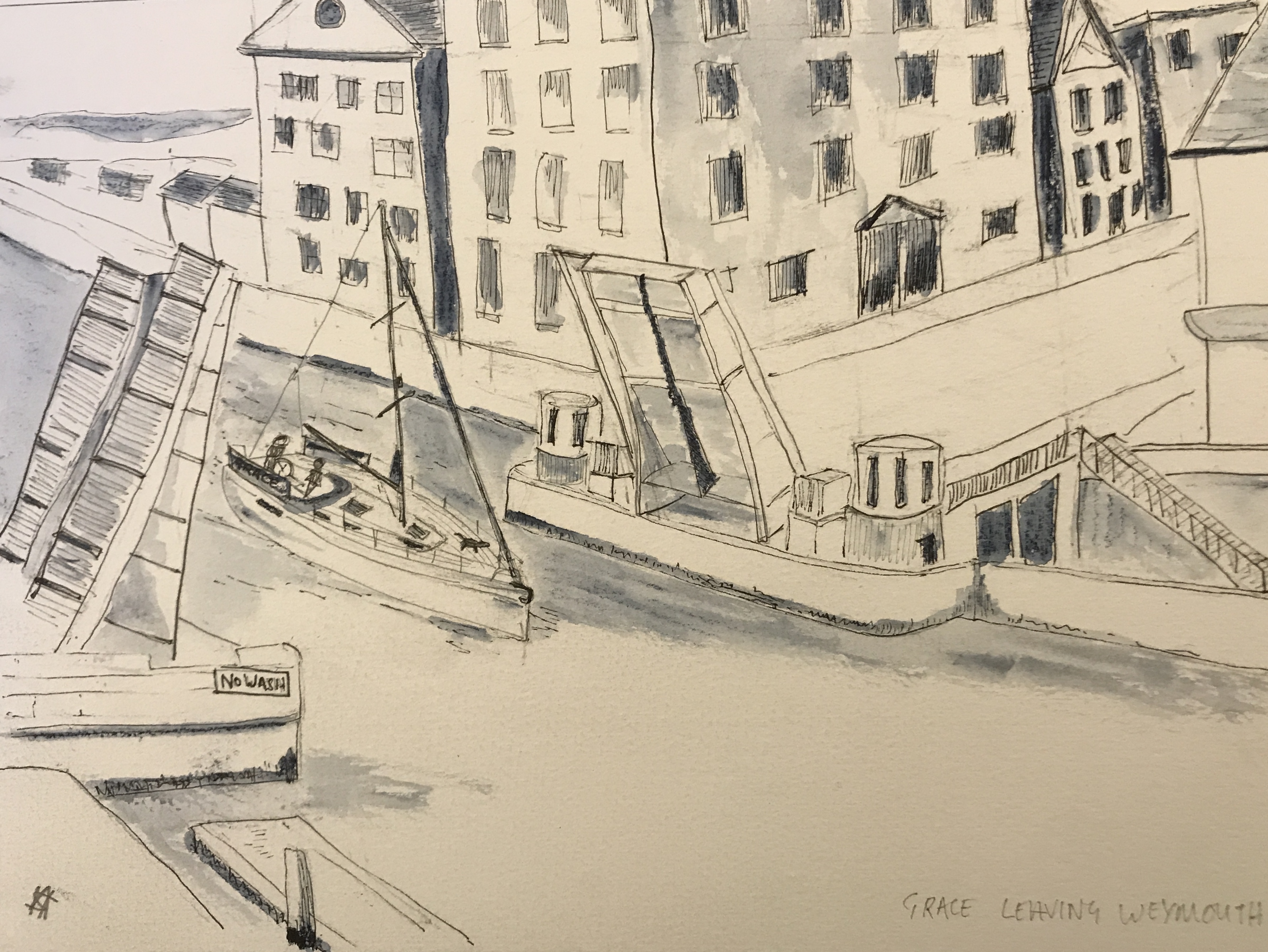
Leaving Weymouth
Our plan for Lyme Bay was to break it down into two day sails, the first leg on leaving Weymouth was to follow a bearing of 160 and to clear the West Shambles North Cardinal Buoy to starboard. It is a distance of about 8 nm. The alternative route meant keeping close in on the inside of the Shambles, keeping the South Cardinal Buoy to port. However all our pilot books were clearly ‘gloomsters’ and warned against it, predicting all sorts of doom and catastrophe at every turn. With only a saving of around 4 nm it seemed scarcely worth it except for the superb view of the Bill of Portland lighthouse!
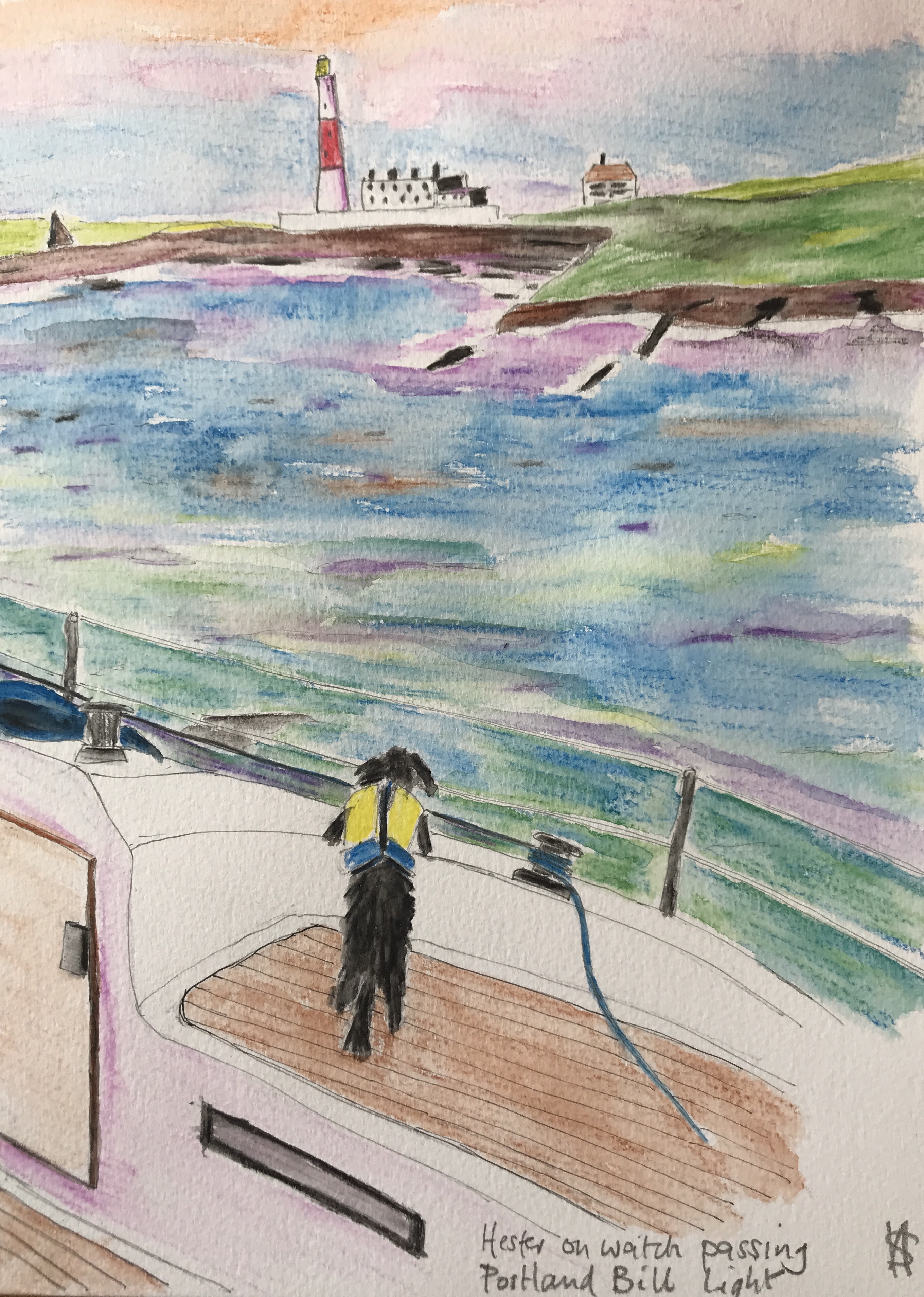
Portland Bill
Once past the West Shambles, we changed course to 230 for a deep leg of 10 nm to get past the rough water around the Bill. We were now into Lyme Bay proper, it is stunning in fine weather. To starboard we had the expanse of Chesil Beach as we headed towards West Bay, Bridport’s port! It is one of the few ports along this part of the coast that does not dry at low tide. There are newish visitor berths in the outer harbour that we could use, providing it is not spring tides! Finding the entrance is really quite easy, simply follow the line of the very distinctive ochre cliffs to the west and the entrance to the port is dead ahead. We did have an alternative port up our sleeves in case the harbour was full, that would be to try for a space on the end of the seasonal pontoon that is moored off Lyme Regis. It would not be comfortable and only just deep enough to take Grace.

On approach to West Port
Next day was a fairly easy 30 nm beat directly across Lyme Bay towards Dartmouth. This would be our last outward bound day of the cruise before we had to turn around and sail back. We picked up the approach to the river Dart at the West Rock South Cardinal Buoy, keeping it and the Castle Ledge Buoy to starboard. Then passing up through The Range, keeping the Checkstone Buoy and Dartmouth Castle to port before mooring up at Dart Haven marina at Kingswear, seven day and approximately 180 nm sailed.

Journey’s end at Dartmouth
The sad thing was we never made it past Start Point (everyone who has taken an RYA course knows Start Point – it seems to be the ‘starting point’ for many of their exam exercises!). Or indeed that we did not manage to complete the trip this season…..but we will next year…..weather permitting!!!
Before we started our second season in the Baltic, we realised that we did not want to sail Grace all the way home ourselves. It would mean either we repeat our lengthy route out to the Baltic or we do a 3/4 day and night sail across the North Sea. Neither Anne or I like night sailing and the North Sea is not the place to make up for our lack of passage making experience. We are, and always will be fair weather sailors!

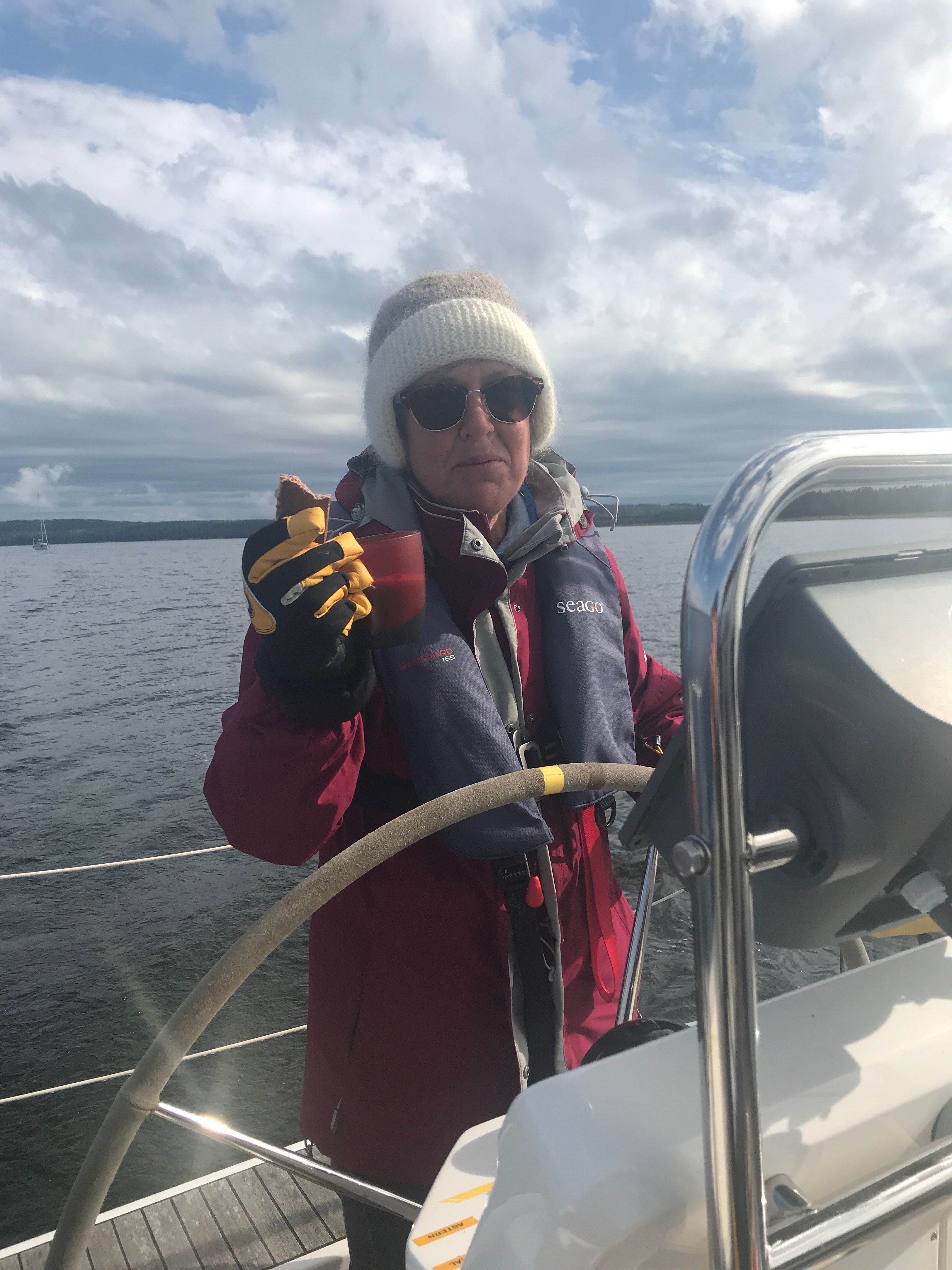
A fair weather sailor!
The obvious answer to our dilemma was to hire an experienced delivery skipper and crew. An internet search came up with a lot of great sounding candidates with glowing references. So by the end of March 2018 and after checking qualifications (Yachtmaster, Instructor Certificates, Masters Ticket) we had booked and paid (let’s call him Capt’n Bob) a professional delivery skipper and his crew to bring Grace home from Goteborg at the end of September. It should be a straight forward sail from Goteborg across through the Skagarack and then west towards the UK East or South coast. We would be happy for them to bring her to any port along the coast!
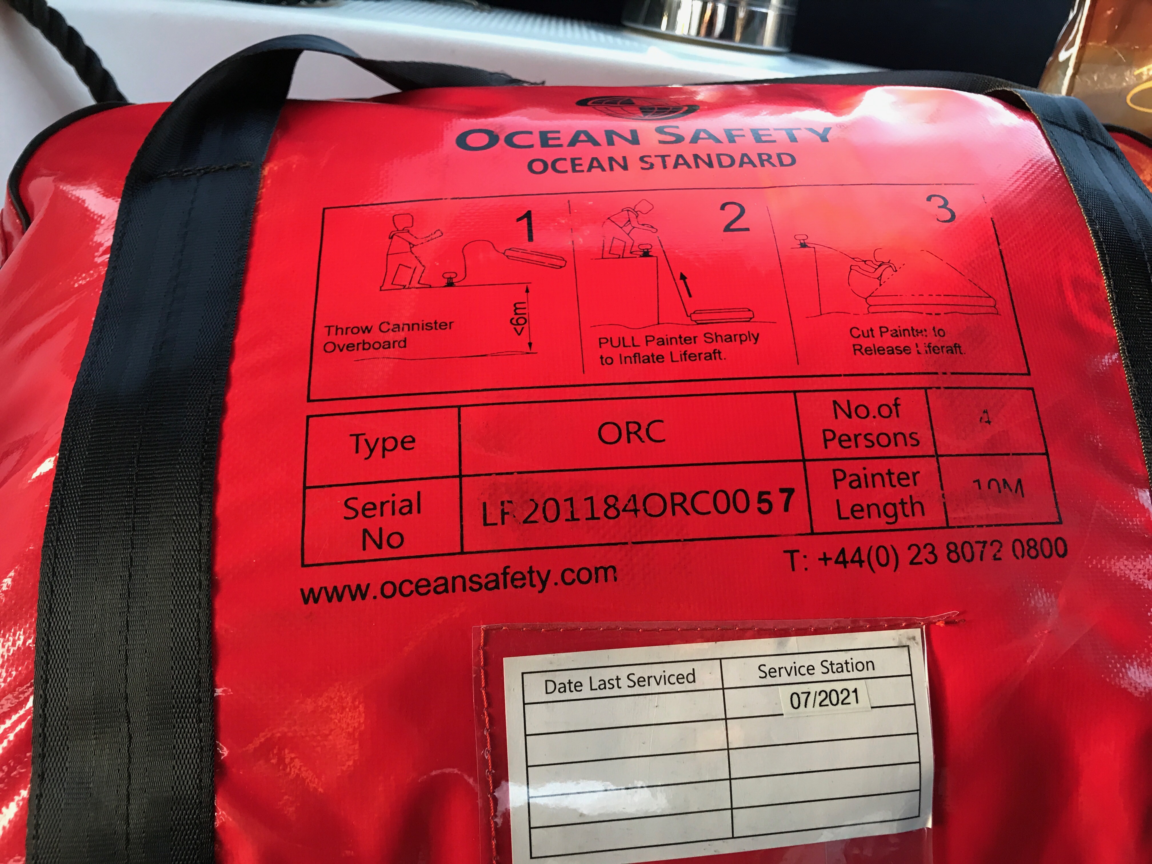
This must be the world’s largest 4 man liferaft. I keep falling over it in the saloon and it does not bring back happy memories of the Capt’n every time I do it!
So in May 2018 we set off from Augustenborg in Denmark, pleased that we had everything sorted!……With just the exception of a saga over sourcing the world’s largest and most lavish (and heaviest) life raft in Stockholm (read the blog for the gory details!). We had a great season, it had been the hottest summer for 200 years and the sailing around the Swedish archipelago was an amazing experience.
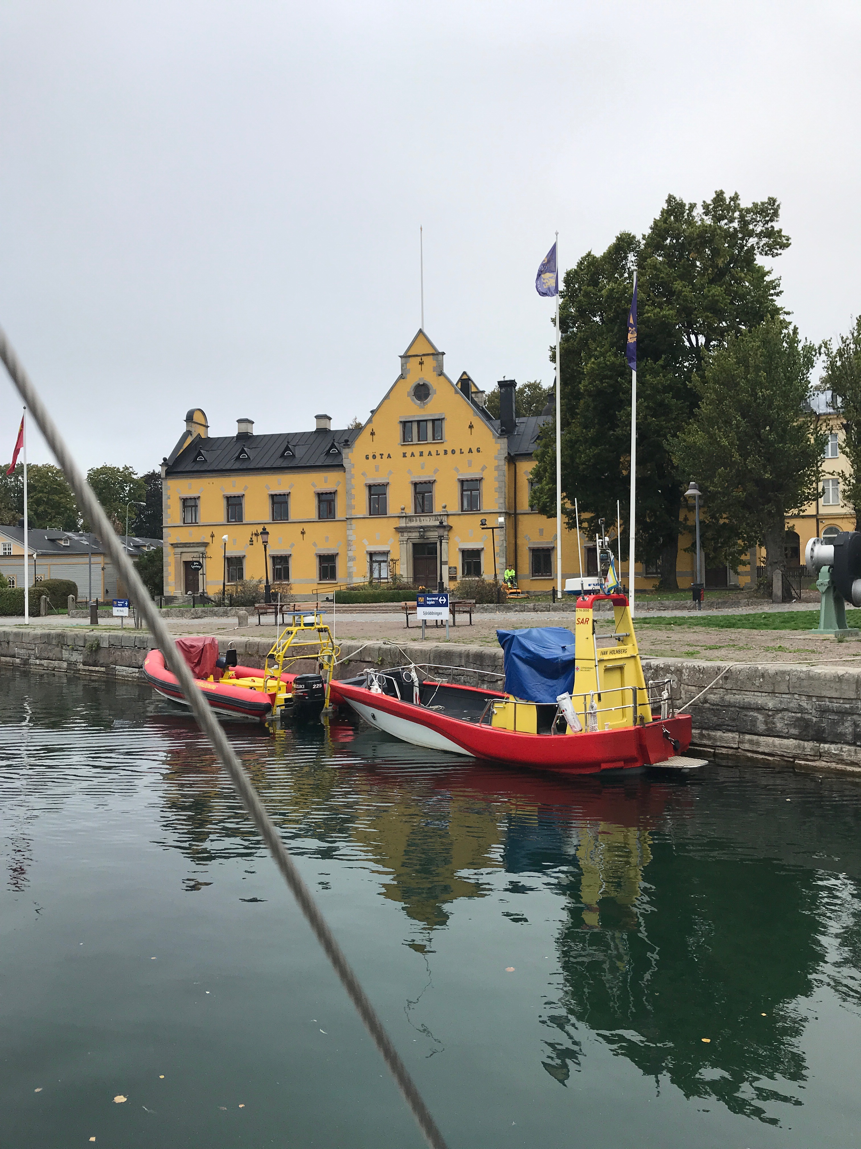
By late September, we were moored up in the Lil Bommen marina right in the heart of Goteborg, ready and waiting for the Capt’n! Grace was fully provisioned; spare gas, a full set of charts, UK Navionics Card, spare diesel, a full set of engine spares and of course the hugely expensive and large liferaft. The Cap’n was not what I had expected. I had at least expected someone who wanted to go sailing! But at least his regular crew, an ex-RN engineer seemed to know what he was doing and I was reassured that he would not sail with someone who could not Grace safely back to the UK. Disappointingly the Cap’n moaned about almost everything; the weather, the marina WiFi, our excellent Swedish charts (I’m very insistent about good charts – you need them for the Baltic), We even scoured Gothenburg to see if we could find different ones to make him happy and eventually found him another one. He then disappeared for the day to the opera house coffee shop to plan his passage……perhaps it would have been better if he had had some clue about where he was going before he arrived!


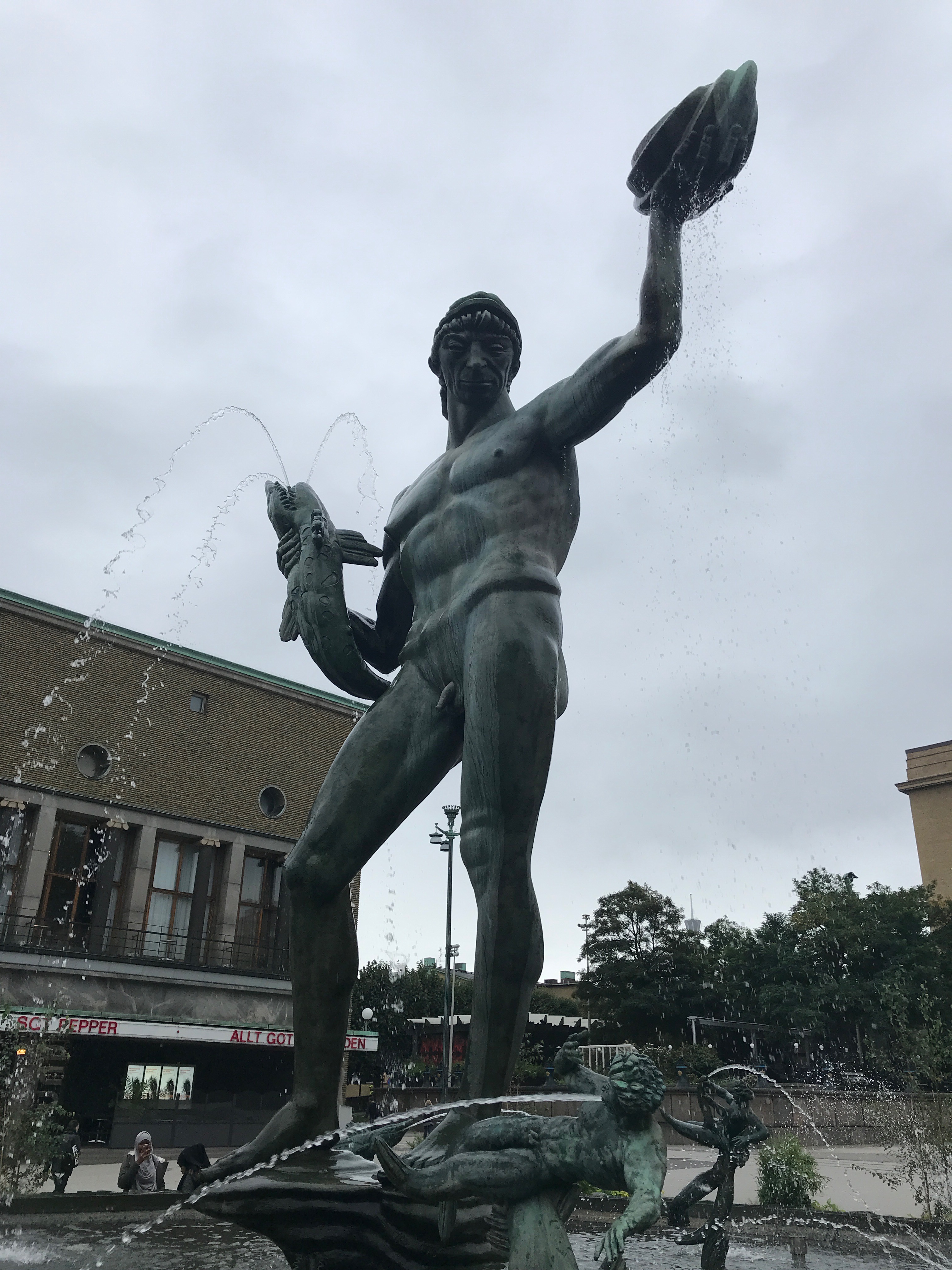
Views of Goteborg, lots of things to see
We were where we were, our plane tickets had been long booked and with lots of things to do waiting for us in our new home, we set off for the airport. We had to trust to the Capt’n to get Grace home safely.
Grace – 3 days passed and still in Goteborg!
It all went quiet, the Capt’n did not answer our calls or texts but finally after 3 days we found they were still in Goteborg due to bad weather and were planning to head down the Oresund and then to Kiel and the canal. They planned to sail out of the Elbe, skirt the Friesian Islands then hug the Dutch, Belgium and French coasts, finally crossing to Dover. The long way round! Possibly the worst possible route as you are going West all the time with the prevailing wind against you most of the way. He now kept telling us that he only had seven days left to complete the trip. Easily achievable with the shorter and much quicker North Sea route but tight on the coastal route. It was from that time that we knew they would never bring Grace home and we needed to find somewhere to overwinter her and get her out of the water before the ice formed. The daily texts started to arrive showing us just how little progress they were making as the time ticked away! Fortunately Anders at Augustenborg in Denmark, the place where we had stayed last year had a space on the his carpark where we could keep Grace for the winter. I instructed the Capt’n to go to Augustenborg which they made surprisingly quickly considering how long it had taken them to leave Goteborg. Buying 3 air fares for them to return to the UK, we were relieved that Grace was in Ander’s safe hands and that she had not been abandoned in some unknown harbour when the crew bailed out!


Grace on Anders’s car park – at least she would have lots of company!
We made a quick November dash to Denmark to clean the boat out, prepare her for the winter and to stock up with Jubilams Beer (Christmas Ale)! Fortunately there was one last space in Ander’s boat storage sheds so we knew Grace would be safe, warm and away for the snow and ice. Minus 15 degrees can do a lot of damage to boat plumbing!

Grace ready for winter


Grace needed tidying after the crew bailed out!
But we still had a problem, how to get Grace home before Brexit!? Why was Brexit a problem? As Grace had been out of UK waters for two years there was a distinct possibility of a VAT bill plus the relaxed approach to customs in all the countries we would sail through might disappear and we just wanted to have her home! Attending several the Cruising Association crew finder meetings in London we realised that we could not get Grace back before March 31st – Brexit Day (at the time!) by sailing her back. We needed another plan!

The world’s biggest boat show – in Düsseldorf
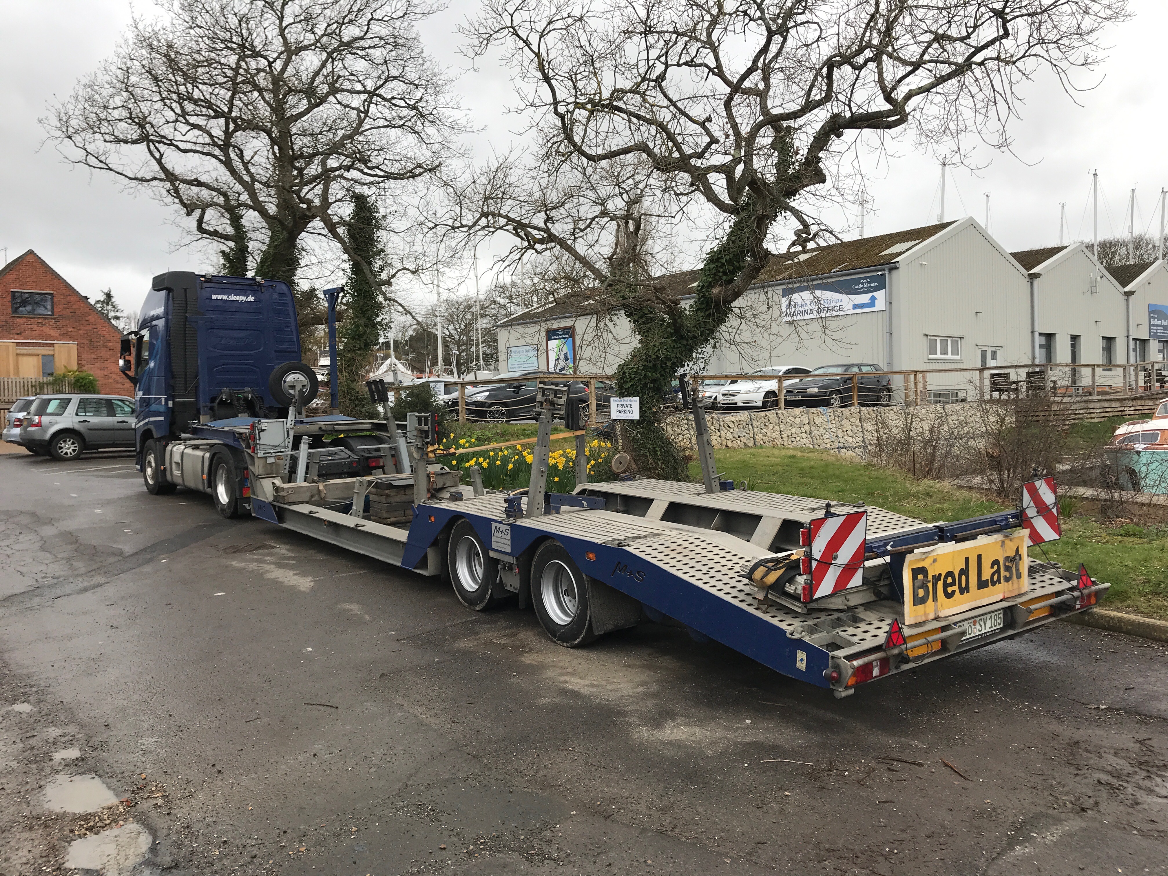
BOOT Dusseldorf is the worlds largest boat show. The worlds largest boat show requires a lot of boats……and they must get to Dusseldorf somehow. Sure enough there were plenty of boat transport companies on display at the exhibition. Based on my uncanny ability to pick winners I chose unlikely named Sleepy Jacht Transporte. Hopefully they would not live up to their name! Fortunately they did not! Based in Kiel, they quickly picked up Grace from Augustenborg. But Grace was not going to leave her adopted home in Denmark that easily as Storm Gareth struck the coast, trapping Grace at Dunkerque for 36 hours. Then as an extra large load she got stopped in Dover for a further 6 hours to await a police escort all the way to Chichester.

Grace leaving Augustenborg
Finally after an epic 4 day journey……

Grace safely back at Birdham Pool
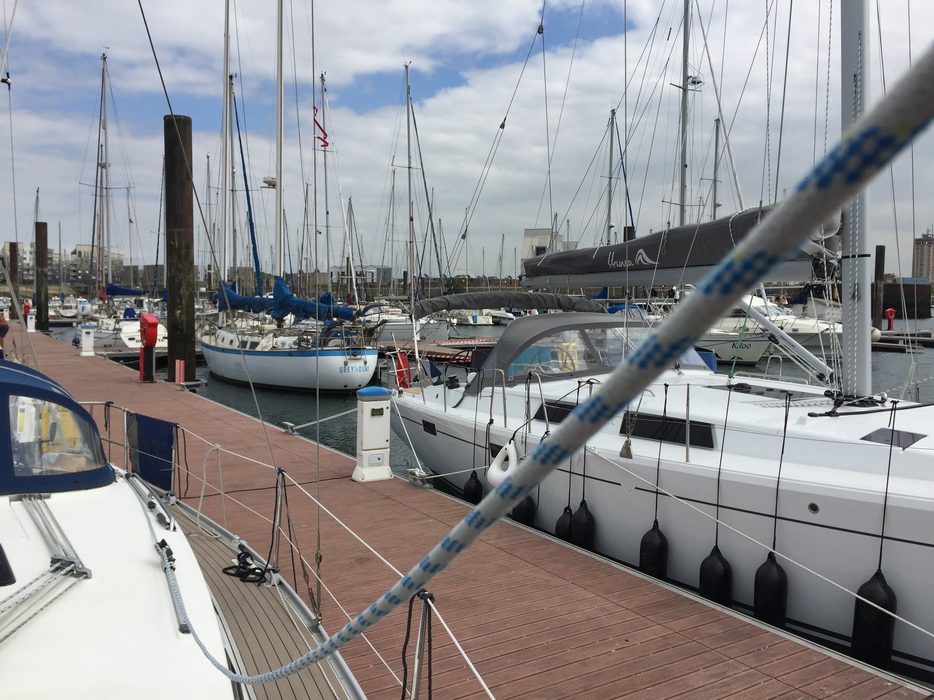
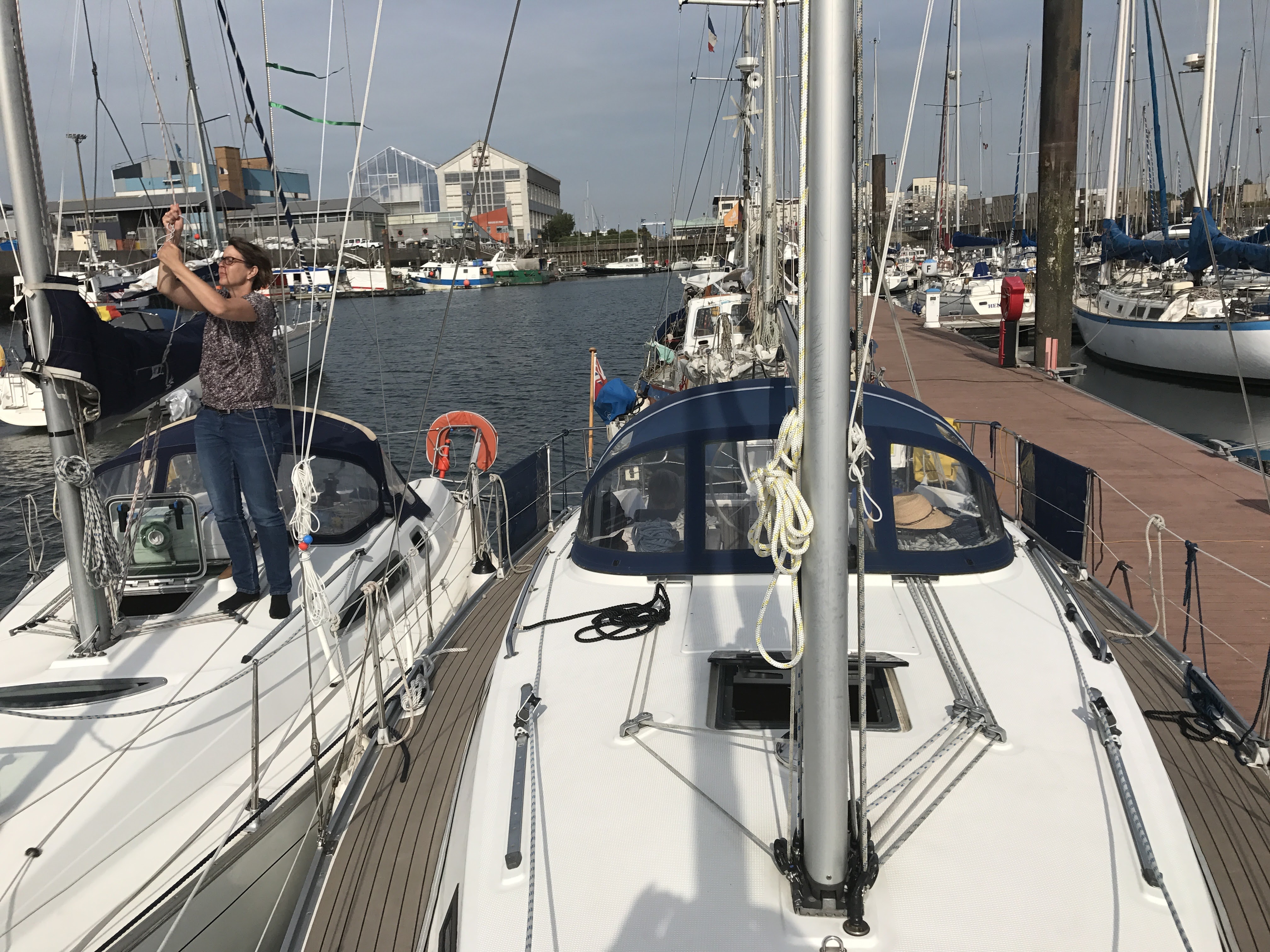
Finally after 4 days we were able to welcome Grace to her new home in Birdham Pool, the oldest leisure marina in Britain and built in the old mill pond. A quick coat of antifouling (it actually took me weeks), refit the sails, renew the genoa furling line, recharge the batteries and top up the water…….Grace was ready to go sailing again!

Back where she belongs and ready to go sailing
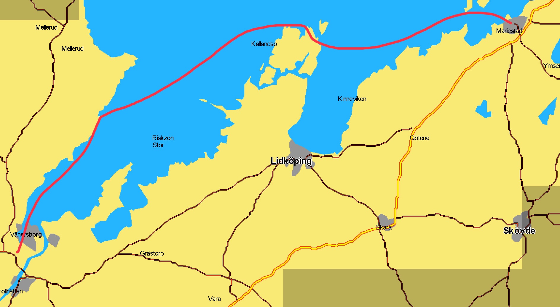
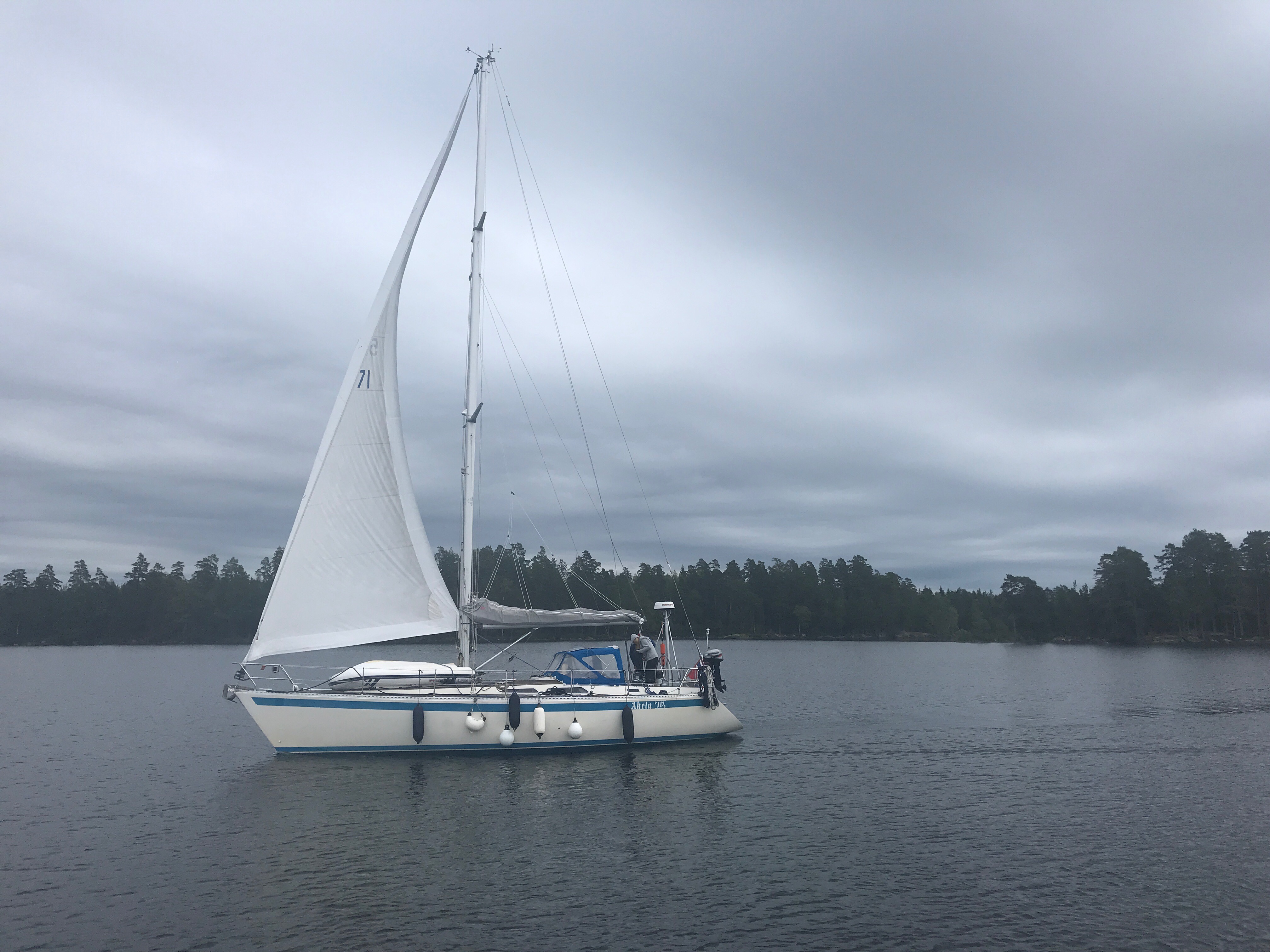
Leaving Vänersborg on a distinctly autumnal day at the start of our Trollhatte Canal journey
Suddenly the very final leg of our two year Baltic odyssey was upon us! This was going to be our last few days with only 50 nm to sail from the marina at Vanersborg to Lil Bommen marina in the centre of Gothenburg. This is where we had agreed to meet the crew who would sail Grace back to the UK for us before the winter set in.
We only had 6 locks left to do, but they are very deep ones! They are designed to take 4,000 tonne Vanermax ocean going ships. Not actually that big compared with the ones we had met in the Kiel Canal which can be up to 70,000 tonnes but not a welcome prospect to meet in the locks!
Bright and early we cast off, the wind had dropped and we were able to leave the marina without any of the drama of our arrival! This was when a strong gust caught our bows as we searched for a space and almost speared the stern of a motorboat with our anchor. To enter the Trollhatte canal proper, you have to make your way back to the main channel across what seems to be an open patch of water but is in fact peppered with unmarked submerged posts. Returning along the track of our arrival on the chartplotter we made it safely to our next obstacle, the road bridge carrying the main road to Stockholm! We arrived at 0800, peak Swedish rush hour and of course the bridge keeper was in no hurry to open it! The approach to the bridge is lined with wooden and steel posts that directs you to the narrow bridge mouth. As you approach it the lights are supposed to change and the bridge will open. I called the bridge up on the VHF and was told that it will open if I got closer. We kept getting but it still did not open – back on the VHF and told to be “closer, closer”. Okay the bridge keeper want to play chicken! Little did he know that we had sailed the canals of Holland so it would not be us who blinked first!
The old lock at Trollhatte
Once through, we were on our way to the Trollhatten Falls and the two deepest locks on the canal. A large LED sign told us that the next lock opening was at 1245 so we moored up to a pontoon and went to explore. Sadly the museum and cafe were closed but we did go and see the original locks from 1840 and explored the “new” one from 1916. The original flight of locks is an impressive cut through the granite especially as it was hewn through the rock by hand.

In the new locks at Trollhatte
Bang on 1245 the bells rang and we dashed back to Grace. We had picked up another boat so we will have company. Somehow it feels less wasteful when you share a lock, I guess a bit like the sharing bath water! The locks are very deep – typically one side is smooth concrete or steel and ideal for protecting the gelcoat and one side is rough rock, not so good for the gelcoat! So always stick to the smooth side! Then just to add interest, the smooth side is not always the same side – it does swap about but we did have a pilot guide which told us. Then in the lock walls there are recesses with bollards in. The idea is that you loop a line round them bow and stern letting it slip through, then just in time slip the line over the next one and so on as you go down. All a bit slimy and involves jiggling the rope with the boat hook while the deck of the boat disappears from underneath you! The nice thing about these locks is that the water flows in and out from underneath rather than through the gates so you don’t get so much surging which would make holding the boat in place difficult. So we begin the Trollhatte lock jive! First reaching up to hold Grace in to the canal wall then waving the boat hook about while trying to put the mooring line over the next hook as it slips past. We were all doing it!

Waiting for a Vänermax
They are big!
As we progressed through the first flight of locks into a small basin, the lock keeper told us to keep well in to starboard as a large cargo ship was coming up through the lock ahead of us. We did and secured to a waiting pontoon. The boat behind us, clearly did not get the message and started past us and on into the lock. There was a sudden flurry of panic as the lock gates opened and he was presented with the very big red bows of the cargo ship. After much going astern he tucked in behind us against the side to wait!

Work boats on the canal
Canal markers
The canal passes through the heart of Sweden
Once down through the lock we had completed the famous Trollhatten Falls. Pressing on we made for Lil Edet, the last lock on the canal. The route takes you through some of the most diverse scenery in Sweden. Up until then our main view of Sweden was of granite rocks, hills and trees but here we passed through rolling green hills and then onto flat open plains. Arriving at the lock about 1700 and decided we would stay at the tiny marina just before the lock and then do our last lock when we were fresh in the morning. Although at the end of the season, the tiny marina was packed with boats that had been put away for the winter. The whole place felt abandoned and desolate and we squeezed into the only space. Venturing into the Lidl in the town for fresh vegetables our opinion was not changed and we hurried back to Grace for supper and bed. We were not allowed to on the canal in darkness so it would be 0900 before we could continue our last leg on to Gothenborg.

Lil Edet
Lil Edet itself quite interesting as it has a large hydroelectric plant that was built around 1900 and still in operation as demonstrated by the hum from the turbines that ran all night and the man in an orange boiler suit with a big oil can that disappeared through a large blue door every hour! There is also the first lock on the canal that dates back to the 18th century.

The original lock on the canal

The hydro power plant at Lil Edet
Up early next morning and ready to go at the first opportunity for the final run into Gothenborg. Just on lock to go, what could possibly go wrong! We had completed almost 150 locks in the last two years – this was going to a be demonstration on how it should be done……or not! Obviously pride comes before a fall. So entering the lock, the first thing you noticed was just how high up and open it was! As usual and when you least want it, Grace’ nastiest vice struck – a brief gust of wind and the bows swing out before we were able to secure the bows to the mooring hooks in the lock walls. As it was such a long lock we motored to the other side with the intention of securing to the bollards on the other side. I hopped off to secure the bows while Anne took the helm but suddenly the bell rang and the water level fell and the boat started to drop away, leaving me on the side just holding a rapidly disappearing mooring line flying through my hands! Quickly Anne radioed up the lock and they reset so we could have another go! Second time lucky! we took a deep breath and slowed right down and it all worked perfectly……we were on our way to Gothenburg. That was our last lock, and what impresses is the depth of them and the way they swallow you up! The Kiel canal ones are much, much longer but you only go down or up a metre. These ones are 20 m deep!
Gota Älvs river

Traffic on the river

Approaching the Jordfallenbron

Getting close to Goteborg as industry popping up along the river banks

 Passing through the busy Marieholmbron
The Trollhatte Canal is really the Goat Alv river with locks at the bumpy bits and waterfalls. So it really takes you through some of Swedens most beautiful countryside, including the first really flat land we had seen for months! On we went under the Jordfallenbron then on to the Marieholm bridge – this is a really busy railway bridge which has 3 train lines into Gothenburg across it. But bang on time, it opened and we were through to the Gota Alvbron and the industrial suburbs of Goteborg. Our journey was almost complete – after 6 locks, 8 bridges, 44 metres down to sea level and 50nm travelled.

Suddenly we are here! Grace in Lil Bommen

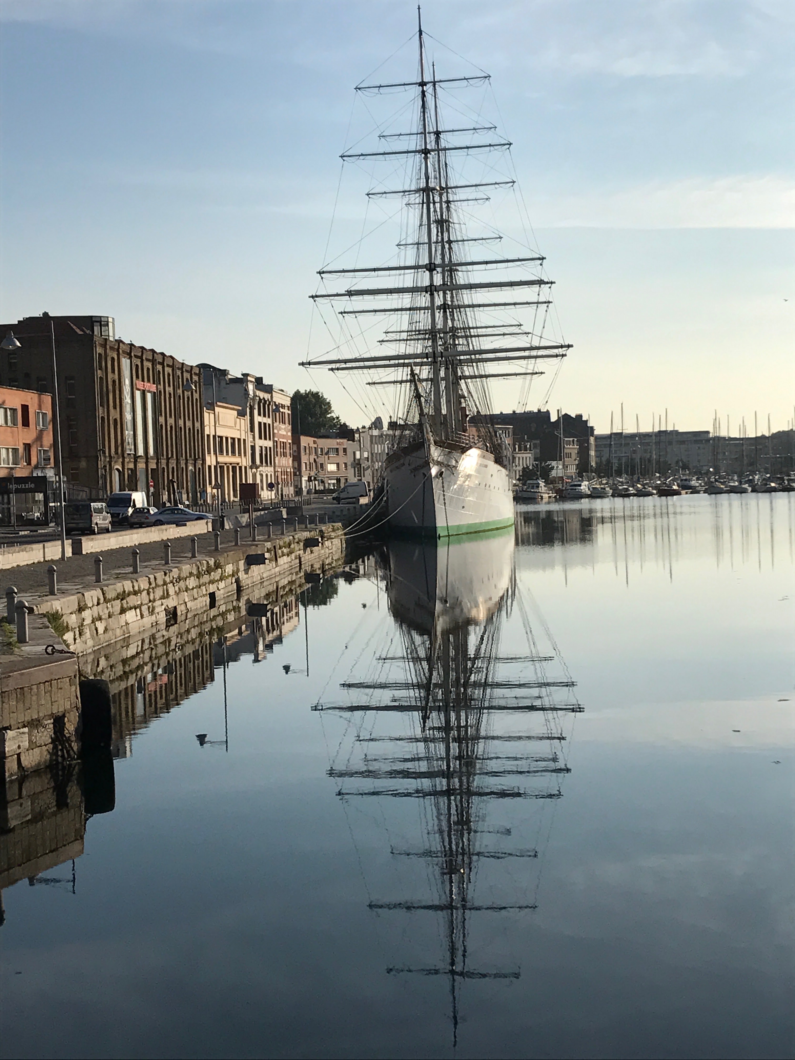
The sailing barque Viking
Suddenly it was all over, with the white hull of the sailing barque Viking to our port side, we had to make a sharp port turn, but not too sharp (as all the pilot books warned!) so avoiding the ships bowsprit from fouling our rigging and into the small Lil Bommen marina. It is a lovely little place right in the centre and next to the Opera house but more importantly just 5 minutes walk from Claas Olsen (Sweden’s Robert Dyas!). We had made it with 3 days to spare and to explore Goteborg….which is about two and a half days too much although it does have a nice park!


The ship museum!
The markets!

The Parks!
The statues and museums! Gothenburg done! Time to prepare Grace for her trip home.
Now we just have to prepare Grace’s trip home…………but more of that later!


Grace prepared for expected bad weather. We were in a nice warm hotel!

At last, the spell of poor weather broke.
Passing the Onso Light and then out into the main body of Lake Varnen.
The next day was beautiful, bright with a crisp autumnal nip to the breeze. The wind had come round to the north, blowing a steady force 3. We now followed the now familiar along the Mariestad channel turning to the east towards the Onso light and the open water. Then turning south east our next leg of 16 nm took us starboard past the Storebanken cardinals and then on down to Lacko on Kallandso with its famous castle. It is possible to moor up in the castle moat but our pilot book warned of all sorts of potential disasters to catch the unwary, we thought that having made it this far and being so close to our destination that we should not chance it! Our plan was that we would moor in Spiko and walk over the hills to see the castle. On our approach to the harbour the rains came down and visibility disappeared, as did the depth and we grounded several times on the muddy bottom. Realising we could not stay here, there just was not the depth of water and we could not figure out where to moor we went on to Granvik, built as a winter refuge for trading ships in the 18th century it had an easy approach with plenty of deep water around its pontoons! A very welcome place to stay the night!


Sailing towards the Storebanken Cardinals.

Lacko Castle in sight

It is possible to moor up in the moat of Lacko Castle – but it is full of concrete blocks hiding just below the water! So better to give it a miss.

Granvikken – This has always been a popular winter refuge for coastal trading ships.
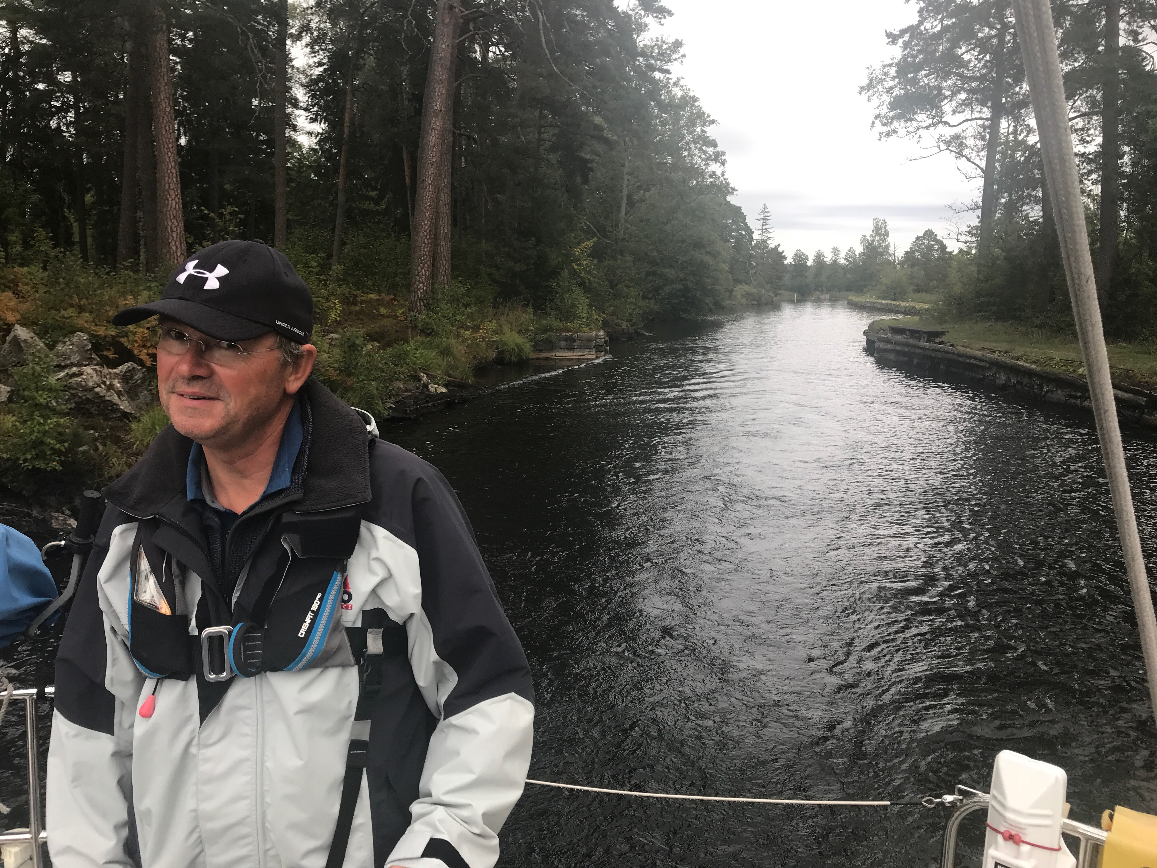
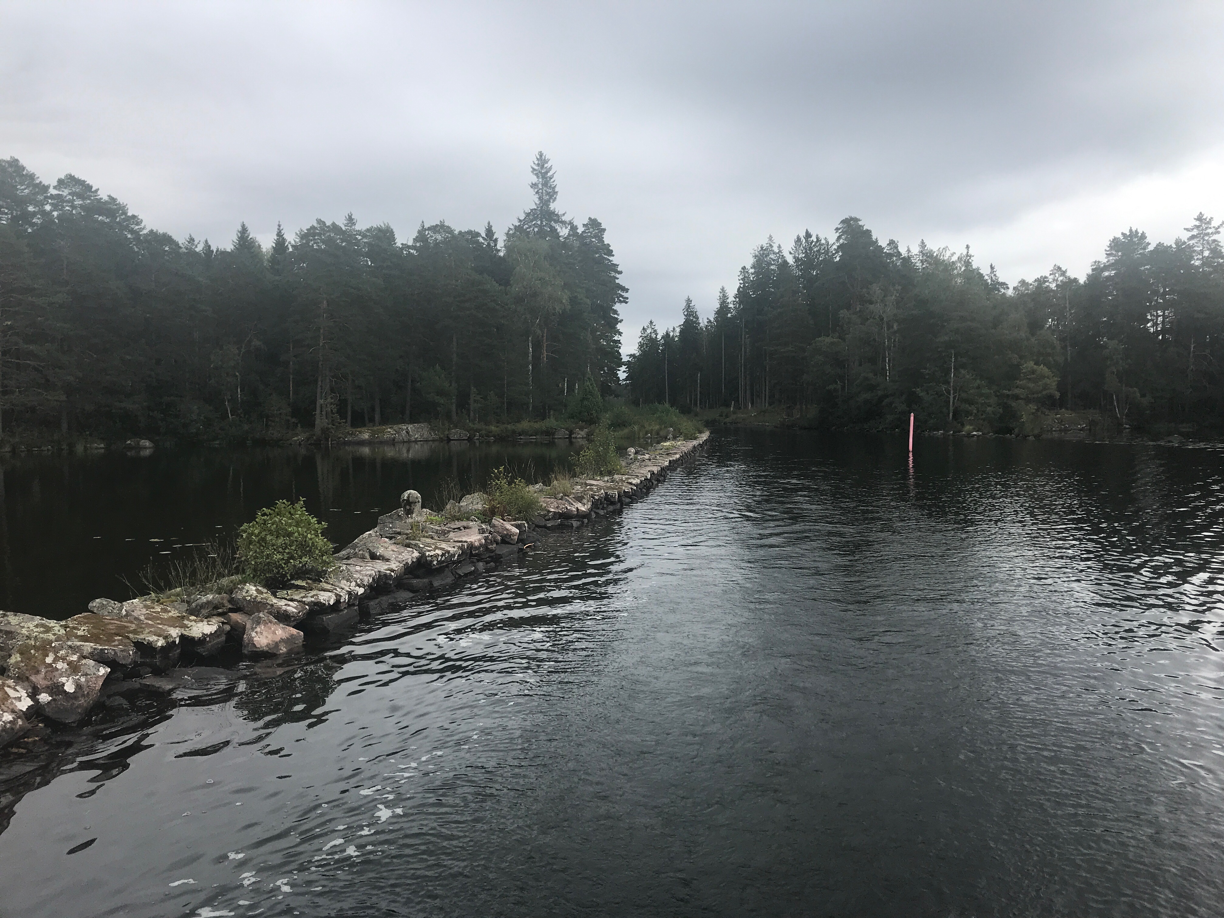
We then took the eastern route across the Navens Grund, a narrow channel through what on the chart seemed a rock strewn wilderness, exiting into the lake at the Navens lighthouse. This route was definitely not for the faint hearted, a channel barely wider than Grace’s 3.4 m girth twisting its way through vicious looking inky black rocks that broke the surface in clouds of white spray. For several hours we sweated our way along the channel until we could see our goal, the lighthouse and the open water. This just filled us full of dread. Huge waves pound the surrounding rocks, until then we had been relatively sheltered but now we got the full force of the wind and Grace became quite tricky to steer and the narrow confines of channel. Oh well, we could not turn back, there just was not room to turn and in the swell we would never find the start of the channel again, we would just have to go on. I am so glad we did this at the end of the trip and not at the start – I’d have wrecked the boat, I just knew that Grace would keep us safe.
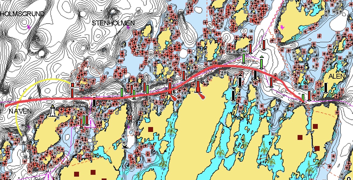
A nightmare of a channel out into a rising force 6!
Sailing out into the open water we realised that would have to make a long leg to the north west sailing deep towards the centre of the lake, we were at 45 degrees to the waves making for a slightly more comfortable ride in the now force 5/6 wind and the very steep swell. We could then make a turn towards the relative shelter of the eastern shore passing the cardinals around Utskottet to port and heading down towards Dalbergasa. Sailing in the shelter of the east shore became very pleasant as we headed down the fjord towards Vannersborg. Every half an hour or so we were passed by ships coming from or going to the Trollhatte. It all seemed to going well and we were in the right place! Time to quit while we were ahead of the game. Dalbergasa seemed the ideal place to stop.
Dalbergasa is strange place! It is a camp site on the banks of the river with a small rickety wooden jetty to moor up to. To mark the river mouth and the way in is a large red pyramid, without it, you would never find it in a month of Sundays! There is then a sharp dogleg turn through a narrow opening in between two cliffs, which if we had not just done the Navens Grund passage would have caused a bit of panic! But once through, it suddenly opened up into a wide green meadow with a gently flowing river through its middle. It is a completely different world and a complete contrast to the roar of the wind and the waves. Opening up in front of us was a positively bucolic and tranquil scene that Constable would have happily painted. We were just missing the hay wain! Oh and there were two thundering great wind turbines right in front of the view!!


Dalbergsa – so peaceful out of the wind!
That night was a celebration, it felt like we had broken free of the grip that Lake Varnen had on us. We would have a relatively short sail down to Vannersborg and the start of the Trollhatte Canal. Barring mishaps we would make to Gothenburg in time.
Next morning started bright and sunny. It was definitely autumnal with the trees on the far bank starting to turn many shades of red. We had had a lovely peaceful night, with just the gentle hum of the wind turbines for company! The only problem was how were we going to turn Grace round in such a narrow river without ending up grounded in the trees on the far bank! I knew that if I could get her bows round then the flow of the river would bring us round okay. It is times like this that a bow thruster would have been perfect! Anyway we don’t have one and it was back to our trusty spring lines! I rigged plenty of fenders on the stern and slip lines to the jetty and we cast of our bow lines, the current flow and engine taking us back against the fenders, slowly Grace’ s bow eased out, then mores quickly now as the current caught us. It was a good job too as the jetty behind began to collapse under Grace’s weight! Releasing the stern slip line, wheel hard to starboard and plenty of engine revs we came round gently and were heading back to the lake. A quick jiggle through the gap in the cliffs and we were met by a brisk force 5 and a sharp swell! Clearly the lake was not going to give us an easy ride on the last leg across her!
Vannersborg is at the head of a deep bay. It is well buoyed through a series of reefs and easy to spot by the stream of ships going either leaving or entering the Trollhatte. We had about 20 nm to sail to the south and then through a lock and railway bridge to reach our berth for the night. We had a lovely sail down the bay, well reefed we tacked through the shoals making an easy 4.5 knots. Finally taking in our sails at the first large green buoy at the start of the shipping channel. This was the last time we would be actually sailing Grace and it felt sad that this part of our adventure was over.
As we motored in the rain started. Perhaps in sympathy with our mood! But no time to mope, we were in a stone lined channel with lock gates and a railway swing bridge at its far end. We radioed the lock keeper and they told us to wait 10 minutes – back to the usual stooging about then! 10 minutes came and went, clearly Swedish trains are not always on time, then finally after another 10 minutes the train came and the bells and whistles began, the bridge very slowly swung open. And then almost immediately started to swing closed again. Okay so this was how it was going to be! Off we went and popped out into a large basin. The canal path marked by a line of wooden posts. Avoiding the temptation to cut across to port and to the marina we followed the line on the chart. Making a sharp turn to port and almost double backing on ourselves close to to next bridge. Making for the opening of the marina you could really feel the strong gusts – not ideal and sure enough while try to find a space we got caught by one of these suddenly blasts and almost clipped the stern of a large motor boat! Simplicity rather than clever was called for here and we just went alongside on the outer pontoon – it was not going to be sheltered but at least it was easy to moor to!

The start of the Trollhatte Canal from Vannersborg Marina.

The next step towards Gothenburg.
Made it! We were in Vannerborg, it would only take two days to traverse the Trollhatte. We had made it before they closed it and we would be in Gothenburg on time! Brilliant!!
We had made such fantastic progress through the Gota Canal that we were at Sjotorp and the entrance to Lake Varnen just after midday. We had been keeping an eye on the weather forecast and there was some nasty weather due later in the day that was predicted to last for a few days. We would not have enough time to get to a safe berth on Kallandso, a spur of land that projects up into the Lake. We also did not want to be trapped at Sjotorp – definitely a one horse town if there ever was one!
Our last lock on the Gota Canal

Heading down towards Mariested under the Torso Bridge
We could sail about 12 nm south down to Mariestad – one of the largest towns on Lake Varnen and the home of Mariestad beer which is available everywhere in Sweden and for which I had developed quite a thirst! So leaving our convoy friends we set off on a course of 180. Taking up a broad reach, we were soon flying down the buoyed Karlsgr channel and under the Torso bridge towards Mariestad. Keeping well to port so as to avoid entering the Tidan river by accident, we entered the harbour following it right up to the centre of the town to moor up along the town quay wall. As the weather closed in we quickly put up the cockpit tent and for the first time in the sailing season, turned on the diesel heating. Soon we were as snug as bugs in rugs!

Mariested in sight!

Secured alongside with the cockpit tent up and prepared for the storm
‘Old Mariested’
For the next 48 hours we settled in on Grace, restocked supplies from the supermarket, we visited what must be the smallest cinema in Sweden to see a rather worthy film in English and strange museum of local shops and cardboard box manufacturing!
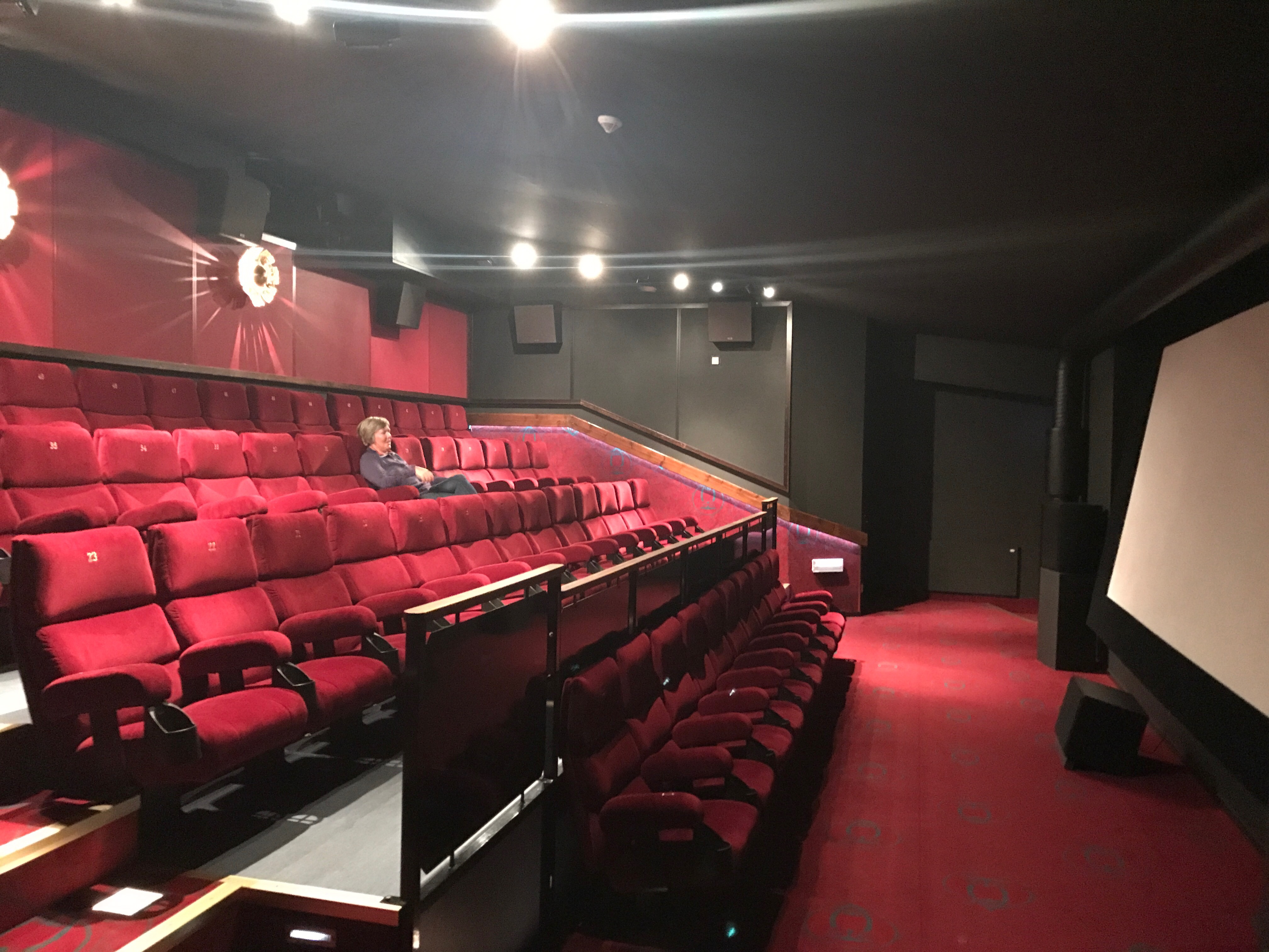
The big screen! The smallest cinema in Sweden?

Museum of cardboard boxes!

Old Ox – the closest thing I could find to the brewery!
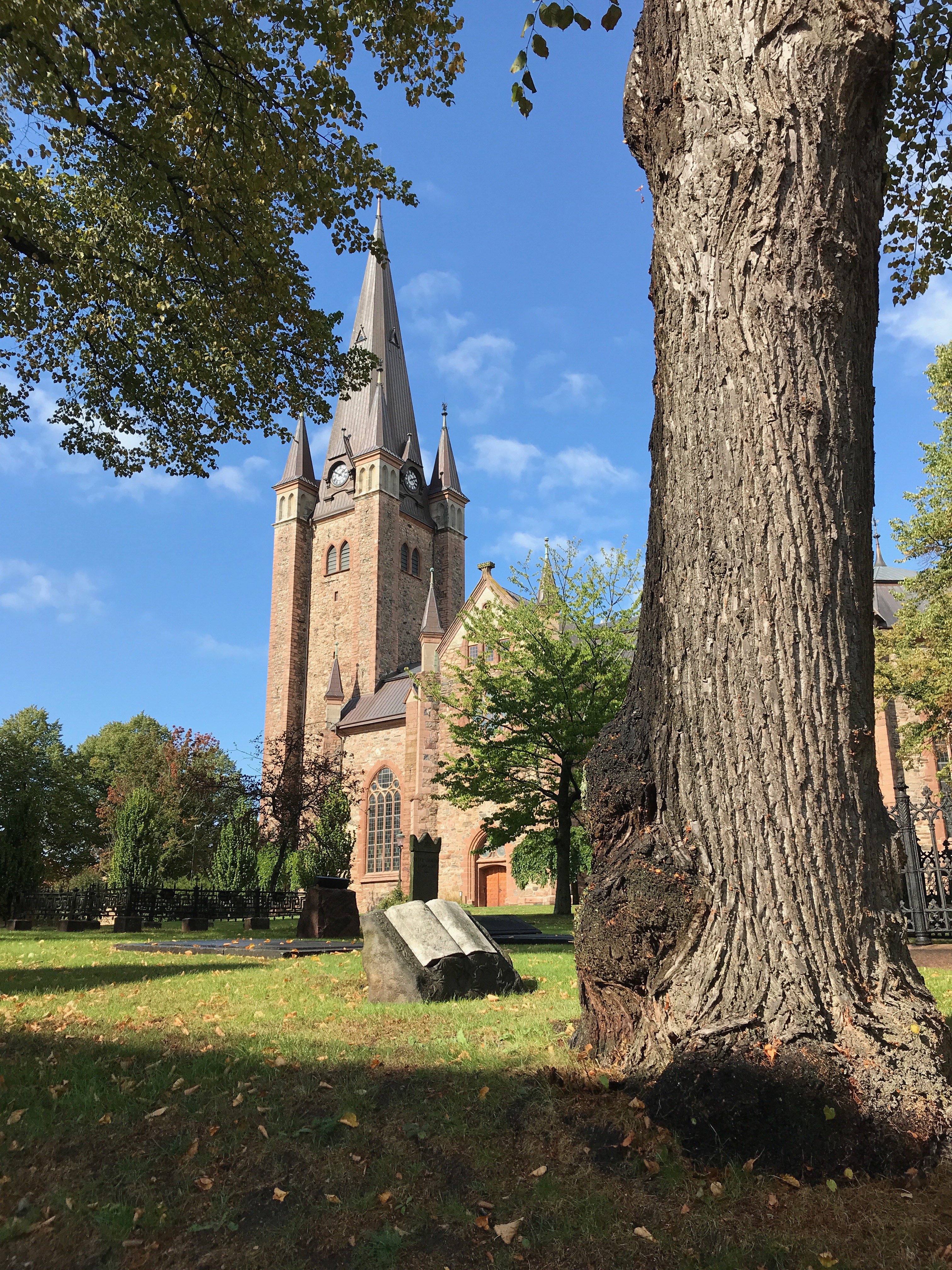

Mariested Church – the tallest tower on this part of the lake and a very welcome landmark!

Mariested is an old town, its charter dates from the 1530s
Lake Varnen is the largest lake in the EU and the third largest in the world behind a couple in Russia. It is so big that it creates its own weather systems – it can be blowing a gale on the lake and brilliant sunshine elsewhere in Sweden…….which it was now!! In fact, Lake Varnen even has its own weather forecast on the TV! Another day passed, I had failed to find the brewery, the biggest in Sweden and we were getting desperate to get going. Although we still had a few days to spare we knew we could not get trapped on the lake for much longer if we were to meet the delivery crew in Gothenburg. And this started to weigh heavily on our minds. I went crazy with the Dymo tape and labelled everything in anticipation and even started to write an instruction book for Grace! We had to get going! The pressure was now on, as the Trollhatte Canal announced that it would be closing in just 10 day time for two weeks for essential repairs to the lock gates at Lilla Edet. This was all starting to get a bit serious!
Next morning seemed a little brighter, still windy but definitely better. The yacht behind us cast off and left, so we packed everything away and did the same. The plan was that we would head east towards Kallandso, a big spur of land that projects into the lake, finding somewhere to stay in amongst it’s many islands at its tip. This should provide some shelter until we could cross the lake on the far side to make the dash towards Vannersborg and the start of the Trollhatte. We also reckoned that we would have to cross the lake towards Mellerud or Dalgasa as sailing down the far side of the lake we would have the shelter of the Eastern shore but also keep us out of the shoals that lined Kallandso. We definitely did not want to have those as a lee shore if the weather turned really nasty!
The plan!
Viknas Point

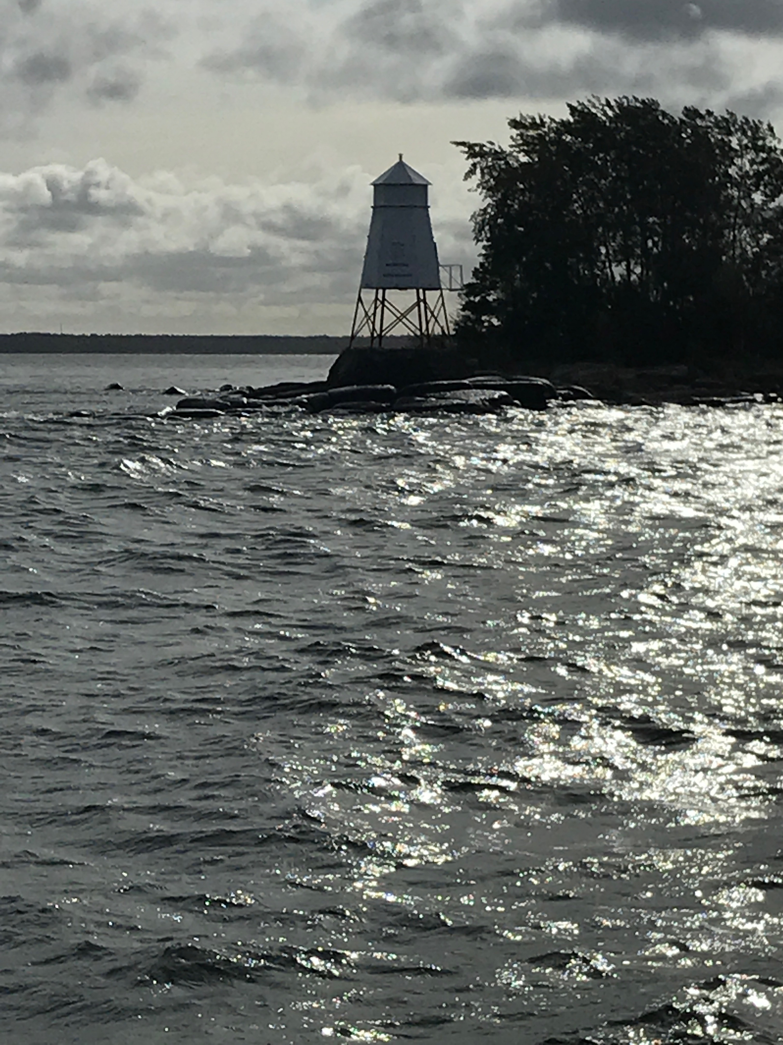
The light on Onso
But first we had to get away from the shelter of Mariestad and through the gap between Viknas point and Onso and into the wide open part of the lake to start our crossing. We sailed north for 3 nm up the Mariestad channel then sharply east at an unusual triangle of buoys for 4 nm towards the light on Onso that marks the gap into the open part of the lake. With the motor to help us we made a series of short tacks up towards Onso, adding a second reef to genoa and main. This did not bode well! We were still in a relatively sheltered spot and we had two reefs in the sails already. Grace was pitching sharply, slamming her bows down in the steep swell. It was all beginning to get a bit uncomfortable!

Out through the gap between Viknas and Onso…..if only we could get there!
Just then the yacht that had left earlier that morning came screaming past us, her crew well wrapped up but focussed on getting back to harbour! We persevered for another few minutes then made a quick U turn and followed them! Absolutely flying as the wind rose again. Oh well, lets try again tomorrow! Which is exactly what we did, with exactly the same result! The one benefit from all of this to-ing and fro-ing was that we discovered we had left the bag with all our money and passports in a restaurant and we could go and get it! It would have been terrible to have made the trip across the lake, only to have to return again to Mariestad to pick up the bag! It must have been fate!
End Game Part 2!
I cannot quite believe how the months have flown by. It is such along time since we handed over Grace to the delivery crew in Gothenburg and returned to Chichester. However I do have an excuse……Hester, our new cockerpoo puppy!
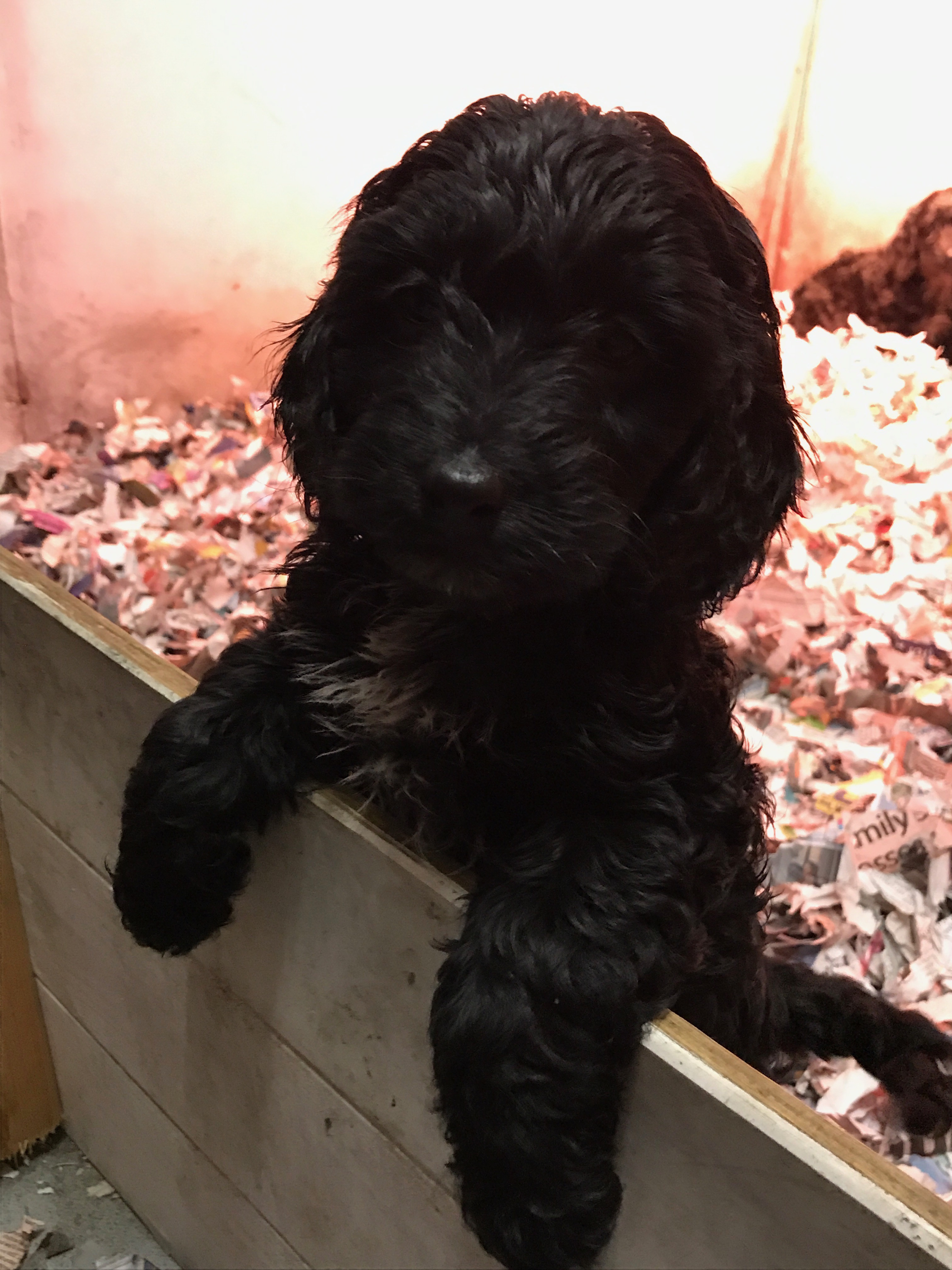


Hester – joins the family!

Hester and her first life jacket!
So, back to the Gota Canal! Having been wowed by the SAAB Viggen at the Aero Museum in Linkoping (pronounced Lin-cherping) we joined a new convoy and set off behind the WASA LEJON, the last pleasure steamer of the season.

SAAB VIGGEN

Following Wasa Lejon
We had picked up an interesting group, a mini ‘QE2’ which had to go in the lock all on its own as it was so big. It was owned by a man who we were never quite sure what he did, but he did have some very large ‘friends’ on board! The lock keeper put us at the back of the lock as we were the smallest. We were behind a large and expensive bespoke yacht with a lovely brushed aluminium finish. They kept panicking and trying to fend us off with boat hooks every time our big bow Bruce anchor came perilously close to their delicate shiny finish…….which was every time we entered a lock! There really was only a couple feet to spare in the lock and I had to make sure I was beyond the lock step to avoid getting my rudder stuck on it!! As there were 6 of them on board it would have been nice they had helped with our lines rather than look anxious every time we approached! It would have helped to reduce the risk to their hull finish.
On our port side at the front was a motorboat from the Faroe Islands, as it was not much bigger than ourselves, it was quite an adventurous trip they were making! Then next to us was a large Norwegian yacht, head back to Oslo. This was crewed by a very blond couple who spent all their time gazing adoringly in to eachother’s eyes! Yuk!
It is still a wonder to me as to how we all fitted into the lock but the lock keeper knew exactly where we had to go!

Squeezing into the lock and bridge
After passing what seemed like endless locks and bridges, we sailed about 20 km to Borensberg and finally Boren where they had the last hand operated lock!

Hand operated lock.

Lock keeping lessons.
We then sailed across Lake Boren to Borenshult and a flight of 5 locks which took us up to 80 m above sea level.

Sailing across Lake Boren

5 Locks at Borenshult
The next day it was more locks and bridges! And then we were at Motala. Motala is canal city, it has workshops, a very clever dry dock that needs no pumps to fill or empty it! Foundries and everything you might need to build your canal! Balthazar Von Platten, the designer and promoter of the canal is also buried by the canal to keep an eye on everyone who passes by!
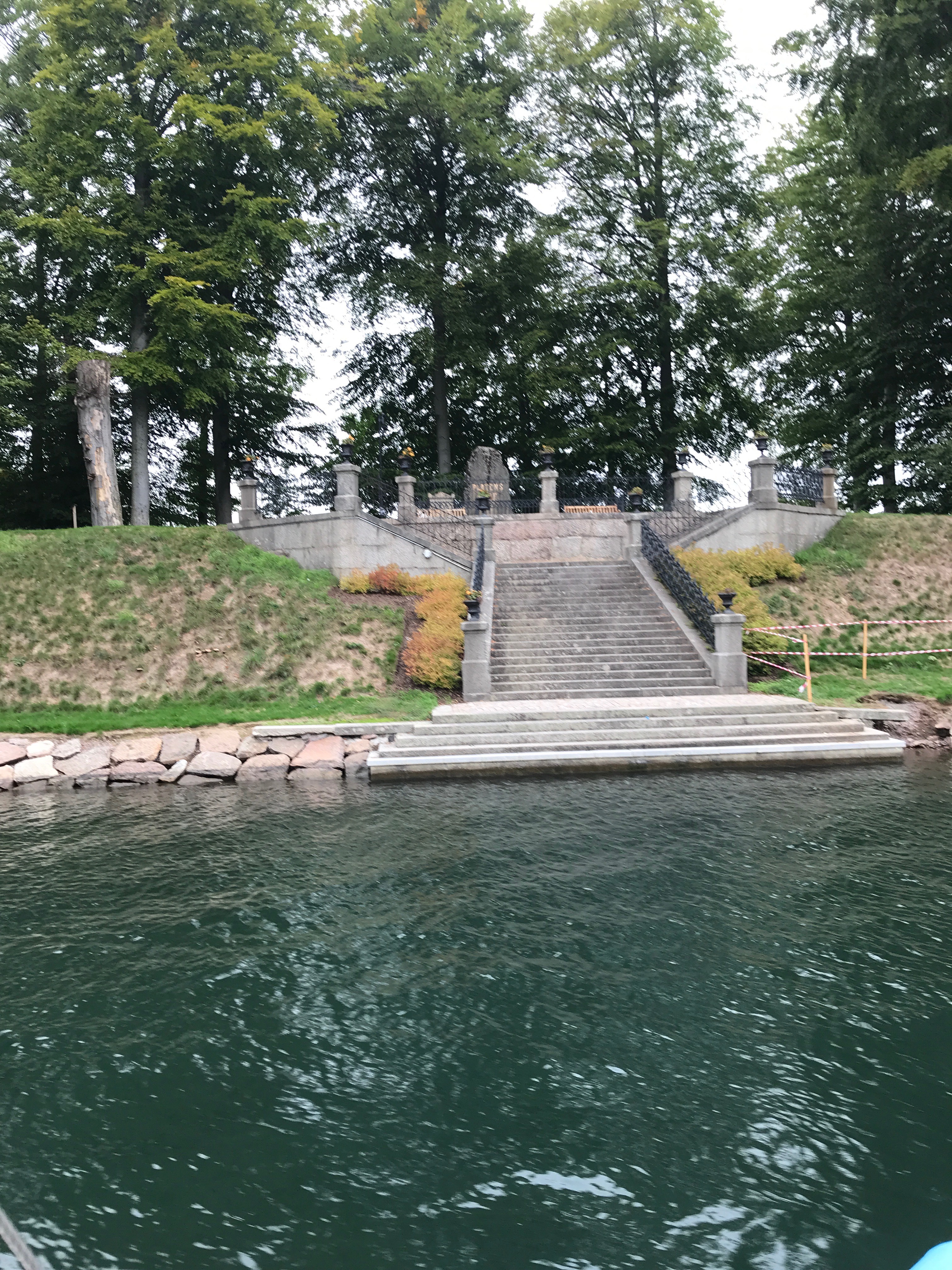
Balthazar Von Platten’s grave watching over the canal!
His stamp is on everything here, he even designed and built Motala on the hillside overlooking Lake Vattern in the form of a big semi circle, all the roads lead down the hill to a focal point in the middle of the lake that coincides with an artwork!
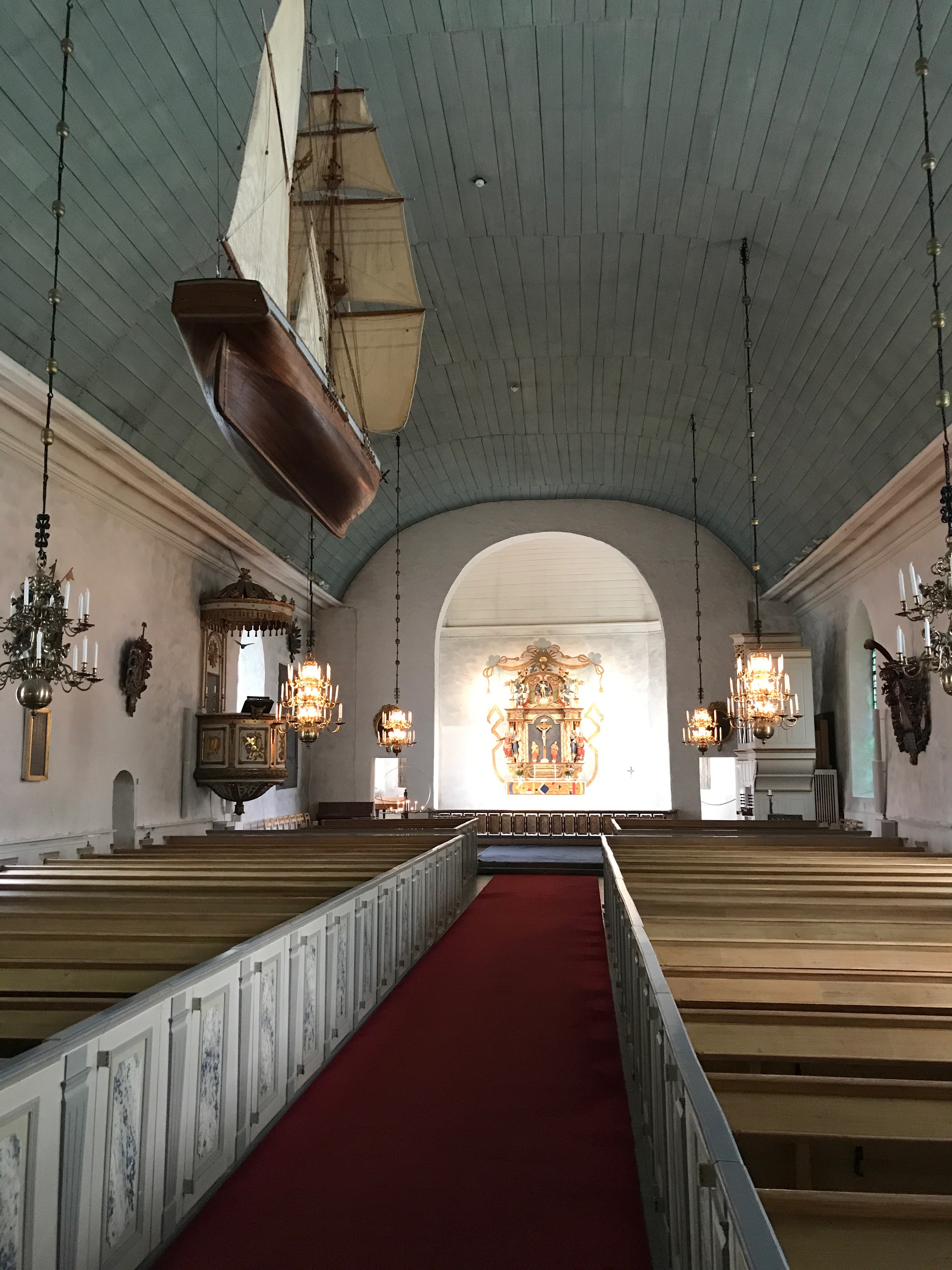
The canal church in Motala
Canal life boats outside the canal offices.
We stopped in the little marina before crossing the Lake to buy some food and have a shower! Focusing on brunch we almost wrecked Grace against the harbour wall. A surprisingly strong cross wind blew us into the starboard finger pontoon, trapping us there. The more I tried to move, the more trouble I got into, so frustrated we decided to make her secure, then go to the cafe and try again when we were refreshed!
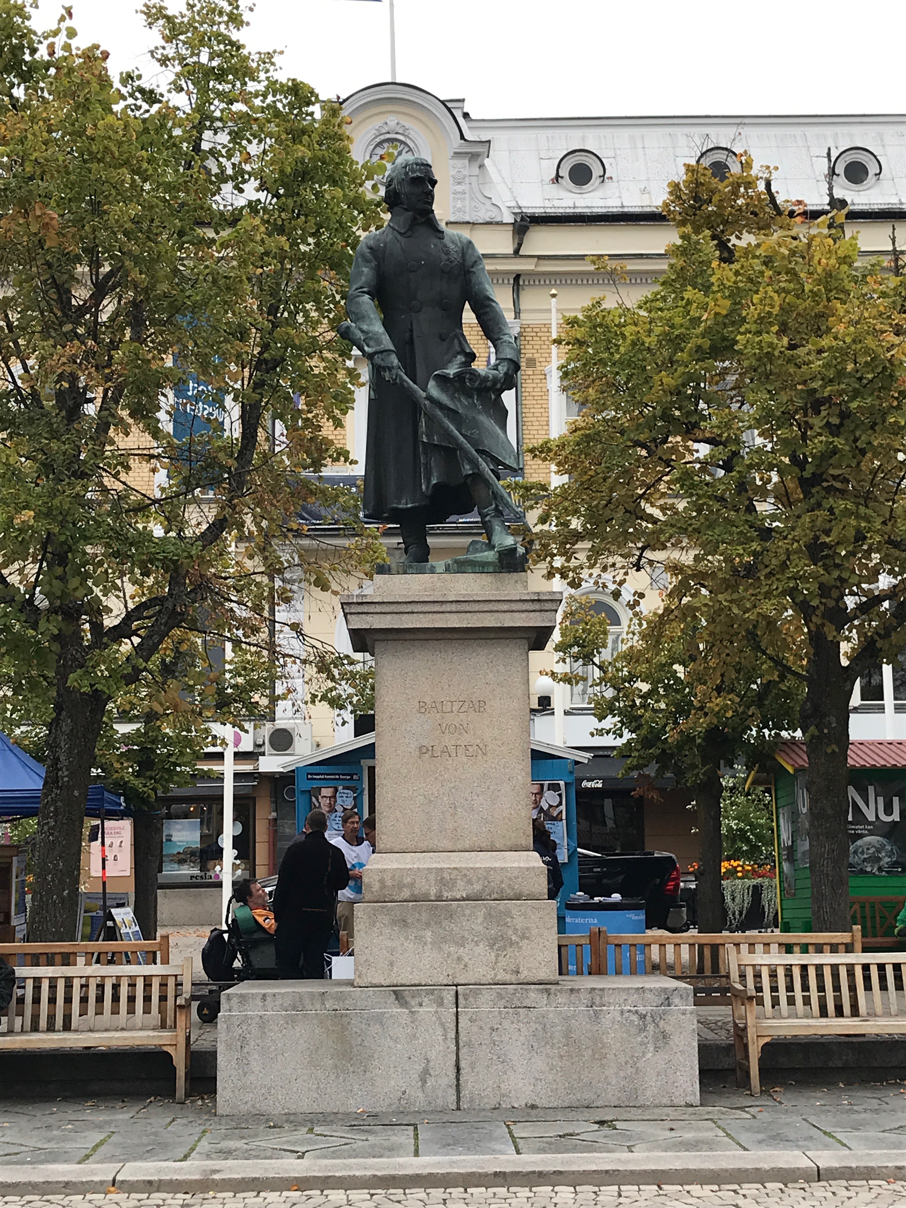
Balthazar Von Platten in the centre of the town.

Glad to be free of the Motala’s marina at last!
It worked! And we were soon away cross Lake Vattern. The lake is huge, the second largest in Sweden and the EU! It is 135 km long and 31 km wide. We were 89 m above sea level so we had almost reached our highest point on the trip of 92 m. Vattern is remarkable for its depth and incredible clarity and being very, very freshwater Grace floated slightly deeper, not by much but she did feel different on the helm!

Setting off across Lake Vattern
Crossing Lake Vattern we headed for the castle at Karlsborg on the western side of the lake. This was also build by Balthazar Von Platten on has day off when he was not building the canal! He designed it to house Sweden’s gold and the royal family in times of war and invasion. It is impressive just on its sheer scale. It was critical that we made the motorway bridge at where the mouth of the canal no later than 1700. This was the main road from Goteborg to Stockholm and was booked to open for our convoy. If we missed it then we would have to wait for the next convoy with space on it……which might mean we were trapped there until next May when the canal opened again if there was no space on the three remaining convoys of the season!
It was a bit grey when we left Motala but as we set our course for Karlsborg the weather changed and we were soon in hifits, fleeces and waterproof jackets. We had about 20 nm cover which we estimated would take us about 5 hours, and as it was midday now, we would not have long to wait at the bridge if all went well……..Two hours in to our trip we were passed by the mini QE2 who had also stopped for lunch at Motala. Steaming at 8 knots they soon disappeared into what was a large bank of fog and mist! By then, I was becoming concerned and considered that we should return to Motala as the entrance to the harbour was easy and still fog free! But it would be catastrophic for our schedule and would put the meeting with the transfer crew in Goteborg in jeopardy. We pressed on but knowing that we could not enter Karlsborg in poor visibility as the entrance channel snaked and zigzagged through a series of difficult rocks and mud banks. Using our instruments we sailed on. Then at about a distance of about 5 nm we saw the hard but vague outline of the fortress walls through the mist. Suddenly we broke through in to a bright and clear afternoon. Once through the rocks that guard the harbour mouth we saw the wooden posts and piles that marked the start of the canal again! It was 1630, loosely tied to a post there was just time for tea and digestive biscuits! Experience tells me that there is alway time for tea and digestive biscuits!!
Time for tea biscuits!
On the way to Forsvik
Once through the bridge we sailed the 4 nm to our night stop at Forsvik. This was the most amazing sail through a series of small interconnected lakes bounded on either side by dense and sweet smelling pine woods. As night fell we found the narrow turning in to canal basin at Forsvik. This is very narrow and has the oldest lock (built in 1813 and not touched since!) on the whole of the canal. Needless to say chaos ensued as the two larger yachts and mini QE2 did battle with eachother to find a place to moor up to for the night. We, with our lighter weight and shallow draft, tucked ourselves in against a rickety wooden pontoon, plugged in the shore power and watched the fun. The mini QE2 jammed itself against the large aluminium yacht blocking the canal. Meanwhile the Norwegians, so engrossed in eachother completely missed the moorings and sailed right up to the lock gates, only to discover there was no where to tie up to and being trapped by the mini QE2 and the aluminium yacht like a cork in a bottle, they had to join all their lines together to reach a few saplings on the canal bank about 35 m away!

On the way to Forsvik for the night.
Next morning, with two days left we had probably the most amazing sail ever! Grace sailed through a wooded sunken wilderness, past tiny islands and through narrow passages which seemed more like flooded country lanes!


Sailing through the countryside!
After about 20 nm we reached the industrial town of Toreboda, crossing the main high speed railway line to Stockholm. We were given strict instructions by the lock keeper that the line would open for us on our approach but we had to sail through without delay as the trains could not stop. Our timing was perfect! As we approached, the track swung open as we made a tight port then starboard turn to cross the line…..just as a yacht coming the other way made a dash for it! A sharp intake of breath and we both squeezed through as the gongs sounded and the bridge began to swing closed! Losers! The mini QE2, despite a sudden surge of speed missed the bridge opening and had to go full astern to avoid ploughing into the bridge…..that would not have been a popular move and would have added a few more scars to the scrapes on their bows!
That night we moored up against a nice wooden pier and went to explore the delights that surely beckoned us in Toreboda. Within five minutes it became apparent that nothing happens or indeed is open on an autumn evening in Toreboda! So back to the boat for tomato pasta and more digestive biscuits!!

The train tracks at Toreboda
Toreboda
Our fifth day in the canal and we were excited that we had almost reached Lake Varnen. We still had 19 locks left to do and 15 nm to cover. As it was downhill all the way (50 m down towards sea level) we fairly flew along our last leg to Sjotorp. Having done almost 40 locks we were all really slick at it! We reached Sjotorp and Varnen a little after 1500.


Sjotorp
The weather forecast was not looking good for the next few days and as Sjotorp held absolutely no attraction for us, we set off immediately down the coast for Mariestad. This is the biggest town on Lake Varnen and is most famous for its beer which is sold everywhere is Sweden and is actually really rather good!!

On the way to Mariestad and beer without delay!
